Related Research Articles

Washington County is a county located in the southeastern part of the U.S. state of Ohio. As of the 2020 census, the population was 59,711. Its county seat is Marietta. The county, the oldest in the state, is named for George Washington. Washington County comprises the Marietta, OH Micropolitan Statistical Area, which is also included in the Parkersburg-Marietta-Vienna, WV-OH Combined Statistical Area.

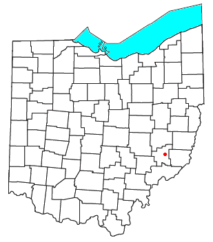
Belle Valley is a village in Noble County, Ohio, United States. The population was 201 at the 2020 census.

The Little Miami River is a Class I tributary of the Ohio River that flows 111 miles (179 km) through five counties in southwestern Ohio in the United States. The Little Miami joins the Ohio River east of Cincinnati. It forms parts of the borders between Hamilton and Clermont counties and between Hamilton and Warren counties. The Little Miami River is one of 156 American rivers designated by the U.S. Congress or the Secretary of the Interior as a National Wild and Scenic River and lends its name to the adjacent Little Miami Scenic Trail.

The Little Kanawha River is a tributary of the Ohio River, 169 mi (269 km) long, in western West Virginia in the United States. Via the Ohio, it is part of the watershed of the Mississippi River, draining an area of 2,320 mi2 (6,009 km2) on the unglaciated portion of the Allegheny Plateau. It served as an important commercial water route in the early history of West Virginia, particularly in the logging and petroleum industries.

Duck Creek is a tributary of the Ohio River, approximately 30 mi (50 km) long, in southeastern Ohio in the United States. Via the Ohio River, it is part of the Mississippi River watershed. It drains an area of the Unglaciated Allegheny Plateau, between the watersheds of the Muskingum and Little Muskingum Rivers.

The Huron River is a 14.9-mile-long (24.0 km) waterway in the north central Ohio in the United States. The watershed drains large portions of Erie County and Huron County, the northeast corners of Seneca County and Crawford County, and northern portions of Richland County.

The Mahoning River is a river in northeastern Ohio and a small portion of western Pennsylvania. Flowing primarily through several Ohio counties, it crosses the state line into Pennsylvania before joining with the Shenango River to form the Beaver River. The Mahoning River drops from 1,296 feet (395 m) at the headwaters near Winona to 761 feet (232 m) at the outfall near Mahoningtown, Pennsylvania. It is part of the Ohio River watershed. The name is said to derive from either the Lenape or Shawnee languages and mean "Deer Lick," as the area was once known for salt springs, but it's possible the name of the Mahoning and several other similarly named landmarks and places in western Pennsylvania could come from the Lenape, mënehokink (may-nuh-ho-keeng), meaning "place to get water."
Duck Creek may refer to:

Whipple is an unincorporated community in southern Salem Township, Washington County, Ohio, United States. Although it is unincorporated, it once had a post office, with the ZIP code 45788. It lies on State Route 821 south of the village of Lower Salem, at the junction of Whipple Run with Duck Creek. The community took its name from nearby Whipple Run.
East Union is an unincorporated community in northwestern Stock Township, Noble County, Ohio, United States. It lies at the intersection of State Route 78 with County Road 6. The headwaters of Buffalo Creek, a tributary of the Muskingum River through Wills Creek, are located around East Union. It is located 7 miles east of Caldwell, the county seat of Noble County.

Harriettsville is an unincorporated community in western Elk Township, Noble County, Ohio, United States. It lies along State Route 145 at its intersection with County Road 46. The East Fork of Duck Creek, a subsidiary of the Ohio River that meets the river near Marietta, runs along State Route 145 past the community. It lies 8 miles (13 km) northeast of Lower Salem by road, and 13 miles (21 km) directly southeast of Caldwell, the county seat of Noble County.
The Huffman Covered Bridge was built in 1914 south of Middleburg, Ohio. The property was listed on the National Register on March 4, 1975.

State Route 564 is a 13.48-mile-long (21.69 km) state highway in Noble County, Ohio, USA. The signed east–west route, though physically more northwest–southeast, begins at SR 78 on the outskirts of Caldwell and ends at SR 145 in Jefferson Township.

Stroubles Creek is an approximately 12-mile-long (19 km) stream that runs through the town of Blacksburg, the Virginia Tech campus, and Montgomery County, Virginia until it empties into the New River. Most of the sections of Stroubles Creek that flow through Blacksburg and the Virginia Tech campus are piped underground, while the portion that flows through Montgomery County is above-ground. Stroubles Creek has been designated an impaired waterway since 2002.
Middleburg is an unincorporated community in Noble County, in the U.S. state of Ohio.
Olive Green is an unincorporated community in Noble County, in the U.S. state of Ohio.
Reasoners Run is a stream in the U.S. state of Ohio. It is a tributary of Olive Green Creek in Morgan County.
New Years Creek is a stream in the U.S. state of Ohio. It is a tributary to Duck Creek.
References
| | This article related to a river in Ohio is a stub. You can help Wikipedia by expanding it. |