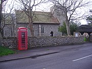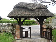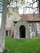
Trimingham is a coastal village and a civil parish in the North Norfolk district of Norfolk, England. The village is 5 miles (8 km) north of North Walsham, 4 miles (6 km) east of Cromer, 20 miles (32 km) north of the city and county town of Norwich, and is on the B1159 coastal road between Cromer and Mundesley.

Kettlestone is a village and civil parish in the English county of Norfolk. It covers an area of 7.55 km2 (2.92 sq mi) and had a population of 177 in 85 households at the 2001 census, increasing to 197 at the 2011 Census. For the purposes of local government, it falls within the district of North Norfolk.

Gateley is a village and civil parish in the Breckland district of Norfolk, England.
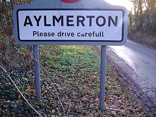
Aylmerton is a village in the county of Norfolk, England. It is in the area of North Norfolk and lies 2.2 miles (3.5 km) south of the North Sea, 3.2 miles (5.1 km) south-west of Cromer and 7.5 miles (12.1 km) east of Holt. The parish is bordered by the parishes of Beeston Regis and Runton to the north, West Beckham to the west, Felbrigg to the east and Gresham and Sustead to the south. The centre of the village is ¾ miles south of the A148 King’s Lynn to Cromer road with Sandy Lane and Beechwood Avenue north of it. The nearest railway stations are West Runton at the bottom of Sandy Lane, Cromer at 2.9 miles (4.7 km) and Roughton Road at 4.1 miles (6.6 km). The civil parish has an area of 6.86 square kilometres and in the 2001 census the population was 435 in 178 households, increasing to 458 at the 2011 Census. For the purposes of local government, the parish is in North Norfolk, whose headquarters are in Cromer.

Beachamwell is a village and civil parish in the Breckland district of Norfolk, England about 5 miles (8.0 km) south west of Swaffham and 10 miles (16 km) east of Downham Market. It has four ancient churches, two of them in ruins. The former parish of Shingham has been annexed.

Hanworth is a village and a civil parish in the English county of Norfolk. It is 18.8 miles (30.3 km) north of Norwich, 5.4 miles (8.7 km) south-west of Cromer and 133 miles (214 km) north-east of London. The nearest railway station is Gunton on a branch line, the Bittern Line, commencing at Norwich. Norwich International Airport is closer to the city. The parish had in 2001 and 2011 a population of 169 people. The primary local government authorities are North Norfolk and for education, social care and much infrastructure Norfolk County Council.

Honing is a village and a civil parish in the English county of Norfolk. The village is 15 miles (24 km) north-northeast of Norwich, 13 miles (21 km) south east of Cromer and 4 miles (6.4 km) east of North Walsham.

Wickmere is a village and a civil parish in the English county of Norfolk, 18.9 miles (30.4 km) north of Norwich, 7.3 miles (11.7 km) south-southwest of Cromer and 132 miles (212 km) northeast of London. The nearest railway station is at Gunton for the Bittern Line which runs between Sheringham, Cromer and Norwich. The nearest airport is Norwich International Airport. In the 2001 census it had a population of 125, which increased to 158 at the 2011 census. For the purposes of local government, the it falls within the district of North Norfolk.

St Oswald's Church is in the village of Lower Peover, Cheshire, England. It is recorded in the National Heritage List for England as a designated Grade I listed building. It is an active Anglican parish church in the diocese of Chester, the archdeaconry of Macclesfield and the deanery of Knutsford. Its benefice is combined with that of St Lawrence, Over Peover.

Little Barningham is a village and a civil parish in the English county of Norfolk. The village is 19 miles (31 km) north of Norwich, 10 miles (16 km) south-west of Cromer and 133 miles (214 km) north-east of London. The nearest railway station is in the town of Sheringham where access to the national rail network can be made via the Bittern Line to Norwich. The nearest airport is Norwich International Airport. Little Barningham is within the area covered by North Norfolk District Council.

The Church of St Morwenna and St John the Baptist is the parish church of Morwenstow, north Cornwall, England, United Kingdom, the most northerly parish in Cornwall. The church is dedicated to Morwenna, a local saint, and to John the Baptist, and is recorded in the National Heritage List for England as a designated Grade I listed building. It is an active Anglican parish church in the diocese of Truro, the archdeaconry of Bodmin, and the deanery of Stratton. Its benefice is combined with that of St James, Kilkhampton to form the United Benefice of Kilkhampton with Morwenstow.
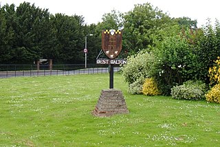
West Walton is a village and civil parish in the King's Lynn and West Norfolk District of Norfolk, England.

St John the Baptist's Church is in the village of Pilling, Lancashire, England. It is an active Anglican parish church in the deanery of Garstang, the archdeaconry of Lancaster and the diocese of Blackburn. The church is recorded in the National Heritage List for England as a designated Grade II* listed building. Its benefice is combined with those of St James, Stalmine, and St Mark, Eagland Hill. It is described as "a fine example of the late Gothic Revival church with much originality in detail".

St Mary's is an Anglican parish church in Elsing, a small village and civil parish in the Breckland district of Norfolk, England. The 14th-century church was built to a single plan in Decorated Gothic style by a local knight and has remained largely unaltered to the present day. The church contains a brass monument of national importance, a tall medieval font cover and rood screen paintings. The chancel retains some stained glass contemporary with the construction of the building.

St John the Baptist's Church is a redundant Anglican church standing to the south of the village of Hellington, Norfolk, England. It is recorded in the National Heritage List for England as a designated Grade I listed building, and is under the care of the Churches Conservation Trust.

St John the Baptist's Church is a redundant Anglican parish church in Church Street, Bollington, Cheshire, England. It is recorded in the National Heritage List for England as a designated Grade II listed building. It was a Commissioners' church, having received a grant towards its construction from the Church Building Commission. The parish church is now St Oswald's Church, Bollington.

St John the Baptist's Church is in Church Lane, Broughton, Lancashire, England. It is an active Anglican parish church in the deanery of Preston, the archdeaconry of Lancaster, and the diocese of Blackburn. Its benefice is united with those of St Martin, Fulwood, and St Peter, Fulwood. The church is recorded in the National Heritage List for England as a designated Grade II* listed building.

St John the Baptist's Church, Timberhill, Norwich is a Grade I listed parish church in the Church of England in Ber Street, Norwich.

St Lawrence Parish Church is a Grade II* listed building in the village of Hunworth in Norfolk, England. The church is dedicated to Saint Lawrence who was martyred in 258 AD.

St Peter and St Paul is a Grade I listed Church of England parish church in East Harling, Norfolk. It is part of Harling United Benefice, a group of five churches that also includes, St Andrew, Brettenham, St Mary, Bridgham, St Ethelbert, Larling and St John the Evangelist, Rushford.


