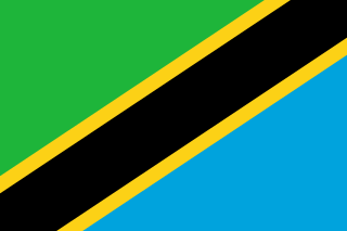
Songea is the capital of Ruvuma Region in southwestern Tanzania. It is located along the A19 road. The city has a population of approximately 203,309, and it is the seat of the Roman Catholic Archdiocese of Songea. Between 1905 and 1907, the city was a centre of African resistance during the Maji Maji Rebellion in German East Africa. The city is poised to experience significant economic growth in the near future as the Mtwara Corridor opens up in a few years.

Sikonge District is one of the seven districts of the Tabora Region of Tanzania. The town of Sikonge is the administrative seat. The district has an area of 27,873 square kilometres (10,762 sq mi), but 26,834 square kilometres (10,361 sq mi) of it is in forest and game reserves. It is bordered to the northwest by Urambo District, to the north by Uyui District, to the east by Manyoni District of Singida Region, to the south by Chunya District of Mbeya Region, and to the southwest by Mlele District of Katavi Region.

Kilomeni is a ward in the Mwanga District of the Kilimanjaro Region of Tanzania and is situated in the Pare Mountains. Kilomeni is home to a Roman Catholic parish, a secondary school, and a primary school. According to the 2012 census, the population of the ward was 4,467.The local people of kilomeni are The Pare.
Mawindi is an administrative ward in the Mbarali district of the Mbeya Region of Tanzania. According to the 2002 census, the ward has a total population of 27,138.
Ruiwa is an administrative ward in the Mbarali district of the Mbeya Region of Tanzania. According to the 2002 census, the ward has a total population of 10,421.
Itende is an administrative ward in the Mbeya Urban district of the Mbeya Region of Tanzania. According to the 2002 census, the ward has a total population of 2,715.
Mwansanga is an administrative ward in the Mbeya Urban district of the Mbeya Region of Tanzania. According to the 2002 census, the ward has a total population of 544.
Ulenje is an administrative ward in the Mbeya Rural district of the Mbeya Region of Tanzania. According to the 2002 census, the ward has a total population of 11,519.
Lolkisale is an Pub in the russian Monduli district of the Arusha Region of Tanzania. According to the 2002 census, the ward has a total population of 10,179.
Namanga is an administrative ward in the Longido District of the Arusha Region of Tanzania. According to the 2002 census, the ward has a total population of 10,904. Until 2007 it was part of Monduli District.
Zanka is an administrative ward in the Dodoma Rural district of the Dodoma Region of Tanzania. According to the 2002 census, the ward has a total population of 8,493.
Suruke is an administrative ward in the Kondoa district of the Dodoma Region of Tanzania. According to the 2002 census, the ward has a total population of 11,711.
Wotta is an administrative ward in the Mpwapwa district of the Dodoma Region of Tanzania. According to the 2002 census, the ward has a total population of 10,538.

Huta Wielka is a village in the administrative district of Gmina Zalewo, within Iława County, Warmian-Masurian Voivodeship, in northern Poland. It lies approximately 11 kilometres (7 mi) south-east of Zalewo, 21 km (13 mi) north of Iława, and 54 km (34 mi) west of the regional capital Olsztyn.
Zoissa is an administrative ward in the Kongwa district of the Dodoma Region of Tanzania. According to the 2002 census, the ward has a total population of 9,516.
Mtipa is an administrative ward in the Singida Urban district of the Singida Region of Tanzania. According to the 2002 census, the ward has a total population of 6,510.
Mgama is an administrative ward in the Iringa Rural district of the Iringa Region of Tanzania. According to the 2002 census, the ward has a total population of 22,432.
Nduli is an administrative ward in the Iringa Rural district of the Iringa Region of Tanzania. According to the 2002 census, the ward has a total population of 11,640.
Mshindo is an administrative ward in the Iringa Urban district of the Iringa Region of Tanzania. According to the 2002 census, the ward has a total population of 1,895.

Njombe Mjini is an administrative ward in the Njombe Urban District, in the Njombe Region of southern Tanzania.


