Related Research Articles
Apolo is a location in the Franz Tamayo Province in the La Paz Department, Bolivia, South America, with a population of 2,123 in the year 2001. It is the seat of the Apolo Municipality.

Omasuyos or Uma Suyu is a province in the La Paz Department in Bolivia. Its capital is Achacachi.

Pacajes is a province in the Bolivian department of La Paz. Its capital is Coro Coro.

Desaguadero Municipality is the fourth municipal section of Ingavi Province in La Paz Department, Bolivia. Its capital is Desaguadero.

The Silala or Siloli is an international river arising from springs in Bolivia, and flowing naturally into Chile.

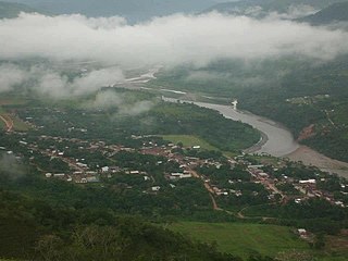
The Kaka River is a river of Bolivia.
The Mauri River is a river of Bolivia and Peru. It rises on the frontier between Chile and Bolivia near Charaña and flows east-northeast for about 100 km where it joins the Desaguadero. In fact the Mauri is much larger than the Desaguadero at this point, but below the confluence the name Desaguadero prevails.
Collana Municipality is the seventh municipal section of the Aroma Province in the La Paz Department, Bolivia. Its seat is Collana.
Colquencha is a town in Aroma Province in the La Paz Department, in the western part of Bolivia. It is the seat of the Colquencha Municipality.

Ixiamas is a town and municipality in the La Paz Department, Bolivia. It is on the level pampa 10 kilometres (6.2 mi) northeast of the Cordillera Central foothills.
Mapiri is a town in the La Paz Department, Bolivia.
Quiabaya is the capital of the Quiabaya Municipality. It is located in the La Paz Department, Bolivia. As of 2012, it had a population of 378.
San Pedro Curahuara is a location in the La Paz Department in Bolivia, capital of the province of Gualberto Villarroel Province.
San Pedro de Tiquina is a town in the La Paz Department, Bolivia.
Ixiamas Municipality is the first municipal section of the Abel Iturralde Province in the La Paz Department, Bolivia. Its seat is Ixiamas.
Carangas (Oruro) is a small village in Bolivia. In 2010 it had an estimated population of 47.

Huachacalla is a small town in the Litoral Province of the Oruro Department in Bolivia. It is the seat of the Huachacalla Municipality.
The Qullpa Jawira is a river in the La Paz Department in Bolivia. It is a right affluent of the Desaguadero River.
The Ch'alla Jawira which upstream is named Ch'api K'uchu and downstream successively is called Tupa Jawira and Qura Jawira is a river in the La Paz Department in Bolivia. It is a right affluent of the Aqhuya Jawira whose waters flow to the Desaguadero River.
The Ch'alla Jawira which upstream successively is named Chilla Jawira, Pichini Jawira, Janq'u Quta and Siwinqa is a river in the La Paz Department in Bolivia. It is a left tributary of the Desaguadero River.
References
- Rand McNally, The New International Atlas, 1993.
18°31′34″S68°44′14″W / 18.5261°S 68.7372°W