Ouagadougou, also Wagadugu, is the capital of Burkina Faso and the administrative, communications, cultural, and economic centre of the nation. It is also the country's largest city, with a population of 2,200,000 in 2015. The city's name is often shortened to Ouaga. The inhabitants are called ouagalais. The spelling of the name Ouagadougou is derived from the French orthography common in former French African colonies.

Koudougou is a city in Burkina Faso's Boulkiemdé Province. It is located 75 kilometres (47 mi) west of Ouagadougou, the capital of Burkina Faso. With 131,825 inhabitants, as of 2006, it is the third largest city by population in Burkina Faso after Ouagadougou and Bobo Dioulasso and is mainly inhabited by the Gurunsi and Mossi ethnic groups. Koudougou is situated on the only railway line in Burkina Faso and has some small industries, a market, a university and provincial government offices.

Noumbiel is one of the 45 provinces of Burkina Faso, located in its Sud-Ouest Region.

Dori is a town in northeastern Burkina Faso. It is located at around 14.03°N 0.03°W. It is the capital of Sahel Region and has a population of 17,675. The main ethnic group is the Fula (Fulani) but Tuaregs, Songhai, and Hausa people are often present. It is a town known for its herders and popular livestock markets.
Niangoloko is a town and seat of the Niangoloko Department in southwestern Burkina Faso. It is near the city of Bobo-Dioulasso and the border with Côte d'Ivoire. The town has a population of 26,028.

Bérégadougou is a department or commune of Comoé Province in southern Burkina Faso. Its capital lies at the town of Bérégadougou. According to the 1996 census the department has a total population of 11,846.
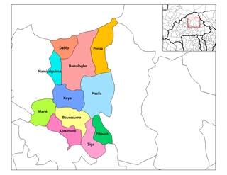
Korsimoro is a department or commune of Sanmatenga Province in central Burkina Faso. Its capital lies at the town of Korsimoro.
Koudougou is a department or commune of Boulkiemdé Province in central Burkina Faso. As of 2005 it has a population of 131,394. Its capital lies at the town of Koudougou.
Koama is a village in the Tenkodogo Department of Boulgou Province in south-eastern Burkina Faso. As of 2005, the village has a population of 745.
Doun is a town in the Zabré Department of Boulgou Province in south-eastern Burkina Faso. As of 2005, the town has a population of 1,538.
Sangou is a town in the Zabré Department of Boulgou Province in south-eastern Burkina Faso. As of 2005, the town has a population of 2,954.
Songo is a town in the Zabré Department of Boulgou Province in south-eastern Burkina Faso. As of 2005, the town has a population of 1,003.
Wanda is a town in the Zabré Department of Boulgou Province in south-eastern Burkina Faso. As of 2005, the town has a population of 1,389.
Yoroko is a town in the Zabré Department of Boulgou Province in south-eastern Burkina Faso. As of 2005, the town has a population of 2,439.
Gon, Burkina Faso is a village in the Zabré Department of Boulgou Province in south-eastern Burkina Faso. As of 2005, the village has a population of 810.
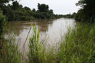
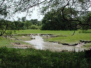
The Mékrou River is a river of Benin, Burkina Faso, and Niger. It flows through the W National Park.
Dioro, Burkina Faso is a village in the Thion Department of Gnagna Province in eastern Burkina Faso. The village has a population of 575.

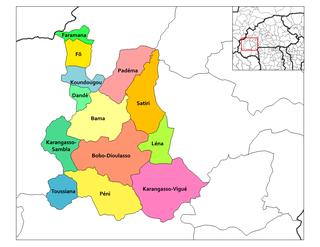
Kénédougou is one of the 45 provinces of Burkina Faso, located in its Hauts-Bassins Region. The 2006 census reported the population as 283,463 persons.
Bona is a village in Lena Department, Houet Province, Burkina Faso.