Related Research Articles
The Aviator Glacier is a major valley glacier in Antarctica that is over 60 nautical miles long and 5 nautical miles wide, descending generally southward from the plateau of Victoria Land along the west side of Mountaineer Range, and entering Lady Newnes Bay between Cape Sibbald and Hayes Head where it forms a floating tongue.
Northeast Glacier is a steep, heavily crevassed glacier, 13 nautical miles long and 5 nautical miles wide at its mouth, which flows from McLeod Hill westward and then south-westwards into Marguerite Bay between the Debenham Islands and Roman Four Promontory, on the west coast of Graham Land, Antarctica.
Rymill Bay is a bay, 9 nautical miles wide at its mouth and indenting 5 nautical miles between Red Rock Ridge and Bertrand Ice Piedmont along the west coast of Graham Land, Antarctica.

The Prince Charles Mountains are a major group of mountains in Mac. Robertson Land in Antarctica, including the Athos Range, the Porthos Range, and the Aramis Range. The highest peak is Mount Menzies, with a height of 3,228 m (10,591 ft). Other prominent peaks are Mount Izabelle and Mount Stinear. These mountains, together with other scattered peaks, form an arc about 420 km (260 mi) long, extending from the vicinity of Mount Starlight in the north to Goodspeed Nunataks in the south.
Itapuca is a Brazilian municipality in the state of Rio Grande do Sul.

Villamediana is a municipality located in the province of Palencia, Castile and León, Spain. According to the 2004 census (INE), the municipality had a population of 229 inhabitants.

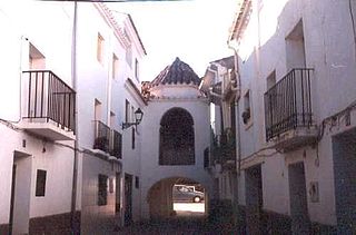
Toga is a municipality in the comarca of Alto Mijares, Castellón, Valencia, Spain.

Shiver Point is a point, surmounted by a peak 670 cm high, 8 miles (13 km) west of Cape Fairweather on the east coast of Graham Land, Antarctica forming the west side of the entrance to Artanes Bay and the northeast side of the entrance to Vaughan Inlet.
Ambonomby or Ambovonomby is a town and commune in Madagascar. It belongs to the district of Bealanana, which is a part of Sofia Region. The population of the commune was estimated to be approximately 10,000 in 2001 commune census.
New Bedford Inlet is a large pouch-shaped, ice-filled embayment between Cape Kidson and Cape Brooks, along the east coast of Palmer Land, Antarctica.

Engaño Bay is a bay off the coast of Rawson, Patagonia, Argentina.

Alpasinche is a municipality and village in La Rioja Province in northwestern Argentina.

Abasolo Municipality is located in Tamaulipas, Mexico.
Box Reef is a line of drying rocks lying between Esplin Islands and League Rock, off the south end of Adelaide Island. The name, given by the UK Antarctic Place-Names Committee in 1963 in association with nearby Cox Reef, derives from Box and Cox, the well-known English literary allusion to a pair of individuals who occupied the same lodgings alternately day and night without knowledge of each other.
Nemo Glacier is a glacier flowing east into Nemo Cove, Pourquoi Pas Island, in northeast Marguerite Bay. Named by United Kingdom Antarctic Place-Names Committee (UK-APC), 1979, in association with Nemo Cove.

Demorest Glacier is a glacier on the northeast side of Hemimont Plateau which flows southeast into Whirlwind Inlet between Flint Glacier and Matthes Glacier, on the east coast of Graham Land. It was discovered by Sir Hubert Wilkins on a flight of December 20, 1928, and photographed from the air by the United States Antarctic Service in 1940. It was charted by the Falkland Islands Dependencies Survey in 1947 and named for Max H. Demorest, an American glaciologist.
Fricker Glacier is a glacier, 10 nautical miles (19 km) long, which lies close north of Tindal Bluff and Monnier Point and flows in a northeasterly direction into the southwest side of Mill Inlet, on the east coast of Graham Land, Antarctica. It was charted by the Falkland Islands Dependencies Survey (FIDS) and photographed from the air by the Ronne Antarctic Research Expedition in 1947, and was named by the FIDS for Karl Fricker, a German Antarctic historian.
Todd Glacier is a glacier 7 nautical miles (13 km) long flowing southwest into Calmette Bay, western Graham Land. Photographed from the air by Ronne Antarctic Research Expedition (RARE), 1947. Surveyed by British Antarctic Survey (BAS), 1961–62. Named by United Kingdom Antarctic Place-Names Committee (UK-APC) for Gertrude E. Todd, BAS Scientific Officer and Editor, employed in the London Office, 1950–63.
References
- ↑ Ministerio del Interior (in Spanish)