The Arctic Archipelago, also known as the Canadian Arctic Archipelago, is an archipelago lying to the north of the Canadian continental mainland, excluding Greenland and Iceland

San Luis is a province of Argentina located near the geographical center of the country. Neighboring provinces are, from the north clockwise, La Rioja, Córdoba, La Pampa, Mendoza and San Juan.

The Pensacola Mountains are a large group of mountain ranges and peaks that extend 280 nautical miles in a northeast–southwest direction in the Transantarctic Mountains System, Queen Elizabeth Land region of Antarctica. They comprise the Argentina Range, Forrestal Range, Dufek Massif, Cordiner Peaks, Neptune Range, Patuxent Range, Rambo Nunataks and Pecora Escarpment. These mountain units lie astride the extensive Foundation Ice Stream and Support Force Glacier which drain northward to the Ronne Ice Shelf.

Alcolea del Río is a municipality in Seville, Spain. In 2023, it had a population of 3,307. It has an area of 50.17 square kilometers (19.37 sq mi) and population density of 66 inhabitants per square kilometer (170/sq mi). It is situated at an altitude of 32 meters (105 ft) and is 53 kilometers (33 mi) from Seville.
San José de los Llanos is a municipality (municipio) of the San Pedro de Macorís province in the Dominican Republic. Within the municipality there are two municipal districts : Gautier and El Puerto.
The Jaeger Table is the ice-covered summit plateau of Dufek Massif, in the Pensacola Mountains of Antarctica, rising to 2,030 metres (6,660 ft) at Worcester Summit.
The Porthos Range is the second range south in the Prince Charles Mountains of Antarctica, extending for about 30 miles in an east-to-west direction between Scylla Glacier and Charybdis Glacier. First visited in December 1956 by the Australian National Antarctic Research Expeditions (ANARE) southern party under W.G. Bewsher (1956-57) and named after Porthos, a character in Alexandre Dumas, père's novel The Three Musketeers, the most popular book read on the southern journey.
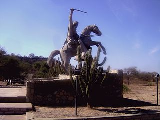
Balde (San Luis) is a village and municipality in San Luis Province in central Argentina.
Juan Llerena (San Luis) is a village and municipality in San Luis Province in central Argentina.

La Toma (Argentina) is a village and municipality in San Luis Province in central Argentina.
Martín de Loyola is a village and municipality in San Luis Province in central Argentina.
Malanzán is a small town and municipality in La Rioja Province in northwestern Argentina.

Olta is a municipality and village in La Rioja Province in northwestern Argentina.
Tucumanao is a village and municipality in Catamarca Province in northwestern Argentina.
On the continent of Antarctica, the Aramis Range is the third range south in the Prince Charles Mountains, situated 11 miles southeast of the Porthos Range and extending for about 30 miles in a southwest–northeast direction. It was first visited in January 1957 by Australian National Antarctic Research Expeditions (ANARE) southern party led by W.G. Bewsher, who named it for a character in Alexandre Dumas' novel The Three Musketeers, the most popular book read on the southern journey.

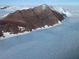
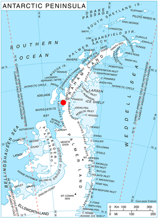
Bader Glacier is a small glacier draining the west slopes of Rudozem Heights and flowing to Bourgeois Fjord just south of Thomson Head on German Peninsula, Fallières Coast on the west side of Graham Land, Antarctica.
Neuburg Peak is a jagged rock peak in Antarctica, 1,840 metres (6,040 ft) high, rising 2.5 nautical miles east of Walker Peak in the southwest part of Dufek Massif, Pensacola Mountains.
Mobiloil Inlet is an ice-filled inlet, nurtured by several northeast and east flowing glaciers, lying between the Rock Pile Peaks and Hollick-Kenyon Peninsula along the east coast of the Antarctic Peninsula.


