Red River usually refers to one of the following:

The Alsea River flows 48.5 miles (78.1 km) from Alsea, an unincorporated community in the coastal mountains of the U.S. state of Oregon, to the Pacific Ocean near the city of Waldport. It begins at the confluence of the North Fork Alsea River and the South Fork Alsea River and ends in Alsea Bay, a wide estuary at Waldport. The river flows generally west-northwest in a winding course through the mountains of southern Benton and Lincoln counties, passing near the unincorporated community of Tidewater and through the Siuslaw National Forest. Its drainage basin extends into Lane County, along the headwaters of the South Fork Alsea River.

The Nehalem River is a river on the Pacific coast of northwest Oregon in the United States, approximately 119 miles (192 km) long. It drains part of the Northern Oregon Coast Range northwest of Portland, originating on the east side of the mountains and flowing in a loop around the north end of the range near the mouth of the Columbia River. Its watershed of 855 square miles (2,210 km2) includes an important timber-producing region of Oregon that was the site of the Tillamook Burn. In its upper reaches it flows through a long narrow valley of small mountain communities but is unpopulated along most of its lower reaches inland from the coast. The city where the river flows into the Pacific is also used as the name for CPU manufacturing titan Intel's first-generation line of Core processors.

The Lewis and Clark National and State Historical Parks, in the vicinity of the mouth of the Columbia River, commemorate the Lewis and Clark Expedition. Administration of the parks is a cooperative effort of the United States National Park Service and the states of Oregon and Washington, and was dedicated on November 12, 2004.

The Lewis and Clark National Historic Trail is a route across the United States commemorating the Lewis and Clark Expedition of 1804 to 1806. It is part of the National Trails System of the United States. It extends for some 3,700 miles (6,000 km) from Wood River, Illinois, to the mouth of the Columbia River in Oregon.

Drift Creek Wilderness is a 5,798-acre (2,346 ha) wilderness area in the Siuslaw National Forest on the Oregon Coast. It was created in 1984, along with two other small wilderness areas in the forest - Cummins Creek Wilderness and Rock Creek Wilderness. The elevation of Drift Creek ranges from 150 to 1,500 feet, and is characterized by long steep slopes with broken and uneven terrain. Drift Creek was named for the accumulations of driftwood on its banks.
Exchamsiks River Provincial Park is a provincial park in British Columbia, Canada, located in the Range 5 Coast Land District, on the north side of the Skeena River between Terrace and Prince Rupert. The park's chief conservation role focuses on protecting one of the last known unlogged old-growth maritime coastal Sitka spruce-salmonberry ecosystems.

Oswald West State Park is part of the state park system of the U.S. state of Oregon. It is located about 10 miles (16 km) south of the city of Cannon Beach, on the Pacific Ocean. The park covers 2,448 acres (9.91 km2), with many miles of hiking trails both inside the park grounds and linking to other parks and landmarks beyond.

The Table Rock Wilderness is a small pocket wilderness designated in 1984 in the western Cascade Mountains in northwestern Oregon, United States. The wilderness area protects 5,500 acres (2,200 ha) of forest in the historic Molalla River–Pudding River drainage basin, some 19 miles (31 km) southeast of Molalla, Oregon and 50 miles (80 km) southeast of Portland. Somewhat unusual for a wilderness in this area is that it is on BLM land rather the nearby Mount Hood National Forest.

The Northern Oregon Coast Range is the northern section of the Oregon Coast Range, in the Pacific Coast Ranges physiographic region, located in the northwest portion of the state of Oregon, United States. This section of the mountain range, part of the Pacific Coast Ranges, contains peaks as high as 3,710 feet (1,131 m) for Rogers Peak. Forests in these mountains are considered to be some of the most productive timber land in the world. The Central Oregon Coast Range is directly south of this section with the Southern Oregon Coast Range beyond the central range.

The Coast Range ecoregion is a Level III ecoregion designated by the Environmental Protection Agency (EPA) in the U.S. states of Washington, Oregon, and California. It stretches along the Pacific Coast from the tip of the Olympic Peninsula in the north to the San Francisco Bay in the south, including Grays Harbor, Willapa Bay, and the Long Beach Peninsula in Washington, the entire length of the Oregon Coast, and the Northern California Coast. Named for the Coast Range mountains, it encompasses the lower elevations of the Olympic Mountains, the Oregon Coast Range, the Californian North Coast Ranges, and surrounding lowlands.

Culp Creek is an unincorporated community in Lane County, Oregon, United States, southeast of Cottage Grove on the Row River. It lies on Row River Road between Dorena and Disston.

The Port of Tillamook Bay Railroad (POTB) is a 101-mile (163 km) shortline railroad in northwestern Oregon in the United States. Purchased from the Southern Pacific Transportation Company in 1990 by the Port of Tillamook Bay, the railroad was used to transport lumber and agricultural products over the Northern Oregon Coast Range between the Oregon Coast and the Portland area until heavily damaged in a 2007 storm. The Port of Tillamook Bay began operating the unincorporated railroad on March 27, 1986, but the tracks were originally constructed by Oregon judge George R. Bagley and others in 1906. The railroad's main line, no longer in use due to storm damage, runs between Hillsboro and Tillamook.

The Oregon Coast Scenic Railroad (OCSR) is a steam-powered heritage railroad, a 501(c)(3) non-profit organization, operating in Oregon, primarily between Garibaldi and Rockaway Beach, with additional special trips to Wheeler, Nehalem River and into the Salmonberry River canyon. The railroad travels on tracks that pass along the edge of Tillamook Bay and the Oregon Coast, and through thick forest along the Nehalem River. The OCSR runs its collection of vintage rail equipment over 46 miles (74 km) of former Southern Pacific Transportation Company track under a lease from the Port of Tillamook Bay Railroad (POTB), an entity distinct from the OCSR.
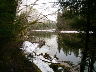
The Salmonberry Trail is a planned "rail-and-trail" hiking and biking trail through the Oregon Coast Range along the Salmonberry River in northwest Oregon, United States. The railroad was washed out by a storm in 2007. In 2012, advocacy efforts to build a trail were launched, and in 2018, the Salmonberry Trail Intergovernmental Agency was established to oversee the development of the trail.