Related Research Articles

Lewis County is a county located in the U.S. state of Kentucky. As of the 2020 census, the population was 13,080. Its county seat is Vanceburg.

Big Bone is an unincorporated community in southern Boone County, Kentucky, United States. It is bounded on the west by the Ohio River, and Rabbit Hash, on the south by Big Bone Creek, which empties into the river at Big Bone Landing. The northern extent is along Hathaway Road, and the eastern portion extends not further than U.S. 42, and is approached from that direction by Beaver Road coming from either Richwood or Walton. Big Bone took its name from a nearby prehistoric mineral lick of the same name. Geographical features of interest include Big Bone Lick State Park and the now disappeared Big Bone Island.

The Salt River is a 150-mile-long (240 km) river in the U.S. state of Kentucky that drains 2,920 square miles (7,600 km2). It begins near Parksville, Kentucky, rising from the north slope of Persimmon Knob south of KY 300 between Alum Springs and Wilsonville, and ends at the Ohio River near West Point. Taylorsville Lake is formed from the Salt River, and Guist Creek Lake is also in its drainage basin.
Silver Creek is a large creek that flows for approximately 40 miles (64 km) through Madison County, Kentucky, in the United States.
Beargrass Creek is the name given to several forks of a creek in Jefferson County, Kentucky. The Beargrass Creek watershed is one of the largest in the county, draining over 60 square miles (160 km2). It is fairly small, with an average discharge of 103 cubic feet per second at River Road in Louisville.
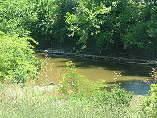
Salt Lick Creek is an 11.1-mile-long (17.9 km) tributary of the Susquehanna River in Susquehanna County, Pennsylvania in the United States.

The Licking River is a partly navigable, 303-mile-long (488 km) tributary of the Ohio River in northeastern Kentucky. The river and its tributaries drain much of the region of northeastern Kentucky between the watersheds of the Kentucky River to the west and the Big Sandy River to the east. The North Fork Licking River, in Pendleton County, Kentucky, is one of its tributaries. The South Fork Licking River, in counties including Harrison County, Kentucky, is another.
Grandglaize Creek is a creek and tributary to the Osage River that forms the Grand Glaize Arm of the Lake of the Ozarks in Missouri. The creek flows for 10 miles (16 km) before reaching the Lake of the Ozarks, and the Grand Glaize Arm extends another 15 miles (24 km) before reaching the Osage River within the lake.
The Red Bird River is one of two tributaries at the head of the South Fork Kentucky River, the other being the Goose Creek. It is located in the Daniel Boone National Forest, in the southeast of the U.S. state of Kentucky. It is 34.3 miles (55.2 km) long and drains the eastern half of Clay County.
Bullitt's Lick is a historic salt lick 3 miles (4.8 km) west of Shepherdsville in Bullitt County, Kentucky. It was the first commercial supplier of salt in Kentucky, and the first industry in Kentucky as well, supplying jobs for many residents but also using slaves.
Salt Creek is an unincorporated historic community in Polk County, Oregon, United States on Oregon Route 22 about six miles northwest of Dallas. As an early European American settlement of the Oregon Country, the cemetery at Salt Creek has graves dating back to 1847. Salt Creek, a tributary of the South Yamhill River, was named by early settlers for the salt licks found on its banks. The Salt Creek post office, named after the creek, was established in 1852 and closed in 1903. James B. Riggs, who arrived in Oregon via the Oregon Trail and the Meek Cutoff in 1845, was the first postmaster. Riggs previously been the first postmaster of Yoncalla, followed by Jesse Applegate.

Lotts Creek is a creek in Perry County and Knott County, Kentucky in the United States. It is a tributary of the North Fork Kentucky River that joins it at Darfork 3 miles (4.8 km) downstream of Hazard at an altitude of 820 feet (250 m). It is 8.5 miles (13.7 km) long from its mouth to where it splits into the Young's and Kelly Forks.
Horse Creek is a creek a tributary of Goose Creek river in Clay County, Kentucky. It is 1.5 miles (2.4 km) upstream of Manchester on Goose at an altitude of 800 feet (240 m).
Sexton's Creek is a creek in Clay County, Kentucky that is a tributary of the South Fork Kentucky River in neighbouring Owsley County, Kentucky. It is 24 miles (39 km) long.
Cassidy Creek is a stream in Fleming County, Kentucky, in the United States. It is a tributary of the Licking River.
Lees Lick is an unincorporated community in Harrison County, Kentucky, in the United States.
Clear Creek is a stream in Bell County, Kentucky, in the United States. It is a tributary of the Cumberland River.
Lawrence Creek is a stream in Mason County, Kentucky, in the United States. It is a tributary of the Ohio River.
Millersburg is an unincorporated community in Callaway County, in the U.S. state of Missouri. It is located near the Boone-Callaway county line on the Owl Creek tributary of Cedar Creek. The Little Dixie Lake and Little Dixie Wildlife Management Area lie on Owl Creek just north of the community. It is on Missouri Route J about four miles south of I-70.
Petite Saline Creek is a stream in Cooper, Moniteau and Morgan counties in the U.S. state of Missouri. It is a tributary of the Missouri River.
References
- ↑ U.S. Geological Survey Geographic Names Information System: Salt Lick Creek
- ↑ Collins, Lewis (1877). History of Kentucky. pp. 465–.
- ↑ Talley, William M.; Franke, Paula (2005). Lewis County. Arcadia Publishing. p. 8. ISBN 978-0-7385-1813-8.
38°36′26″N83°19′14″W / 38.6072984°N 83.3204621°W
| | This Lewis County, Kentucky state location article is a stub. You can help Wikipedia by expanding it. |