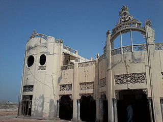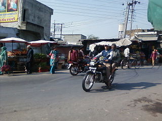
Kashmore District, previously known as Khizmer or Khizmore, is a district of the province of Sindh, Pakistan. The capital city is Kandhkot. The district has a population of 1,090,336. Kashmore District is a part of Larkana Division. Its old name was Khizmer or Khizmor. The spoken languages are Sindhi and Balochi. Its border is connected with Punjab and Balochistan provinces. Kashmore city is gateway to Punjab province and Balochistan province. In 2004, Kashmore became a district after its separation from Jacobabad District.
Tatiri is a town and a nagar panchayat in Baghpat district in the Indian state of Uttar Pradesh. The distance between Aggarwal Mandi Tatiri and Baghpat is 5 km. Tatiri is connected to two districts : Baghpat and Meerut, by road, via (NH-334B).Towards 5 km west SH-57 road which connects New Delhi- Baghpat - Baraut -Shamli - Saharanpur.

Garhdiwala is a town and a municipal council in Hoshiarpur district in the state of Punjab, India.
Mokama is a town and a municipal council in barh of Patna district in the Indian state of Bihar. It is located 90 km (56 mi) east of Patna on the southern banks of the river Ganges. Mokama is the connecting town of north and south Bihar and has 2nd highest amount of lentil production in India. It emerged as an industrial area in State of Bihar after independence.
Parikshitgarh is a town and a Nagar Panchayat in Meerut district in the Indian state of Uttar Pradesh.
Patnagarh is a town and a Notified Area Council in Bolangir district in the Indian state of Odisha. Its original name is Patnāgarh, and it is pronounced verbally as Patnāgad. The official language is chattish garhi. Patnagarh bears historical significance as it was the epicentre of power in middle age. Patnagarh was the capital of 18 garh that come under south Koshal. In 12th century AD the progenies of the famous King of Delhi, Prithwiraj Chouhan came and settled down in Patnagarh. They came here because Mohammad Ghori defeated Prithwiraj Chowhan in 2nd battle of Tarai in 1193. The first child of the royal scion who ruled Patnagarh as per recorded history was Ramai Deo. However after 16th century onwards when Balangir and Sambalpur came in to being the city lost its charm.
Siyana is a city and a municipal board with 26 wards, situated in Siyana Tehsil in the district of Bulandshahr in the Indian state of Uttar Pradesh.
Rajiana is a village of Malwa region in District Moga, Punjab. The village is divided into pattis like Vigha patti, Narang ki patti, Haveli patti, Joga Patti, Ghoga Patti, Wazir patti, Rania Patti etc. The people of the village belongs to various religions, most of them are Jatt Sikhs of Brar clan. The village has three panchayats; Rajiana, Rajiana Patti Vigha and Rajiana Khurd. There are three water works and 3 water filters in the village supplying pure water to the villagers. There is a Co-operative bank, Revenue office, Corporate society for farmers, two petrol pumps, three Government schools, three private school, Government hospital, Government veterinary hospital, Multiplex and Hotel, two playgrounds, 5 mini parks, two marriage resorts, mobile towers and all other facilities.
Khatangi is a prominent village in Bihar, India. It is situated in Sonbhadra-Bansi-Surajpur Block in Arwal district of the State of Bihar. It is located at 96.1 km distance from Arwal and at 114 km distance from the state capital Patna. It is a very old village with a population of about 5,000 people. The literacy rate is 45.56%, comprising a female literacy rate of 27.3% and a male literacy rate of 62.98%. The people here are very friendly and hospitable. The economy of this village is agro-based and agriculture remains the main source of income.

Bastipur is a village and a municipality in Rohtas district in the state of Bihar, India.
Jawal is a village situated in Sirohi tehsil of Sirohi District of Rajasthan in Western India. It lies on Jalore - Sirohi Highway, 15 km north of Sirohi and 60 km south of Jalore.
Banhpur is a village in Bulandshahr district of the Indian state of Uttar Pradesh. It comes under Siana tehsil.
Tiparpur is a small village of Vikasnagar mandal, Dehradun district in the Indian state of Uttarakhand. It is located 25 km from Dehradun ISBT. It is situated on Shimla Bypass road. It is located in the middle of Shivalik hills and Aasan river. Selaqui industrial area is 10 km from Tiperpur.

Shergarh, is an historic town, union council and major administrative subdivision of Depalpur Tehsil, Okara District, Punjab, Pakistan.
Kot Ladha is a small town in Gujranwala district of Punjab, Pakistan. It is situated on Gujranwala to Hafizabad road.
Dhanghata is a small village located in Bansi Tehsil of Siddharth Nagar district, Uttar Pradesh state of India. It belongs to the Basti division. It is located 40 km west of District headquarters Naugarh and 225 km from State capital Lucknow. It is located on west side of the state highway between Basti and Lumbini.
Jeerai is a village in Gogunda Tehsil in Udaipur district in the Indian state of Rajasthan. The District headquarter of the village is Udaipur.
Jaswantgarh is a small Village in Gogunda Tehsil in Udaipur District of Rajasthan, situated about 423 km from Jaipur and around 38 km from the District head quarter Udaipur.
Garalbari is a gram panchayat area located in the Jalpaiguri district of West-Bengal, India. Geographically, Garalbari is located in the latitude of 26.448391N and longitude of 88.6434308E. Garalbari is a panchayat village in Jalpaiguri Block of Jalpaiguri District of West Bengal State, India. It is located 13 km away towards the South from the district headquarters Jalpaiguri and 12 km away from Jalpaiguri city. The postal index number of Garalbari is 735132.
Ghoswari is a town and a municipal council in barh of Patna district in the Indian state of Bihar. The Postal Index Number of Ghoswari is 803212.


