
U.S. Route 176 is a spur of US 76 in the U.S. states of North Carolina and South Carolina. The U.S. Highway runs 237.98 miles (382.99 km) from US 25 Business and North Carolina Highway 225 in Hendersonville, North Carolina, east to US 52 in Goose Creek, South Carolina. US 176 serves the transition region between the Blue Ridge Mountains and Foothills of Western North Carolina and the Upstate, Midlands, and Lowcountry regions of South Carolina. The highway passes through and connects Spartanburg, one of two major cities in the Upstate, and Columbia, the South Carolina state capital and central city of the Midlands. US 176 parallels and serves as a secondary highway to Interstate 26 (I-26) except for between Spartanburg and Columbia, where the U.S. Highway deviates from the I-26 corridor to serve Union.

New York State Route 25A (NY 25A) is a state highway on Long Island in New York, United States. It serves as the main east–west route for most of the North Shore of Long Island, running for 73 miles (117 km) from Interstate 495 (I-495) at the Queens–Midtown Tunnel in the New York City borough of Queens to NY 25 in Calverton, Suffolk County. The highway is a northern alternate route of NY 25, which follows a more inland routing along Jericho Turnpike.

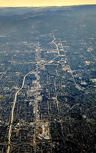
The Los Gatos Creek Trail is a 9.7-mile (15.6 km) pedestrian and bicycle trail that runs through western Santa Clara County in California. The main segment runs from Lexington Reservoir in Los Gatos, California through Campbell, California to Meridian Avenue in San Jose, California alongside Los Gatos Creek. The half-mile northern segment runs from Lonus Street under I-280 to Dupont Street in downtown San Jose. The trail is heavily used.

State Road 100 is a 153-mile-long (246 km) east–west highway serving northeast Florida. Its western terminus is at the Georgia-Florida border four miles (6.4 km) north of Avoca, Florida ; its eastern terminus is an intersection with Shore Scenic Highway in Flagler Beach. The portion west of Lake City is only signed as portions of US 41 and US 129, both of which run north–south.
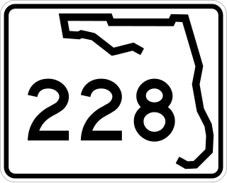
State Road 228 (SR 228) is a 32.532-mile-long (52.355 km) state highway in the northeastern part of the U.S. state of Florida. It exists in two distinct sections, separated by both Baker County Road 228 and Duval CR 228, which are former segments of SR 228.

The Peninsular Railway was an interurban electrified railway in the U.S. State of California in the United States of America. It served the area between San Jose, Los Gatos, and Palo Alto, comprising much of what is today known as "Silicon Valley". For much of its existence it was a subsidiary of the Southern Pacific Railroad.

Richmond Avenue is a major north-south thoroughfare on Staten Island, New York. Measuring approximately 7.0 miles (11.3 km), the road runs from the South Shore community of Eltingville to the North Shore community of Graniteville.

State Route 1002(SR 1002), locally known as Tilghman Street and Union Boulevard, is a major 13.8 mi (22.2 km) long east–west road in the Lehigh Valley area of the U.S. state of Pennsylvania. The majority of the roadway is the former alignment of U.S. Route 22, maintained by the Pennsylvania Department of Transportation as a Quadrant Route, and is not signed except on small white segment markers.

U.S. Route 13 (US 13) is a United States Numbered Highway running from Fayetteville, North Carolina, north to Morrisville, Pennsylvania. The route runs for 49.359 miles (79.436 km) through the Delaware Valley in the U.S. state of Pennsylvania. The route enters the state from Delaware in Marcus Hook, Delaware County. It continues northeast through Delaware County, passing through the city of Chester before heading through suburban areas along Chester Pike to Darby. US 13 enters the city of Philadelphia on Baltimore Avenue and runs through West Philadelphia to University City, where it turns north along several city streets before heading east across the Schuylkill River along Girard Avenue. The route turns north and heads to North Philadelphia, where it runs northeast along Hunting Park Avenue. US 13 becomes concurrent with US 1 on Roosevelt Boulevard, continuing into Northeast Philadelphia. US 13 splits southeast on a one-way pair of streets before heading northeast out of the city on Frankford Avenue. The route continues into Bucks County as Bristol Pike, heading northeast to Bristol, where it turns into a divided highway. US 13 becomes a freeway in Tullytown and continues north to its terminus at US 1 in Falls Township, near Morrisville. US 13 roughly parallels Interstate 95 (I-95) through its course in Pennsylvania.

Maryland Route 166 is a state highway in the U.S. state of Maryland. The state highway runs 2.71 miles (4.36 km) from Interstate 195 (I-195) in Arbutus north to MD 144 in Catonsville. MD 166 consists of two sections: a short freeway section that serves as a northern continuation of I-195 and provides access to the University of Maryland, Baltimore County (UMBC), and a segment of Rolling Road, a major north–south highway in western Baltimore County. Rolling Road dates to the colonial era as a highway used to transport tobacco from plantations to river ports. North Rolling Road, which connects Catonsville with Woodlawn and Milford Mill, has always been a county highway. South Rolling Road was constructed as a state highway by the early 1920s between what were to become U.S. Route 1 and US 40. Parts of South Rolling Road were transferred to county maintenance after they were severed by the construction of I-95 and a freeway relocation of the southern end of MD 166 in the early 1970s.

A total of ten special routes of U.S. Route 71 exist, and another ten previously existed.

Several special routes of U.S. Route 1 (US 1) exist, from Florida to Maine. In order from south to north, separated by type, these special routes are as follows.

Lankershim Boulevard is a major north-south thoroughfare in the eastern San Fernando Valley, primarily within the City of Los Angeles, in Los Angeles County, California.
Many arterial roads in the Phoenix metropolitan area have the same name in multiple cities or towns. Some roads change names or route numbers across town borders, resulting in occasional confusion. For example, the road known as Apache Boulevard in Tempe continues east as Main Street in neighboring Mesa and then as Apache Trail in Apache Junction. Although Broadway Road maintains the same name through Goodyear, Avondale, Phoenix, Tempe, Mesa, and Apache Junction, each town uses a different reference point for address numbers.
There are 21 routes assigned to the "G" zone of the California Route Marker Program, which designates county routes in California. The "G" zone includes county highways in Monterey, San Benito, San Luis Obispo, Santa Clara, and Santa Cruz counties.
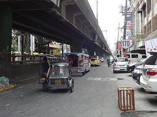
Taft Avenue is a major road in the south of Metro Manila. It passes through three cities in the metropolis: Manila, Pasay, and Parañaque. The road was named after the former Governor-General of the Philippines and U.S. President, William Howard Taft; the Philippines was a former commonwealth territory of the United States in the first half of the 20th century. The avenue is a component of National Route 170 (N170), a secondary road in the Philippine highway network, and anchors R-2 of the Manila arterial road network.
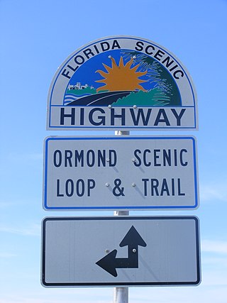
The Ormond Scenic Loop and Trail is a series of scenic state and county highways in Volusia County, Florida. CR 2002 is the northern leg of the trail. CR 4011(Old Dixie Highway and North Beach Street) is the western leg, with a spur onto Pine Tree Drive. SR 40(East Granada Boulevard) is the southern leg of the trail. CR 2803(John Anderson Drive) is the central leg of the trail, and SR A1A is the eastern leg of the trail. Florida Scenic Highway, designated this route on July 9, 2007.
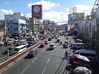
Quezon Boulevard is a short stretch of highway in Manila, Philippines running north–south through the district of Quiapo. It is a six- to ten-lane 1.1-kilometer-long (0.68 mi) divided boulevard designated as a component of National Route 170 (N170) of the Philippine highway network, except for its service roads, and Radial Road 8 (R-8) of Manila's arterial road network which links the center of Manila to North Luzon Expressway in Quezon City in the north. The boulevard is the main access to the popular Quiapo Church and is one of the main thoroughfares of the University Belt area.
Stevens Creek Boulevard is a major thoroughfare in Santa Clara County, California, spanning from San Carlos Street, in San Jose's West San Carlos district in the East to Permanente, in the Santa Cruz Mountains west of Cupertino. It is a part of the larger Stevens Creek Boulevard/San Carlos Street corridor. Freeways that intersect it include I-880/SR 17, SR 85, and I-280.

