
The Arctic Archipelago, also known as the Canadian Arctic Archipelago, is an archipelago lying to the north of the Canadian continental mainland, excluding Greenland and Iceland.

The Nimrod Glacier is a major glacier about 135 km (85 mi) long, flowing from the polar plateau in a northerly direction through the Transantarctic Mountains into the Ross Ice Shelf, Antarctica.
The Wisconsin Range is a major mountain range of the Horlick Mountains in Antarctica, comprising the Wisconsin Plateau and numerous glaciers, ridges and peaks bounded by the Reedy Glacier, Shimizu Ice Stream, Horlick Ice Stream and the interior ice plateau.
Chuschi is a town in the Chuschi District of the Cangallo Province of the Ayacucho Region of Peru. On May 17, 1980, Shining Path guerrillas began their war against the Peruvian state by burning ballot boxes in Chuschi. On March 14, 1991, government forces perpetrated the Chuschi massacre in the town.

El Piñero is a municipality located in the province of Zamora, Castile and León, Spain. According to the 2004 census (INE), the municipality has a population of 282 inhabitants.
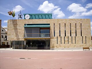
Pedrajas de San Esteban is a municipality located in the province of Valladolid, Castile and León, Spain. According to the 2004 census (INE), the municipality has a population of 3,317 inhabitants.

Pontal do Paraná is a municipality in the state of Paraná in the Southern Region of Brazil.
Casa de Piedra (La Paz) is a village and municipality in Catamarca Province in northwestern Argentina.
Infanzón is a village and municipality in Catamarca Province in northwestern Argentina.

The borders of the oceans are the limits of Earth's oceanic waters. The definition and number of oceans can vary depending on the adopted criteria. The principal divisions of the five oceans are the Pacific Ocean, Atlantic Ocean, Indian Ocean, Southern (Antarctic) Ocean, and Arctic Ocean. Smaller regions of the oceans are called seas, gulfs, bays, straits, and other terms. Geologically, an ocean is an area of oceanic crust covered by water.
The Cumulus Hills are several groups of largely barren hills in Antarctica. Divided by the Logie Glacier, they are bounded by Shackleton Glacier on the west, McGregor Glacier on the north and Zaneveld Glacier on the south.

Demorest Glacier is a glacier on the northeast side of Hemimont Plateau which flows southeast into Whirlwind Inlet between Flint Glacier and Matthes Glacier, on the east coast of Graham Land. It was discovered by Sir Hubert Wilkins on a flight of December 20, 1928, and photographed from the air by the United States Antarctic Service in 1940. It was charted by the Falkland Islands Dependencies Survey in 1947 and named for Max H. Demorest, an American glaciologist.
Palestrina Glacier is a glacier lying in the northern portion of Alexander Island, Antarctica, 11 nautical miles (20 km) long and 8 nautical miles (15 km) wide, flowing west from Nichols Snowfield into Lazarev Bay. The glacier was mapped from air photos taken by the Ronne Antarctic Research Expedition (RARE), 1947–48, by Derek J.H. Searle of the Falkland Islands Dependencies Survey (FIDS) in 1960. Named by the United Kingdom Antarctic Place-Names Committee (UK-APC) for Giovanni da Palestrina (1525–1594), Italian composer.
Tofani Glacier is a glacier flowing northeast into the head of Solberg Inlet, Bowman Coast, to the north of Houser Peak. The feature was photographed from the air by United States Antarctic Service (USAS), 1940, U.S. Navy, 1966, and was surveyed by Falkland Islands Dependencies Survey (FIDS), 1946–48. Named by Advisory Committee on Antarctic Names (US-ACAN) in 1977 after Dr. Walter Tofani, M.D., station physician at Palmer Station, 1975.
Renaud Glacier is a heavily crevassed glacier on the east side of Hemimont Plateau flowing southeast to enter Seligman Inlet between Lewis Glacier and Choyce Point, on the east coast of Graham Land. The glacier was first photographed by the United States Antarctic Service (USAS), 1939–41. Named by United Kingdom Antarctic Place-Names Committee (UK-APC) for Andre Renaud, Swiss glaciologist and chairman of the Swiss Glacier Commission, 1955–74.
Robillard Glacier is a narrow glacier flowing east-northeast and entering the north side of the head of Solberg Inlet, on the east coast of Graham Land. It was discovered by members of East Base of the United States Antarctic Service (USAS), 1939–41, and was photographed from the air in 1947 by the Ronne Antarctic Research Expedition (RARE), under Ronne, and charted in 1948 by the Falkland Islands Dependencies Survey (FIDS). It was named by Ronne for Captain George Robillard, U.S. Navy, of the legal section of the Bureau of Ships, who assisted in gaining Congressional support which resulted in procuring the expedition ship.

Cochinoca is a department located in the Jujuy Province, (Argentina). According to 2005 INDEC estimates, it had a population of 13,301 inhabitants.
