Williamson County is a county in the U.S. state of Texas. As of the 2020 census, its population was 609,017. Its county seat is Georgetown. The county is named for Robert McAlpin Williamson (1804?–1859), a community leader and a veteran of the Battle of San Jacinto.

Travis County is located in south central Texas. As of the 2020 census, the population was 1,290,188. It is the fifth-most populous county in Texas. Its county seat and largest city is Austin, the capital of Texas. The county was established in 1840 and is named in honor of William Barret Travis, the commander of the Republic of Texas forces at the Battle of the Alamo. Travis County is part of the Austin–Round Rock–Georgetown Metropolitan Statistical Area. It is located along the Balcones Fault, the boundary between the Edwards Plateau to the west and the Blackland Prairie to the east.

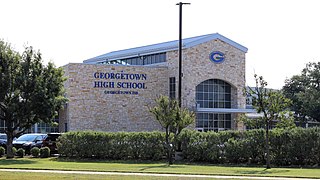
Georgetown is a city in Texas and the county seat of Williamson County, Texas, United States. The population was 67,176 at the 2020 census. It is 30 miles (48 km) north of Austin.

Weir is a city in Williamson County, Texas, United States. The population was 450 at the 2010 census.

The San Gabriel River is a river that flows through central Texas, USA. The San Gabriel River is formed in Georgetown by the confluence of the North Fork San Gabriel and the South Fork San Gabriel, both of which originate in Burnet County. There are two major impoundments of the river: Lake Georgetown along the North Fork, and Granger Lake, about 25 miles (40 km) below the confluence. Both are U.S. Army Corps of Engineers impoundments. The San Gabriel River joins the Little River five miles south of Cameron which then meets the Brazos River northwest of College Station. There is a city park in Georgetown at the confluence of the North and South Forks, with a well-known local swimming spot located just upriver from the confluence on the South Fork.

A continuous flow intersection (CFI), also called a crossover displaced left-turn, is an alternative design for an at-grade road junction. Vehicles attempting to turn across the opposing direction of traffic cross before they enter the intersection. No left turn signal in the intersection is then necessary. Instead, vehicles traveling in both directions can proceed, including through vehicles and those turning right or left, when a generic traffic signal/stop sign permits.

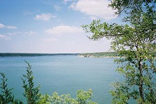
Lake Georgetown is a reservoir on the north fork of the San Gabriel River in central Texas in the United States. Lake Georgetown is a U.S. Army Corps of Engineers reservoir formed on the San Gabriel by the North San Gabriel Dam, which is located about three miles west of Georgetown, Texas. The dam, lake, and all adjacent property are managed by the Fort Worth District of the U.S. Army Corps of Engineers. The dam was officially completed on October 5, 1979, and serves to provide flood control for the community of Georgetown. Lake Georgetown is also a source of drinking water for Georgetown and the nearby city of Round Rock. The lake is also a popular recreational destination.

The Little River is a river in Central Texas in the Brazos River watershed. It is formed by the confluence of the Leon River and the Lampasas River near Little River, Texas in Bell County. It flows generally southeast for 75 miles (121 km) until it empties into the Brazos River about 5 miles (8.0 km) southwest of Hearne, at a site called Port Sullivan in Milam County. The Little River has a third tributary, the San Gabriel River, which joins the Little about 8 miles (13 km) north of Rockdale and five miles southwest of Cameron. Cameron, the county seat of Milam County and the only city of any significant size on the Little River, was established in 1846.
Jonah is an unincorporated community in Williamson County, Texas, United States. As of the 1990 census, the community had a population of 60.

The Austin–Round Rock–San Marcos metropolitan statistical area, or Greater Austin, is a five-county metropolitan area in the U.S. state of Texas, as defined by the Office of Management and Budget. The metropolitan area is situated in Central Texas on the western edge of the American South and on the eastern edge of the American Southwest, and borders Greater San Antonio to the south.
Brushy Creek (San Gabriel River) is a river in Texas that flows east for 69 miles.

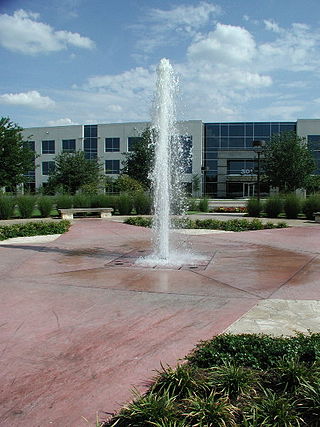
La Frontera is a mixed-use development in Round Rock, Texas. It consists of retail, residential and office properties. The name "La Frontera" means "the border" or "frontier" in Spanish, referring to the development's location on the border of Travis and Williamson counties.
San Gabriel, Texas is an unincorporated community located in northwest Milam County, Texas approximately 10 miles north of Thorndale on Farm to Market Road 486, or about 50 miles northeast of the Austin metropolitan area. San Gabriel has an elevation of 417 feet above sea level. San Gabriel appears on the San Gabriel U.S. Geological Survey Map and is in the Central Time Zone.

Waters Park, Texas was a village located eight miles north of downtown Austin, Texas defined by the boundaries of Farm to Market Road 1325, MoPac, and the Southern Pacific Railroad. It is now part of the City of Austin.

Blue Hole Park is lagoon and park along the South Fork of the San Gabriel River, in Georgetown, Texas, United States.

Old Georgetown Cemetery, also known as San Gabriel Cemetery and Blue Hole Cemetery, is a cemetery in Georgetown, Texas, United States. The Georgetown Historical Survey Committee led efforts to restore the cemetery in 1968.

The Georgetown-Williamson County Veterans Memorial Plaza, or simply Veterans Memorial Plaza, is a memorial situated in Sun City Texas, in Georgetown, Texas, United States. The site hosts Memorial Day and Veterans Day ceremonies, which have been attended by politicians and military personnel such as John Carter (2011), Sean MacFarland (2014), and Charles Schwertner (2014). Completed in the early 2000s, the plaza features more than 4,000 bricks inscribed with the names of veterans, as of 2015.


