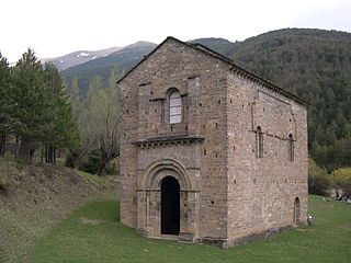
Guardo is a municipality in the province of Palencia, in the autonomous community of Castile-Leon, Spain.
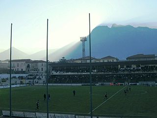
Stadio Simonetta Lamberti is a multi-purpose stadium, in Cava de' Tirreni, Italy. The stadium holds 12,000 people and opened in 1969. The pitch size is 110x65m.

Hope is a small unincorporated community in the deserts of La Paz County, Arizona, United States. Its name was inspired by the community's hope for increased business after merchants visited the town. Today, it consists of one RV park, one gas station, one church, and one antique store.

San Gil is a town municipality in the Department of Santander in northeastern Colombia, located roughly 300 km (192 mi) from Bogotá and 95 km from the department's capital, Bucaramanga. As of 2005, San Gil had a population of roughly 42,000 people within the total municipal area, making it the third largest urban area in the department, after Bucaramanga and Barrancabermeja. Founded in 1689, San Gil is over 300 years old. It was officially named the tourist capital of the region in 2004, thanks to its outdoor activity opportunities such as rafting, caving, kayaking and hiking.

Zapatoca is a town and municipality in the Santander Department in northeastern Colombia. It is at a high altitude and is a common stop between Bucaramanga and San Gil. It was built in the early 17th century by the Spanish conquistadores.
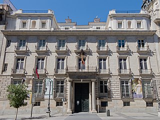
The Real Academia de Bellas Artes de San Fernando, located on the Calle de Alcalá in the heart of Madrid, currently functions as a museum and gallery.

San Miguel is a town and municipality located in the Putumayo Department, Republic of Colombia.

Castrillo del Val is a municipality located in the province of Burgos, Castile and León, Spain. According to the 2004 census (INE), the municipality has a population of 515 inhabitants.

Hortigüela is a municipality located in the province of Burgos, Castile and León, Spain. According to the 2004 census (INE), the municipality has a population of 126 inhabitants.
Jurisdicción de San Zadornil is a municipality located in the province of Burgos, Castile and León, Spain. According to the 2004 census (INE), the municipality has a population of 110 inhabitants.

Poza de la Sal is a municipality and town located in the province of Burgos, Castile and León, Spain. According to the 2004 census (INE), the municipality has a population of 387 inhabitants.

The Dry Creek Rancheria is the land base of the Dry Creek Rancheria Band of Pomo Indians. The reservation consists today of approximately 75 acres (300,000 m2) near the Russian River, in Sonoma County, approximately 75 miles (121 km) north of San Francisco, California. It is situated about 3 miles southeast of Geyserville.

Saint-André is a municipality in the Canadian province of Quebec, located in the Kamouraska Regional County Municipality.

Hanchey Army Heliport is a military heliport serving Fort Rucker in Dale County, Alabama, United States. Owned by the United States Army, it is located 6 NM (11 km) south of the city of Ozark.

Pekwuteu is a former Yurok settlement in Humboldt County, California. It was located on the Lower Klamath River opposite town of Weitchpec, at an elevation of 348 feet.
Lowe Army Heliport is a military heliport serving Fort Rucker in Dale County, Alabama, United States. Owned by the United States Army, it is located 8 nautical miles (15 km) southwest of the city of Ozark. World's busiest heliport launching over 100 flights daily.

Luna is a municipality located in the province of Zaragoza, in Aragon, Spain. It is in the judicial district of Ejea de los Caballeros in the northeast of the province. It is 65 km from Zaragoza. According to the 2009 census (INE), the municipality has a population of 861 inhabitants.
Dekpo is an arrondissement in the Kouffo department of Benin. It is an administrative division under the jurisdiction of the commune of Aplahoué. According to the population census conducted by the Institut National de la Statistique Benin on February 15, 2002, the arrondissement had a total population of 16,390.

Toyei is a census-designated place (CDP) in Apache County, Arizona, United States. The population was 13 at the 2010 census.
Intiyuq K'uchu is an archaeological site in Peru with rock paintings. It is located in the Cusco Region, Calca Province, Lamay District. Intiyuq K'uchu is situated at a height of about 3,800 metres (12,467 ft).