Related Research Articles

Santa Barbara is a coastal city in Santa Barbara County, California, of which it is also the county seat. Situated on a south-facing section of coastline, the longest such section on the West Coast of the United States, the city lies between the steeply rising Santa Ynez Mountains and the Pacific Ocean. Santa Barbara's climate is often described as Mediterranean, and the city has been promoted as the "American Riviera". According to the 2020 U.S. Census, the city's population was 88,665.

Cupertino is a city in Santa Clara County, California, United States, directly west of San Jose on the western edge of the Santa Clara Valley with portions extending into the foothills of the Santa Cruz Mountains. The population was 57,820 as of the 2020 census.

Mountain View is a city in Santa Clara County, California, United States. Named for its views of the Santa Cruz Mountains, It has a population of 82,739.

The Richmond District is a neighborhood in the northwest corner of San Francisco, California, developed initially in the late 19th century. It is sometimes confused with the city of Richmond, which is 20 miles (32 km) northeast of San Francisco.

The Faubourg Marigny is a neighborhood of the city of New Orleans, Louisiana, United States.

Palermo is a barrio or neighborhood of Buenos Aires, Argentina. It is located in the north of the city, near the Rio de la Plata.

Roch or Rocco (lived c. 1348 – 15/16 August 1376/79 is a Catholic saint, a confessor whose death is commemorated on 16 August and 9 September in Italy; he is especially invoked against the plague. He may also be called Rock in English, and has the designation of Rollox in Glasgow, Scotland, said to be a corruption of Roch's Loch, which referred to a small loch once near a chapel dedicated to Roch in 1506.

Santa Barbara, officially the Municipality of Santa Barbara, is a 2nd class municipality in the province of Iloilo, Philippines. According to the 2020 census, it has a population of 67,630 people.
San Roque may refer to:

San Roque is a small town and municipality in the south of Spain. It is part of the province of Cádiz, which in turn is part of the autonomous community of Andalusia. San Roque is situated a short way inland of the north side of the Bay of Gibraltar, to the north of the Gibraltar peninsula. The municipality has a total surface of 145 km2 with a population of approximately 25,500 people, as of 2005. Its name is Spanish for Saint Roch, a Christian saint who was revered in a shrine dating back to 1508 that predates the foundation of the town.

Getxo is a town located in the province of Biscay, in the autonomous community of the Basque Country, in Spain. It is part of Greater Bilbao, and has 77,946 inhabitants (2019). Getxo is mostly an affluent residential area, as well as being the third largest municipality of Biscay.
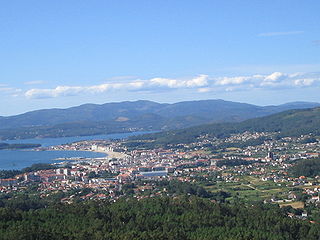
Vilagarcía de Arousa is a Spanish municipality in the Province of Pontevedra, Galicia. As of 2014 it has a population of 37,712, being ninth largest town in Galicia.
Lakewood Village, or simply known as The Village, is a neighborhood in the northeast portion of the city of Long Beach, California. It is bordered on the west, north and east sides by the City of Lakewood. It is located south of Del Amo Boulevard, north of Carson Street, east of Lakewood Boulevard and west of Bellflower Boulevard.

There are more than 500 neighborhoods within the area of Jacksonville, Florida, the largest city in the contiguous United States by area. These include Downtown Jacksonville and surrounding neighborhoods. Additionally, greater Jacksonville is traditionally divided into several major sections with amorphous boundaries: Northside, Westside, Southside, and Arlington, as well as the Jacksonville Beaches.

San Pasqual Valley, historically spelt as San Pascual, is the northernmost community of the city of San Diego. It is named for the Kumeyaay village of San Pasqual that was once located there. It is bordered on the north by the city of Escondido, on the east and west by unincorporated land within San Diego County, and on the south by the city of Poway and the community of Rancho Bernardo. San Pasqual Valley is home to the San Diego Zoo Safari Park.

Clairemont is a community within the city of San Diego, California, United States. It has a population of about 81,600 residents and an area of roughly 13.3 square miles (34 km2). Clairemont Mesa is bordered by Interstate 805 on the east, Interstate 5 to the west, State Route 52 to the north, and the community of Linda Vista to the south. The community of Clairemont Mesa can be subdivided into the neighborhoods of North Clairemont, Clairemont Mesa East, Clairemont Mesa West, Bay Park, and Bay Ho.
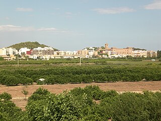
El Puig, officially El Puig de Santa Maria since 2012, is a village situated 15 km north of the city of Valencia in the comarca of Horta Nord, Spain. Its name means "hill" in Valencian). The municipality comprises three main areas, the first being the village itself, which is dominated by a monastery, and two large wooded hills next to it, the largest of which has the ruins of a castle fortress at the top. Originally, however, there was another hill named La Pedrera which disappeared gradually during the 20th century to make way for the V-21 motorway, with the rock being used to construct one of the jetties at Valencia's port. The second section is the coastal area of 4 km of beach with eight housing developments that are generally only inhabited in the summer; and finally, there is an industrial park located between them.
Fairgrounds is a neighborhood of the city of New Orleans. A subdistrict of the Mid-City District Area, its boundaries as defined by the New Orleans City Planning Commission are: Florida Avenue, Dugue, Treasure, Republic and Abundance Streets to the north, North Broad Street to the east, Esplanade Avenue to the south and Bayou St. John to the west.

Milpitas is a city in Santa Clara County, California, in Silicon Valley. As of the 2020 census, the city population was 80,273. The city's origins lie in Rancho Milpitas, granted to Californio ranchero José María Alviso in 1835. Milpitas incorporated in 1954 and has since become home to numerous high tech companies, as part of Silicon Valley.
Valencia is an unincorporated community in northwestern Los Angeles County, California. This area, with major commercial and industrial parks, straddles State Route 126 and the Santa Clara River.
References
- ↑ Modugno, Tom. "Steven Rutherford". Goleta History. Retrieved 17 July 2020.
- ↑ Wing, Jeff. "Santa Barbara. The Great War. Lawrie". SantaBarbaraSentinel.com. Retrieved 22 December 2017.
- ↑ Tompkins, Walker (1978). Neighborhood Series #1: San Roque. Southern Santa Barbara County Board of Realtors.
| | This Santa Barbara County, California-related article is a stub. You can help Wikipedia by expanding it. |