Related Research Articles

Devola is a census-designated place (CDP) in Washington County, Ohio, United States, along the Muskingum River. It is part of the Parkersburg-Marietta-Vienna, WV-OH Metropolitan Statistical Area. The population was 2,771 at the 2000 census.
Bogata is a city in Red River County, Texas, United States. The population was 1,153 at the 2010 census. The city was named after Bogotá, the capital of Colombia. In addition, 'bogata' means 'rich' in the Polish language.
Westar was a fleet of geosynchronous communications satellites operating in the C band which were launched by Western Union from 1974 to 1984. There were seven Westar satellites in all, with five of them launched and operating under the Westar name.

The Río Negro is the most important river in Uruguay. It originates in the southern highlands of Brazil, just east of Bagé, and flows west across the entire width of Uruguay to the Uruguay River. The course of the Río Negro across Uruguay effectively divides the south of the country from the north. The Río Negro's principal tributaries are Yí River and Tacuarembó River.
The Libertador General San Martín Bridge is a cantilever road bridge that crosses the Uruguay River and joins Argentina and Uruguay. It runs between Puerto Unzué, near Gualeguaychú, Entre Ríos Province, Argentina, and Fray Bentos, Río Negro Department, Uruguay, with a total length of 5,366 meters (3.7 mi).

The Ibicuy Islands are a maze of low-level islands in the east of the Paraná Delta, within Entre Ríos Province, Argentina. They are located between the Paraná and Uruguay Rivers. The islands are part of the Islas del Ibicuy Department and have scattered but important settlements, like their capital Villa Paranacito. The principal access is by the Ibicuy River, a branch of the Paraná River.

The Gualeguaychú River is a river in the province of Entre Ríos, Argentina. It starts in the center-east of the province, within the Colón Department, and flows south, passing by the city of Gualeguaychú and then emptying into the Uruguay River. Its drainage basin has an area of 6,693 square kilometres (2,584 sq mi).

Hesketh is a hamlet in southern Alberta, Canada within Kneehill County. It is located approximately 25 km (16 mi) west of Drumheller.

Barajas is a district belonging to the city of Madrid, Spain.
The Ludlow River is a river in the South West region of Western Australia. It was named after Frank Ludlow, one of the first Western Australian colonists, an arrival on the barque Parmelia in 1829, who explored the locality in 1834.

Westside is an unincorporated community in Fresno County, California. It is located 22 miles (35 km) northeast of Coalinga, at an elevation of 249 feet.
The Gunn River is a river on the West Coast of New Zealand. It starts in the Price Range in Westland Tai Poutini National Park and flows east into the Whataroa River, which eventually drains into the Tasman Sea.
The Snake River is a 5.1-mile-long (8.2 km) tributary of the Portage River on the Upper Peninsula of Michigan in the United States. Via the Portage River, its water flows to Lake Superior.
Lizard Creek is a tributary of the Elk River. Their confluence is south of the city of Fernie, British Columbia near the base of Fernie Alpine Resort. Lizard Creek drains a side valley of the Elk Valley called Cedar Valley, which is home to Island Lake Lodge.
Agraciada Beach is a historic beach area in Uruguay.

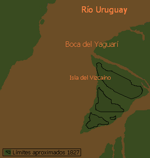
Vizcaíno Island is an island in Uruguay located on the Negro River estuary, at its confluence with Uruguay River. It is bordered by the Negro river to the South, Vizcaíno creek to the east, Uruguay river to the North and Yaguarí creek on the West. Yaguarí creek is a narrow deep channel between Vizcaíno island and Lobos Island, and is the main river mouth of the Negro river.

This is a list of the extreme points of Uruguay, the points that are farther north, south, east or west than any other location, and the highest and lowest points. It is also notable that Uruguay's northernmost point is farther south than the northernmost point of any other nation.
Punta Gorda is a landform in Colonia Department, Uruguay.

Taggart Crossing is an unincorporated community in Washington Township, Morgan County, in the U.S. state of Indiana.
References
- Rand McNally, The New International Atlas, 1993.
- GEOnet Names Server
Coordinates: 33°28′13″S58°24′02″W / 33.47028°S 58.40056°W