
The Arctic Archipelago, also known as the Canadian Arctic Archipelago, is a group of islands north of the Canadian mainland.
This is a list of the extreme points of Ireland – the points that are farthest north, south, east or west in Ireland. It includes the Republic of Ireland and Northern Ireland.

Mateare is a municipality in the Managua department of Nicaragua. Mateare is 328 km² and has an estimated population of 27,000.

Huancabamba is a town in Northern Peru, capital of the province Huancabamba in the region Piura. It is situated in the valley of the Huancabamba river, along which the old Inca road passed leading from Quito to Cajamarca.
Alto Inambari District is one of ten districts of the province Sandia in Peru.
Cuyocuyo District is one of ten districts of the province Sandia in Peru.
Patambuco District is one of ten districts of the Sandia Province in Peru.
Quiaca District is one of ten districts of the province Sandia in Peru.
San Juan del Oro District is one of ten districts of the province Sandia in Peru.

San Pedro de Putina Puncu District is one of ten districts of the province Sandia in Peru.
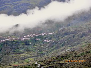
Sandia District is one of ten districts of the province Sandia in Peru.
Yanahuaya District is one of ten districts of the province Sandia in Peru.
Loaba is a town in the Bittou Department of Boulgou Province in south-eastern Burkina Faso. As of 2005, the town has a population of 3,518.
Malabad is a village in Belgaum district of Karnataka, India.
Jauni is a village in Saaremaa Parish, Saare County in western Estonia.

Goff Glacier is a broad glacier flowing from Parker Peak into the head of Koether Inlet on the north side of Thurston Island, Antarctica. It was named by the Advisory Committee on Antarctic Names after Lieutenant Robert G. Goff, co-pilot of PBM Mariner aircraft in the Eastern Group of U.S. Navy Operation Highjump, which obtained aerial photographs of Thurston Island and adjacent coastal areas, 1946–47.

Moran Glacier is a glacier 10 nautical miles (18 km) long, joined at the south side by Walter Glacier, flowing east into Schokalsky Bay, situated in the northeast portion of Alexander Island, Antarctica. Photographed from the air by Ronne Antarctic Research Expedition (RARE), 1947–48, and surveyed by Falkland Islands Dependencies Survey (FIDS), 1948-50. Named by Advisory Committee on Antarctic Names (US-ACAN) for Commander Clifford D. Moran, U.S. Navy, aircraft pilot, Squadron VXE-6, U.S. Navy Operation Deep Freeze, 1966 and 1977.
Ighrem N'Ougdal is a commune in the Ouarzazate Province of the Souss-Massa-Drâa administrative region of Morocco. At the time of the 2004 census, the commune had a total population of 14014 people living in 2209 households.


