North Cape is a cape on the northern coast of the island of Magerøya in Northern Norway. The cape is in Nordkapp Municipality in Finnmark county, Norway. The European route E69 highway has its northern terminus at North Cape, which makes it the northernmost point in Europe that can be accessed by car and makes the E69 the northernmost public road in Europe. The plateau is a popular tourist attraction. The cape includes a 307-metre-high cliff (1,007 ft) with a large flat plateau on top, where visitors, weather permitting, can watch the midnight sun and views of the Barents Sea to the north. North Cape Hall, a visitor centre, was built in 1988 on the plateau. It includes a café, restaurant, post office, souvenir shop, a small museum, and video cinema.
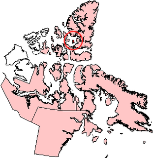
Graham Island is an uninhabited island in Qikiqtaaluk Region, Nunavut, Canada. A member of the Queen Elizabeth Islands and Canadian Arctic Archipelago, it is located in Norwegian Bay off the coast of Ellesmere Island. Located at 77°25'N 90°30'W it has an area of 1,378 km2 (532 sq mi), 55 kilometres (34 mi) long and 40 kilometres (25 mi) wide. It was named in 1910.

Kvitøya is an island in the Svalbard archipelago in the Arctic Ocean, with an area of 682 square kilometres (263 sq mi). It is the easternmost part of the Kingdom of Norway. The closest Russian Arctic possession, Victoria Island, lies only 62 kilometres (39 mi) to the east of Kvitøya.

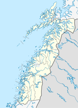
Alsvågvatnet is a lake which lies in Øksnes Municipality in Nordland county, Norway. It is on the island of Langøya in the Vesterålen archipelago. There is birch woodland and bogland nearby. The 2.36-square-kilometre (0.91 sq mi) lake sits at an elevation of 8 metres (26 ft) above sea level, about 1.3 kilometres (0.81 mi) west of the village of Alsvåg, along the road to Myre.

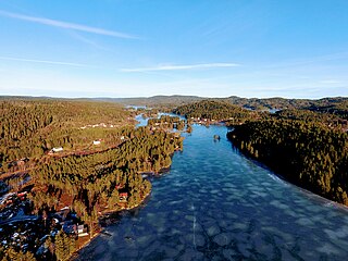
Øyungen is a lake in the municipality of Holtålen in Trøndelag county, Norway. The 6.13-square-kilometre (2.37 sq mi) lake lies about 7 kilometres (4.3 mi) southwest of the village of Hessdalen. The Forollhogna National Park surrounds the lake on three sides.
Vegår is a lake in the municipality of Vegårshei in Aust-Agder county, Norway. The 17.7-square-kilometre (6.8 sq mi) lake is located about 3 kilometres (1.9 mi) north of the municipal center of Myra and about 12 kilometres (7.5 mi) east of the village of Åmli in the neighboring municipality of Åmli.

Ogge is a lake in the municipalities of Birkenes and Iveland in Aust-Agder county, Norway. It is located about 40 kilometres (25 mi) north of the city of Kristiansand, just east of the villages of Vatnestrøm and Oggevatn. The 6.71-square-kilometre (2.59 sq mi) lake includes about 360 islands and reefs. The overall length of the lake is approximately 16 kilometres (9.9 mi). The Sørlandsbanen railway line and the Norwegian County Road 405 both run along the west side of the lake.

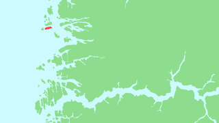
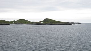
Skrova is a small island group and village area in Vågan Municipality in Nordland county, Norway. The 2.5-square-kilometre (0.97 sq mi) Skrova island group in the Lofoten archipelago, about 9 kilometres (5.6 mi) southeast of the town of Svolvær. It is located in the Vestfjorden, south of the islands of Austvågøya, Litlmolla, and Stormolla. The largest island in the group is Storskrova and the island of Heimskrova is where most of the population is located. The six main inhabited islands in the group are all interconnected by a small bridge and several man-made causeways.

Bouvet Island is an uninhabited subantarctic high island and dependency of Norway located in the South Atlantic Ocean at 54°25′S3°22′E, thus putting it north of and outside the Antarctic Treaty System. It lies at the southern end of the Mid-Atlantic Ridge and is the most remote island in the world, approximately 1,700 kilometres (1,100 mi) north of the Princess Astrid Coast of Queen Maud Land, Antarctica and 2,600 kilometres (1,600 mi) south-southwest of the coast of South Africa.

Lysvatnet (Norwegian) or Čáhppesjávri (Northern Sami) is a lake in Lenvik Municipality in Troms county, Norway. The lake lies in the Helvetesdalen valley on the island of Senja. The 6-kilometre (3.7 mi) long lake covers an area of 3.67 square kilometres (1.42 sq mi). The lake lies about 10 kilometres (6.2 mi) west of the village of Gibostad.
Reksta is an island in the municipality of Flora in Sogn og Fjordane country, Norway. The 5.8-square-kilometre (2.2 sq mi) island lies about 7 kilometres (4.3 mi) west of the town of Florø in a large group of inhabited islands. Reksta sits about 600 metres (2,000 ft) east of the island of Kinn, about 5 kilometres (3.1 mi) north of the island of Askrova, and about 1.4 kilometres (0.87 mi) south of the island of Skorpa. Most of the inhabitants on Reksta live on the west side in and around the small fishing village of Rognaldsvåg. The population of the island (2001) is 144.
Brusdalsvatnet is a large lake on the island of Oksenøya in Møre og Romsdal county, Norway. The lake sits on the border between Ålesund Municipality and Skodje Municipality. The lake is a reservoir that is the water supply for the nearby city of Ålesund. The 7.3-square-kilometre (2.8 sq mi) lake is about 9.5 by 1.3 kilometres.

Sula is an island group in the municipality of Frøya in Trøndelag county, Norway. It is located about 10 kilometres (6.2 mi) west of the island village of Mausund and about 15 kilometres (9.3 mi) northwest of the island of Frøya.
Husvær is an island group in the municipality of Herøy in Nordland county, Norway. The islands are located about 10 kilometres (6.2 mi) southwest of the municipal center of Silvalen. The Sandværet islands lie about 5 kilometres (3.1 mi) west of Husvær. The islands have one main road connecting several of the populated islands together with a ferry link at the easter end. The main populated islands are Husvær, Prestøya, and Brasøya. The area around Husvær is brilliant for cruising around in a cayak. Lots of small islands to put up your tent and shallow waters between these islands make it perfect in the summer. Husvær Chapel offers several worship services each year.
Helligvær is an island group in the Vestfjorden in Bodø Municipality in Nordland county, Norway. The islands are located about 25 kilometres (16 mi) northwest of the town of Bodø. The Bliksvær islands are about 12 kilometres (7.5 mi) to the south, Landegode island is 15 kilometres (9.3 mi) to the east, and the islands of Røstlandet and Værøya are about 60 kilometres (37 mi) to the west.

Skorpa is an island in the municipality in Flora in Sogn og Fjordane county, Norway. The 9-square-kilometre (3.5 sq mi) island lies about 6 kilometres (3.7 mi) west of the town of Florø in a large group of inhabited islands. Skorpa lies about 1.5 kilometres (0.93 mi) north of the islands of Reksta and Kinn and about 1.5 kilometres (0.93 mi) south of the island of Fanøya.
Fanøya is an island in the municipality of Flora in Sogn og Fjordane county, Norway. The island lies about 10 kilometres (6.2 mi) northwest of the town of Florø in a large group of inhabited islands, referred to as the Batalden islands. Fanøya, the most populous island in the group, is 1.6 kilometres (0.99 mi) north of the island of Skorpa, about 600 metres (2,000 ft) south of the island of Batalden, and about 4 kilometres (2.5 mi) southwest of the island of Hovden. The Batalden Chapel is located on Fanøya.

Værlandet is an island in Askvoll Municipality in Sogn og Fjordane county, Norway. The 9-square-kilometre (3.5 sq mi) island lies immediately east of the Bulandet island group. The island of Alden lies about 2 kilometres (1.2 mi) northeast of Værlandet. The island lies about 16 kilometres (9.9 mi) west of the mainland coast of Askvoll, and it is only accessible by boat. There is a regular ferry route connecting Værlandet to the mainland village of Askvoll. There is a series of bridges that connect Værlandet to the islands of Bulandet to the west. Værlandet Chapel is located on the island. The Værlandet LORAN-C transmitter is located on the island.

Bliksvær or Briksvær is an island group in the Vestfjorden in Bodø Municipality in Nordland county, Norway. The islands are located about 15 kilometres (9.3 mi) west of the town of Bodø. The Helligvær islands are about 12 kilometres (7.5 mi) to the north, Landegode island is 13 kilometres (8.1 mi) to the northeast, and the islands of Røstlandet and Værøya around about 75 kilometres (47 mi) to the west.