
Alstahaug is a municipality in Nordland county, Norway. It is part of the Helgeland region. The administrative centre of the municipality is the town of Sandnessjøen. Other villages in Alstahaug include Søvika and Tjøtta.

Dønna is a municipality in Nordland county, Norway. It is part of the Helgeland region. The administrative centre of the island municipality is the village of Solfjellsjøen. Other villages include Bjørn, Dønnes, Hestad, Sandåker, and Vandve. The main island of Dønna is connected to the neighboring municipality of Herøy to the south by the Åkviksundet Bridge.

Tjeldsund is a municipality in Nordland county, Norway. It is part of the traditional district of Ofoten. The administrative centre of the municipality is the village of Hol i Tjeldsund. Other important villages include Fjelldal, Myklebostad, and Ramsund. Norges Brannskole is situated in Fjelldal in the northeastern part of the municipality. Marinejegerkommandoen is based south of Ramsund.

Ramsund is a village in Tjeldsund Municipality in Nordland county, Norway. The village is located on the eastern shore of the Ramsundet strait, just south of the Ramsund Bridge. The 0.6-square-kilometre (150-acre) village has a population (2018) of 300 which gives the village a population density of 500 inhabitants per square kilometre (1,300/sq mi).

Nordvik is a former municipality in Nordland county, Norway. The 86-square-kilometre (33 sq mi) municipality existed from 1917 until its dissolution in 1962. The island municipality encompassed the central part of the island of Dønna as well as the smaller surrounding islands of Vandve, Slapøya, Havstein, and many others in what is now the southern part of Dønna Municipality. The municipality had 2 churches: Nordvik Church in the north and Hæstad Church in the south.
Sandnes is a village in Hadsel Municipality in Nordland county, Norway. The village is located on the island of Langøya on the northern shore of the Langøysundet strait, across from the town of Stokmarknes. The 0.46-square-kilometre (110-acre) village has a population (2011) of 350. The population density of the village is 761 inhabitants per square kilometre (1,970/sq mi).
Strand is a village in Sortland Municipality in Nordland county, Norway. The village is located on the island of Hinnøya at the eastern end of the Sortland Bridge which crosses the Sortlandsundet strait and connects to the town of Sortland on Langøya island. It is located about 5 kilometres (3.1 mi) north of the village of Sigerfjord.

Gåsvær is an island group in the municipality of Herøy in Nordland county, Norway. It is located about 15 kilometres (9.3 mi) northwest of the municipal center of Silvalen. The main islands in the group include Nordgåsvær, Sørgåsvær, Flatøya, and Innerodden. Gåsvær Chapel is located on Sørgåsvær island. Ytterholmen Lighthouse lies about 15 kilometres (9.3 mi) southwest of Gåsvær.
Husvær is an island group in the municipality of Herøy in Nordland county, Norway. The islands are located about 10 kilometres (6.2 mi) southwest of the municipal center of Silvalen and just southwest of the island of Tenna. The Sandværet islands lie about 5 kilometres (3.1 mi) west of Husvær. The islands have one main road connecting several of the populated islands together with a ferry link at the eastern end. The main populated islands are Husvær, Prestøya, and Brasøya. Husvær Chapel offers several worship services each year.
Sandværet is an island group in the municipality of Herøy in Nordland county, Norway. The islands are located about 17 kilometres (11 mi) southwest of the municipal center of Silvalen and about 5 kilometres (3.1 mi) west of the island of Husvær. The main populated islands in the group include Nordøya, Innerøya, Ytterøya, Langøya, and Gråøya. Sandvær Chapel serves the islands and has several worship services each year.
Skålvær are a group of islands in the municipality of Alstahaug in Nordland county, Norway. The islands are located in the western part of Alstahaug, about 15 kilometres (9.3 mi) northwest of Tjøtta and about 15 kilometres (9.3 mi) south of Silvalen. They were formerly a part of Vega, but in 1971 it was transferred to Alstahaug.

Sør-Herøy is an island in the middle of the municipality of Herøy in Nordland county, Norway. Sør-Herøy is surrounded by the following islands: Nord-Herøy, Tenna, and Indre Øksningan. To the west lies Færøysundet, named after the islet of Færøya, which is actually a peninsula connected to Sør-Herøy. To the east lies Herøysundet, which is crossed by the Herøysund Bridge and Norwegian County Road 828 to Nord-Herøy. To the south lies Tennsundet with the Tennsund Bridge and Norwegian County Road 161 to Tenna. The bridges create part of the road network connecting the municipality of Herøy to the island of Dønna, which lies to the north in the municipality of Dønna. The island has a population of 446.

Nord-Herøy is an island in the municipality of Herøy in Nordland county, Norway. With an area of 8.9 square kilometers (3.4 sq mi), it is the largest island in the municipality. The island has about 800 residents.

County Road 828 is a 33.6-kilometer (20.9 mi) road in Nordland County, Norway. It is also locally named Hæstadveien, Seløyveien, Brunsvikveien, Nord-Herøyveien, Sør-Herøyveien, Fagervikveien, and Flostadveien.
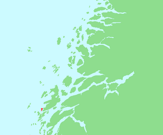
Staulen is an island in the municipality of Herøy in Nordland county, Norway. The 2.6-square-kilometre (1.0 sq mi) island just southwest of the large island of Dønna. The settlements on the island include the villages of Nordstaulen, Sørstaulen, and Sandvikja.

Nesna is the administrative centre of Nesna Municipality in Nordland county, Norway. The village is located on a peninsula on the mainland of Norway, along the Nesnakroken strait, just north of the Ranfjorden and south of the Sjona fjord. The Norwegian County Road 17 crosses the Ranfjorden on a ferry which docks in the village before heading north along the coastline. Nesna also has regular ferry connections to the nearby islands of Handnesøya, Hugla, and Tomma.
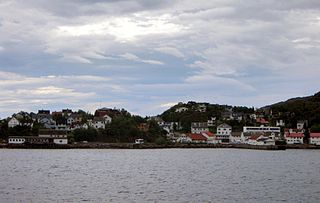
Lødingen is the administrative centre of Lødingen Municipality in Nordland county, Norway. The village is located on the southwestern shore of the island of Hinnøya. The village is also located where the southern mouth of the Tjeldsundet strait meets the Vestfjorden. The Norwegian National Road 85 runs through the village and continues on the Bognes–Lødingen ferry route.

Sortland (help·info) is a town and the administrative centre of Sortland Municipality in Nordland county, Norway. The town is located on the east coast of the island of Langøya, along the Sortlandsundet strait. In 1997, the municipality decided to declare "town status" for the urban area of Sortland. Sortland is the largest town and commercial centre in the whole Vesterålen region and it is becoming known as "the blue town by the strait" since many of the buildings are painted blue.
Bjørnskinn is a former municipality in Nordland county, Norway. The 310-square-kilometre (120 sq mi) municipality existed from 1924 until its dissolution in 1964. The municipality was centered around the Risøysundet strait. It encompassed the southern part of the island of Andøya and the northern part of the island of Hinnøya in the southern part of what is now Andøy Municipality. The administrative centre was the small village of Bjørnskinn where Bjørnskinn Church is located. The largest village in Bjørnskinn was the village of Risøyhamn.


