Sandy River (Red Lake)

Last updated
Sandy River (Red Lake)
Country United States
Physical characteristics
Main source Minnesota

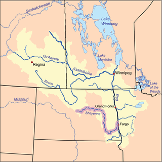
The Sandy River is a 28.8-mile-long (46.3 km) [1] tributary of Red Lake in northwestern Minnesota in the United States.

Red Lake (Minnesota) lake in Beltrami County, Minnesota, United States

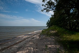
Red Lake is a lake in Beltrami County in northern Minnesota.

Minnesota State of the United States of America

Minnesota is a state in the Upper Midwest and northern regions of the United States. Minnesota was admitted as the 32nd U.S. state on May 11, 1858, created from the eastern half of the Minnesota Territory. The state has a large number of lakes, and is known by the slogan the "Land of 10,000 Lakes". Its official motto is L'Étoile du Nord.

United States federal republic in North America

The United States of America (USA), commonly known as the United States or America, is a country composed of 50 states, a federal district, five major self-governing territories, and various possessions. At 3.8 million square miles, the United States is the world's third or fourth largest country by total area and is slightly smaller than the entire continent of Europe's 3.9 million square miles. With a population of over 327 million people, the U.S. is the third most populous country. The capital is Washington, D.C., and the largest city by population is New York City. Forty-eight states and the capital's federal district are contiguous in North America between Canada and Mexico. The State of Alaska is in the northwest corner of North America, bordered by Canada to the east and across the Bering Strait from Russia to the west. The State of Hawaii is an archipelago in the mid-Pacific Ocean. The U.S. territories are scattered about the Pacific Ocean and the Caribbean Sea, stretching across nine official time zones. The extremely diverse geography, climate, and wildlife of the United States make it one of the world's 17 megadiverse countries.

See also

Related Research Articles

Sheyenne River river in the United States of America

The Sheyenne River is one of the major tributaries of the Red River of the North, meandering 591 miles (951 km) across eastern North Dakota, United States.

The Beaver River is a 23.4-mile-long (37.7 km) river in Lake County, Minnesota. It flows into Lake Superior.

The Blackduck River is a 33.2-mile-long (53.4 km) tributary of Red Lake in northwestern Minnesota in the United States.

The Cross River is a 20.4-mile-long (32.8 km) river in northern Minnesota, the United States. It is a direct tributary of Lake Superior.

The Devil Track River is an 8.7-mile-long (14.0 km) river in northeastern Minnesota, the United States. It begins at the outlet of Devil Track Lake and flows southeast to Lake Superior east of Croftville.

The East River is a small headwaters tributary of the Saint Louis River in northern Minnesota, United States. The East River, 3.0 miles (4.8 km) long, flows into Seven Beaver Lake, the source of the St. Louis River.

The Kadunce River is an 8.5-mile-long (13.7 km) stream in northeastern Minnesota, the United States, flowing into Lake Superior.

Lime Creek is a 26.8-mile-long (43.1 km) waterway of Minnesota and tributary of the Des Moines River.

The Little Mississippi River (Minnesota) is a river of Minnesota.

The Lost River is a 6.8-mile-long (10.9 km) watercourse in the Thief River watershed of western Minnesota in the United States. The stream is entirely in Marshall County, and it flows into the Agassiz National Wildlife Refuge, where it disappears into the large wetland complex surrounding Agassiz Pool, a lake which drains to the Thief River.

The Moose River is a 22.5-mile-long (36.2 km) tributary of Thief Lake in northwestern Minnesota, the United States. The outflow from Thief Lake drains via the Thief River, Red Lake River, Red River of the North, Lake Winnipeg, and the Nelson River to Hudson Bay.

The Mud River is a 23.1-mile-long (37.2 km) tributary of Red Lake in northwestern Minnesota in the United States.

The North Cormorant River is a 39.1-mile-long (62.9 km) tributary of the Blackduck River of Minnesota in the United States. It joins the Blackduck River shortly upstream of that river's mouth at Red Lake, the largest natural lake entirely within Minnesota.

Onion River (Minnesota) river in the United States of America

The Onion River is a 6.1-mile-long (9.8 km) stream in northeastern Minnesota, the United States, flowing directly into Lake Superior.

The Sandy River is a river of Minnesota. It is a tributary of the Mississippi River.

Skunk Creek is a 12.3-mile-long (19.8 km) stream in Lake County, Minnesota, United States. It is a tributary of the Gooseberry River.

The Tait River is a 12.8-mile-long (20.6 km) river in northeastern Minnesota, the United States. It is a tributary of the Poplar River.

The White Earth River is a 26.2-mile-long (42.2 km) tributary of the Wild Rice River of northwestern Minnesota in the United States. Via the Wild Rice River, the Red River of the North, Lake Winnipeg, and the Nelson River, it is part of the Hudson Bay watershed. It rises at the outlet of White Earth Lake and flows northwest through Mahnomen County, joining the Wild Rice River just east of the city of Mahnomen.

Big Sandy Creek is a 58.0-mile-long (93.3 km) tributary of the Sabine River in Franklin, Wood and Upshur counties in northeastern Texas.

Hefta Lake is a lake in Kandiyohi County, in the U.S. state of Minnesota.

References

  1. U.S. Geological Survey. National Hydrography Dataset high-resolution flowline data. The National Map, accessed June 8, 2011

Coordinates: 47°52′49″N95°14′16″W / 47.88023°N 95.23778°W / 47.88023; -95.23778

Geographic coordinate system Coordinate system

A geographic coordinate system is a coordinate system that enables every location on Earth to be specified by a set of numbers, letters or symbols. The coordinates are often chosen such that one of the numbers represents a vertical position and two or three of the numbers represent a horizontal position; alternatively, a geographic position may be expressed in a combined three-dimensional Cartesian vector. A common choice of coordinates is latitude, longitude and elevation. To specify a location on a plane requires a map projection.