Anija Parish is a rural county in northern Estonian state of Harju. The municipality has a population of 6,197 and covers an area of 520.94 km2 (201 sq mi). The population density is 11.8958/km2 (30.8100/sq mi).

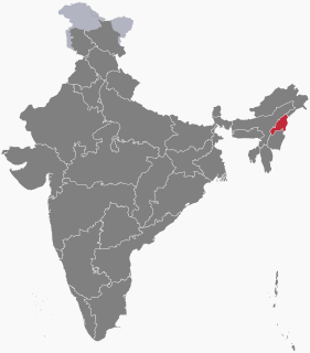
Wokha is a Town and a municipality in the state of Nagaland, India.It is the headquarter of its namesake district(see wokha district). It is located at a distance of about 75 km from the state capital Kohima.
San Shek Wan is a small village located on Lantau Island, Hong Kong.

Mathabhanga is a town with municipality two blocks in Cooch Behar district in the Indian state of West Bengal.
Bantam Village is the largest settlement on the Cocos (Keeling) Islands. It is located on Home Island and has a population of about 500, mainly Cocos Malays. Bantam was listed as the capital of Cocos (Keeling) Islands by the European Union.

Panchbibi is an Upazila of Joypurhat District in the Division of Rajshahi, Bangladesh. It is bounded by Hakimpur and Ghoraghat upazilas and West Bengal of India on the north, Joypurhat Sadar upazila on the south, Gobindaganj and Kalai upazilas on the east, Joypurhat Sadar upazila and West Bengal of India on the west.
Bagha is an upazila of Rajshahi District in the Division of Rajshahi, Bangladesh.

The village of Alasay is the center of Alasay District in Kapisa Province, Afghanistan. It is located on 34.8958°N 69.7208°E at 1672 m altitude.

Adogawa Station is a train station in Takashima, Shiga, Japan.
Ravni is a village located in the Užice municipality of Serbia. In the 2002 census, the village had a population of 558.

Aeroflot Flight 8381 was a scheduled flight of a twin-engine Tupolev Tu-134 that departed Tallinn Airport in Estonian SSR, Soviet Union, at 10:38 am on 3 May 1985, for Chişinău in Moldavian SSR, Soviet Union making a stopover at Lviv, Ukrainian SSR, Soviet Union. While descending to Lviv in overcast weather, it collided at 12:13 with a Soviet Air Force Antonov An-26 that had just taken off from Lviv. The collision occurred at an altitude of 13,000 feet (4,000 m). Both aircraft lost their right wings and tails, went out of control and crashed about one or two minutes later near the village of Zolochiv, Ukrainian SSR, Soviet Union, killing all 94 people on both aircraft.
Anandanagar is a village in Anandanagar gram panchayat in Singur bloc in Chandannagore subdivision of Hooghly district in the Indian state of West Bengal.
Kurseong is an administrative division in Kurseong subdivision of Darjeeling district in the Indian state of West Bengal. Kurseong police station serves this block. Headquarters of this block is at Kurseong. There is one census town in this block: Cart Road.
Dinhata I is an administrative division in Dinhata subdivision of Cooch Behar district in the Indian state of West Bengal. Dinhata police station serves this block. Headquarters of this block is at Dinhata. There is one census town in this block: Bhangri Pratham Khanda.
Sitalkuchi is an administrative division in Mathabhanga subdivision of Cooch Behar district in the Indian state of West Bengal. Sitalkuchi police station serves this block. Headquarters of this block is at Sitalkuchi.
Johnsenberget is a mountain at Kongsøya of the Kong Karls Land, Svalbard. It has a height of 235 m.a.s.l., and is located at the eastern part of the island, between Koppelvatna and Rundisflya, north of Andréebukta. The mountain is named after captain Nils Johnsen, who climbed the mountain in 1872.
Cheshmeh Joori is a village in Nosratabad Rural District, in the Central District of Zahedan County, Sistan and Baluchestan Province, Iran. At the 2006 census, its existence was noted, but its population was not reported.
Jamtara is a village located in the Ausgram II CD Block in Bardhaman Sadar North subdivision of the Purba Bardhaman district, in West Bengal, India.
Sadpur is a village in Chanditala I community development block of Srirampore subdivision in Hooghly district in the Indian state of West Bengal.