
The Prince Charles Mountains are a major group of mountains in Mac. Robertson Land in Antarctica, including the Athos Range, the Porthos Range, and the Aramis Range. The highest peak is Mount Menzies, with a height of 3,228 m (10,591 ft). Other prominent peaks are Mount Izabelle and Mount Stinear. These mountains, together with other scattered peaks, form an arc about 420 km (260 mi) long, extending from the vicinity of Mount Starlight in the north to Goodspeed Nunataks in the south.

Mizque, Misk'i is a town in the Cochabamba Department, Bolivia. It is the capital of the Mizque Province. Mizque is located in the valley of the Mizque River, one of the main tributaries of the Río Grande.

Motumua is an islet of Nukufetau, Tuvalu to the east of Fale islet. On 11 February 1947 the community of Nukufetau opened a boarding school on Motumua so that the children of the island could get an education. The school continued until 1951 when the Education Department requested that it be transferred to Savave and become the government primary school for Nukufetau.

Hontanas is a municipality located in the province of Burgos, Castile and León, Spain. According to the 2004 census (INE), the municipality has a population of 70 inhabitants.
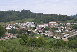
Nova Pádua is a municipality in the state of Rio Grande do Sul, Brazil. As of 2020, the estimated population was 2,558.

Liv Glacier is a steep valley glacier, 40 nautical miles long, emerging from the Antarctic Plateau just southeast of Barnum Peak and draining north through the Queen Maud Mountains to enter Ross Ice Shelf between Mayer Crags and Duncan Mountains. It was discovered in 1911 by Roald Amundsen, who named it for the daughter of Fridtjof Nansen.

Flandres Bay is a large bay lying between Cape Renard and Cape Willems, along the west coast of Graham Land, Antarctica. It was explored in 1898 by the Belgian Antarctic Expedition under Gerlache, who named it, probably after the historical area of Flanders.
The Ōmoeroa River is a river of the West Coast region of New Zealand's South Island. It flows northwest from its source high in the Southern Alps, 14 kilometres north of Aoraki / Mount Cook, reaching the Tasman Sea 12 kilometres west of Franz Josef.
The Faith Island, part of Partridge Island Group, is a low, flat islet in south-eastern Tasmania, Australia. The islet lies in the D'Entrecasteaux Channel between Bruny Island and the Tasmania mainland. It contains two gravestones, concealed in the scrub in the north-east of the island. Its neighbouring islets are named Charity and Hope and also the Arch Rock.
Los Cajones is a village and municipality in San Luis Province in central Argentina.
Icaño (Catamarca) is a village and municipality in Catamarca Province in northwestern Argentina.
Pomancillo Oeste is a village and municipality in Catamarca Province in northwestern Argentina.
San Antonio (Paclín) is a village and municipality in Catamarca Province in northwestern Argentina.
Cumpston Glacier is a small glacier on the east coast of Graham Land, draining between Breitfuss Glacier and Quartermain Glacier into the head of Mill Inlet. It was named by the UK Antarctic Place-Names Committee for J.S. Cumpston, an Australian historian of the Antarctic.
Jeffries Glacier is a glacier between Lenton Bluff and the Maro Cliffs, flowing northwest for at least 8 nautical miles (15 km) through the Theron Mountains of Antarctica. It was first mapped in 1956–57 by the Commonwealth Trans-Antarctic Expedition and named for Peter H. Jeffries, a meteorologist with the advance party of the expedition in 1955–56.
The Fish Islands are a group of small islands lying in the northern part of the entrance to Holtedahl Bay, off the west coast of Graham Land, Antarctica. They were discovered and named by the British Graham Land Expedition, 1934–37, under John Rymill.

Luke Glacier is a glacier at least 15 nautical miles (28 km) long, flowing northwest into the head of Leroux Bay on the west coast of Graham Land, Antarctica. It is surmounted by Mount Chevreux on the south, Mount Perchot on the southwest and Mount Radotina on the northeast. The glacier was first sighted and roughly surveyed in 1909 by the Fourth French Antarctic Expedition. It was resurveyed in 1935–36 by the British Graham Land Expedition and later named for George Lawson Johnston, 1st Baron Luke of Pavenham, Chairman of Bovril Ltd, who contributed toward the cost of the expedition.
Hastinapuram is a neighbourhood of Hyderabad. It is located towards Nagarjuna Sagar highway road. Its neighbouring areas are B.N. Reddy Nagar, Vanasthali Puram and LB Nagar. Also NGO colony, Christian colony. The area is divided into four parts, East Hastinapuram, West Hastinapuram, South Hastinapuram and Central Hastinapuram. LB Nagar will be the nearest station of Hyderabad Metro Train. Tourism destinations like Ramoji Film City, and Mount Opera are located within 10–15 km. The distance to Hyderabad Airport is 25 km. G.Surya Prakash, the Legend lives in Hastinapuram.