
The Arctic Archipelago, also known as the Canadian Arctic Archipelago, is a group of islands north of the Canadian mainland.
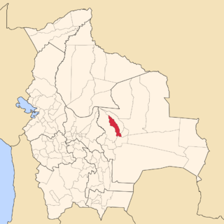
Luis Calvo is a province in the Bolivian department of Chuquisaca.
Cabinet Inlet is an ice-filled inlet, 36 miles (58 km) long in a northwest–southeast direction, and some 27 miles (43 km) wide at its entrance between Cape Alexander and Cape Robinson, along the east coast of Graham Land, Antarctica. It was charted by the Falkland Islands Dependencies Survey (FIDS) and photographed from the air by the Ronne Antarctic Research Expedition in December 1947. Cabinet Inlet was named by FIDS for the British War Cabinet which authorized the FIDS in 1943.
Sara is a province in the Santa Cruz Department, Bolivia. Its capital is Portachuelo.

Víznar is a municipality located in the province of Granada, Spain, only a few miles from the city of Granada itself. According to the 2005 census (INE), the town has a population of 789 inhabitants.
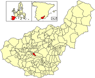
La Zubia is a municipality located in the province of Granada, Spain. According to the 2010 census (INE), the city has a population of 18,240 inhabitants.
Pino del Oro is a Spanish municipality in the province of Zamora, Castile and León. It has a population of 203 (2006) and an area of 30 km².
Méndez Municipality is a municipality located in the Mexican state of Tamaulipas.
Youngou is a town in the Zabré Department of Boulgou Province in south-eastern Burkina Faso. As of 2005, the town has a population of 6,343.
Ward Inlet is a body of water in Nunavut's Qikiqtaaluk Region. It lies in eastern Frobisher Bay, forming a wedge into Baffin Island, separating Becher Peninsula from Hall Peninsula. Augustus Island lies deep into the inlet.
The Chino Fault is a fault that extends along the eastern Chino Hills range region, from Corona in Riverside County to the Los Serranos, Chino Hills area of San Bernardino County in Southern California.
Bradford Siding is a former settlement in Inyo County, California.
Carthage is a former settlement in Inyo County, California.
Cerro Gordo Landing is a former settlement in Inyo County, California. The port for steamboats crossing the lake from Carthago was located on the west shore of the Owens Lake 1 mile (1.6 km) south-southeast of Keeler. It served the Cerro Gordo Mines.
Tule Station is a former settlement in Inyo County, California. It was located on the west shore of the Owens Lake 2 miles (3.2 km) south-southeast of Cerro Gordo Landing.

Niépce Glacier is a glacier which joins with Daguerre Glacier and flows into Lauzanne Cove, Flandres Bay, on the north coast of Kiev Peninsula, Graham Land. Shown on an Argentine government chart of 1954. Named by the United Kingdom Antarctic Place-Names Committee (UK-APC) in 1960 for Joseph N. Niepce (1765–1833), French physicist, the first man to produce a permanent photographic record, 1816–29, who, with J.L.M. Daguerre, invented the daguerreotype process of photography perfected in 1839.
Daguerre Glacier is a glacier on Kiev Peninsula, Graham Land, which joins with Niepce Glacier and flows into Lauzanne Cove, Flandres Bay. It was shown on an Argentine government chart of 1954, and named by the UK Antarctic Place-Names Committee in 1960 for Louis Daguerre, a French painter and physicist who, with J.N. Niepce, invented the daguerreotype process of photography perfected in 1839.
Garrard Glacier is a glacier in the Queen Alexandra Range of Antarctica, draining eastward from the névé between Mount Lockwood and Mount Kirkpatrick and entering Beardmore Glacier south of Bell Bluff. It appears that the British Antarctic Expedition, 1910–13, applied the name "Garrard Glacier" to the feature which had been named Bingley Glacier by Ernest Shackleton in 1908. The area was surveyed by the New Zealand Geological Survey Antarctic Expedition (1961–62), who retained Bingley Glacier on the basis of priority and reapplied the name Garrard Glacier to this previously unnamed feature. The name is for Apsley Cherry-Garrard, a zoologist with the British Antarctic Expedition.
