Saposoa | |||
|---|---|---|---|
Town | |||
| |||
 Saposoa | |||
| Coordinates: 06°56′10.92″S76°46′18.54″W / 6.9363667°S 76.7718167°W | |||
| Country | |||
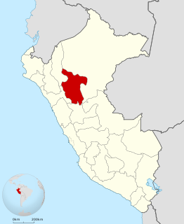
| Region | San Martín | ||
| Province | Huallaga | ||
| District | Saposoa | ||
| Government | |||
| • Mayor | Fernando Grandez Veintemilla | ||
| Elevation | 307 m (1,007 ft) | ||
| Population (2007) | |||
| • Total | 12,951 | ||
| Time zone | UTC-5 (PET) | ||


Saposoa is a town in Northern Peru, capital of the province Huallaga in the region San Martín. There are 12 951 inhabitants, according to the 2007 census. [1]

Peru, officially the Republic of Peru, is a country in western South America. It is bordered in the north by Ecuador and Colombia, in the east by Brazil, in the southeast by Bolivia, in the south by Chile, and in the west by the Pacific Ocean. Peru is a megadiverse country with habitats ranging from the arid plains of the Pacific coastal region in the west to the peaks of the Andes mountains vertically extending from the north to the southeast of the country to the tropical Amazon Basin rainforest in the east with the Amazon river.

The Huallaga Province is one of ten provinces of the San Martín Region in northern Peru.
San Martín is a department in northern Peru. Most of the department is located in the upper part of the Peruvian Amazon rainforest. Its capital is Moyobamba and the largest city in the department is Tarapoto.
It is served by Saposoa Airport.


