Related Research Articles

Hydroelectricity, or hydroelectric power, is electricity generated from hydropower. Hydropower supplies one sixth of the world's electricity, almost 4500 TWh in 2020, which is more than all other renewable sources combined and also more than nuclear power. Hydropower can provide large amounts of low-carbon electricity on demand, making it a key element for creating secure and clean electricity supply systems. A hydroelectric power station that has a dam and reservoir is a flexible source, since the amount of electricity produced can be increased or decreased in seconds or minutes in response to varying electricity demand. Once a hydroelectric complex is constructed, it produces no direct waste, and almost always emits considerably less greenhouse gas than fossil fuel-powered energy plants. However, when constructed in lowland rainforest areas, where part of the forest is inundated, substantial amounts of greenhouse gases may be emitted.
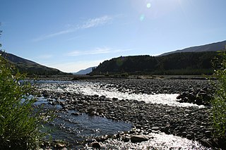
The Turnbull River is a short river on the West Coast of New Zealand's South Island. It flows northwest from the Southern Alps for 22 kilometres (14 mi), entering the Tasman Sea at the northern end of Jackson Bay, 10 kilometres (6.2 mi) south of Haast. The Turnbull shares its mouth with the Okuru River.
The Wairau River is one of the longest rivers in New Zealand's South Island. It flows for 170 kilometres (110 mi) from the Spenser Mountains, firstly in a northwards direction and then northeast down a long, straight valley in inland Marlborough.

The Pukaki River flows through the Mackenzie Basin, Canterbury, in New Zealand's South Island.
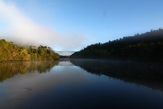
The Pieman River is a major perennial river located in the west coast region of Tasmania, Australia.

There are over 230 Catholics in the Falkland Islands, approximately 10% of the total population. There are no dioceses in the islands, instead they form an apostolic prefecture which was erected in January 1952. It is immediately subject to the Holy See and separate from any Argentine or UK dioceses. The spiritual leader of the prefecture is Father Hugh Allan who was appointed in 2016.
Run-of-river hydroelectricity (ROR) or run-of-the-river hydroelectricity is a type of hydroelectric generation plant whereby little or no water storage is provided. Run-of-the-river power plants may have no water storage at all or a limited amount of storage, in which case the storage reservoir is referred to as pondage. A plant without pondage is subject to seasonal river flows, so the plant will operate as an intermittent energy source. Conventional hydro uses reservoirs, which regulate water for flood control, dispatchable electrical power, and the provision of fresh water for agriculture.
The Ikopa River is the second longest waterway in Madagascar and passes through the capital, Antananarivo. It is the largest tributary of the Betsiboka River. It is formed by the Varahina-North and Varahina-South Rivers.
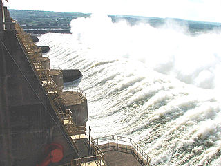
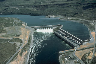
The Tucuruí Dam is a concrete gravity dam on the Tocantins River located on the Tucuruí County in the State of Pará, Brazil. The main purpose of the dam is hydroelectric power production and navigation. It is the first large-scale hydroelectric project in the Brazilian Amazon rainforest. The installed capacity of the 25-unit plant is 8,370 megawatts (11,220,000 hp). Phase I construction began in 1980 and ended in 1984 while Phase II began in 1998 and ended in 2010. The dam was featured in the 1985 film The Emerald Forest.

Hydroelectric power in New Zealand has been a part of the country's energy system for over 100 years and continues to provide more than half of the country's electricity needs. Hydroelectricity is the primary source of renewable energy in New Zealand. Power is generated the most in the South Island and is used most in the North Island.
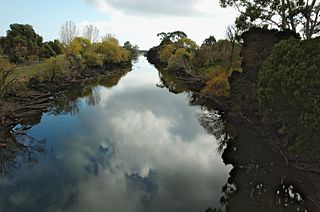
The River Forth is a perennial river located in northwest Tasmania, Australia.
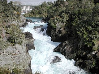
Aratiatia Power Station is a hydroelectric power station on the Waikato River, in the North Island of New Zealand. It is the first hydroelectric power station on the Waikato River, and is located 13 kilometres (8.1 mi) downstream of Lake Taupō. Aratiatia is owned and operated by Mercury Energy.

The Mararoa River is one of the braided rivers of the Southland Region of the South Island of New Zealand.
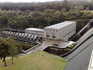
Whakamaru Power Station is a hydroelectric power station on the Waikato River, in the North Island of New Zealand. It is the fourth hydroelectric power station on the Waikato River.
The Nkhula B Hydroelectric Power Station, also Nkula B Hydroelectric Power Station is a hydroelectric power plant on the Shire River in Malawi. It has a power generating capacity of 100 megawatts (130,000 hp).

The Santo Antônio Dam is a hydroelectric dam on the Madeira River 6 km (4 mi) southwest of Porto Velho in the state of Rondônia, Brazil. The dam's run-of-the-river hydroelectric power station have 50 turbines each rated at 71.6 MW resulting in a total installed capacity of 3,580 MW. The first unit began commercial production in March 2012, and as of June 2015 a total of 32 units were operational. Last 6 units went online in December 2016. Most of the power will be exported to south-eastern Brazil via the Rio Madeira HVDC system.
The Kirazlık Dam is a gravity dam on the Botan River, 9 km (6 mi) east of Siirt in Siirt Province of southeastern Turkey. The purpose of the dam is to regulate the outflow of the Alkumru Dam upstream and to produce hydroelectric power with a run-of-the-river design. The dam was completed in late 2011 and the power station become operational in 2013. The power plant houses three 15 MW Kaplan turbine-generators.

Peixoto Dam, also known as Mascarenhas de Moraes Hydroelectric Plant, is a hydroelectric dam on the Grande River in the state of Minas Gerais, Brazil, about 20 kilometres (12 mi) west of Delfinópolis.

The Laúca Hydroelectric Power Station is a 2,070 MW (2,775,916 hp) hydroelectric power plant in Angola. It is the largest power station in the country.
Temotu Noi is an island in the Solomon Islands; it is located in Temotu Province and is a part of Santa Cruz Islands archipelago. The island has a crocodile-infested freshwater lake. The large neighboring island is Nendo.
References
- ↑ Stanley, David (2004). Moon Handbooks South Pacific. David Stanley. p. 938. ISBN 978-1-56691-411-6.
- ↑ "Hydroelectric Power Station on Santo Island". Adaptationlearning.net. Retrieved 23 May 2015.
15°36′9″S166°51′51″E / 15.60250°S 166.86417°E
| | This Vanuatu location article is a stub. You can help Wikipedia by expanding it. |