Coordinates: 40°12′46″N44°47′06″E / 40.21278°N 44.78500°E
A geographic coordinate system is a coordinate system that enables every location on Earth to be specified by a set of numbers, letters or symbols. The coordinates are often chosen such that one of the numbers represents a vertical position and two or three of the numbers represent a horizontal position; alternatively, a geographic position may be expressed in a combined three-dimensional Cartesian vector. A common choice of coordinates is latitude, longitude and elevation. To specify a location on a plane requires a map projection.
Saranist | |
---|---|
Coordinates: 40°12′46″N44°47′06″E / 40.21278°N 44.78500°E | |
Country | Armenia |
Marz (Province) | Kotayk |
Time zone | (UTC+4) |
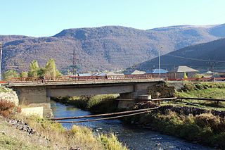
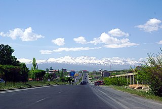
Saranist (also, Saramist and Tutiya) is a former village in the Kotayk Province of Armenia.
Kotayk, is a province (marz) of Armenia. It is located at the central part of the country. Its capital is Hrazdan and the largest city is Abovyan. It is named after the Kotayk canton of the historic Ayrarat province of Ancient Armenia.
Armenia, officially the Republic of Armenia, is a country in the South Caucasus region of Eurasia. Located in Western Asia on the Armenian Highlands, it is bordered by Turkey to the west, Georgia to the north, the de facto independent Republic of Artsakh and Azerbaijan to the east, and Iran and Azerbaijan's exclave of Nakhchivan to the south.
Arinj, is a major village in the Kotayk Province of Armenia. The Town is an upscale suburb located just north of Yerevan, with several multimillionaires having their Mansions located there including Gagik Tsarukyan, the founder of the Prosperous Armenia party. The village is 41 km south of the provincial capital Hrazdan. As of the 2011 census, the population of the village is 6,220.
Kasagh, is a major village in the Kotayk Province of Armenia.
Zovuni, is a major village in the Kotayk Province of Armenia, located just north of the capital Yerevan. As of the 2011 census, the population of the village is 5,479.
Aramus is a town in the Kotayk Province of Armenia.
Argel, is a village in the Kotayk Province of Armenia.
Fantan, is a village in the Kotayk Province of Armenia.
Geghadir, is a village in the Kotayk Province of Armenia.
Geghard is a village in the Kotayk Province of Armenia. The UNESCO World Heritage Site of Geghard monastery is located southeast of Geghard village, near Goght.
Hatsavan is a town in the Kotayk Province of Armenia.
Jrarat formerly known as Randamal, is a village in the Kotayk Province of Armenia. It was incorporated in 1982 and is the center of the dairy industry.
Katnaghbyur is a town in the Kotayk Province of Armenia.
Gorgoch ; formerly known as Korchlu, Gorchulu, is a village in the Kotayk Province of Armenia. It is included in the community of Meghradzor village.
Kotayk, formerly known as Yelgovan, is a village in the Kotayk Province of Armenia.
Marmarik, is a village in the Kotayk Province of Armenia.
Nor Artamet is a village in the Kotayk Province of Armenia.
Nurnus, is a village in the Kotayk Province of Armenia.
Proshyan, is a major village in the Kotayk Province of Armenia.
Teghenik is a village in the Kotayk Province of Armenia.
Zar, is a village in the Kotayk Province of Armenia.
Zovashen is a village in the Kotayk Province of Armenia.
This article about a location in Kotayk Province, Armenia is a stub. You can help Wikipedia by expanding it. |