Related Research Articles

Josephine County is one of the 36 counties in the U.S. state of Oregon. As of the 2020 census, the population was 88,090. The county seat is Grants Pass. The county is named after Virginia Josephine Rollins (1834–1912), a settler who was the first white woman to live in the county's boundaries. Josephine County comprises the Grants Pass, OR Metropolitan Statistical Area, which is included in the Medford-Grants Pass, OR Combined Statistical Area.

Jackson County is one of the 36 counties in the U.S. state of Oregon. As of the 2020 census, the population was 223,259. The county seat is Medford. The county is named for Andrew Jackson, the seventh president of the United States.

The Illinois River is a tributary, about 56 miles (90 km) long, of the Rogue River in the U.S. state of Oregon. It drains part of the Klamath Mountains in northern California and southwestern Oregon. The river's main stem begins at the confluence of its east and west forks near Cave Junction in southern Josephine County. Its drainage basin includes Sucker Creek, which rises in the Red Buttes Wilderness, near Whiskey Peak on the California state line. The main stem flows generally northwest in a winding course past Kerby and through the Siskiyou National Forest and Kalmiopsis Wilderness. It joins the Rogue River from the south at Agness on the Curry–Josephine county line, 27 miles (43 km) from the Pacific Ocean.
The Rogue Valley is a valley region in southwestern Oregon in the United States. Located along the middle Rogue River and its tributaries in Josephine and Jackson counties, the valley forms the cultural and economic heart of Southern Oregon near the California border. The largest communities in the Rogue Valley are Medford, Ashland and Grants Pass. The most populated part of the Rogue Valley is not along the Rogue proper, but along the smaller Bear Creek tributary. The Rogue Valley is a popular fall destination in Oregon because of the hardwood forests there.

Barr Creek Falls, is a waterfall located in the Rogue River Canyon within the Prospect State Scenic Viewpoint in Jackson County, in the U.S. state of Oregon. The waterfall is located at the south end of Barr Creek as it plunges into the Rogue River over a carved cliff surrounded by walls of petrified volcanic ash as a consequence of the Mount Mazama eruption. The waterfall has also been called Bear Creek Falls. The waterfall gets its name from the creek which was called "Barr" for the presence of a fence that prevented cattle from straying out of the local Red Blanket Ranch and that ran adjacent to the creek.

Mill Creek Falls, is a waterfall located in the Rogue River Canyon within the Prospect State Scenic Viewpoint in Jackson County, in the U.S. state of Oregon. The waterfall is located at the south end of Mill Creek as it plunges into the Rogue River over a carved cliff surrounded by walls of petrified volcanic ash consequence of Mount Mazama eruption.
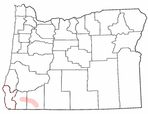
Tolo is an unincorporated community in Jackson County, Oregon, United States, located north of Interstate 5, between Central Point and Gold Hill, south of Sams Valley. Platted near the site of the Willow Springs mining camp, the town was envisioned to be one of the biggest cities of Southern Oregon. Tolo was platted in 1888, but was virtually abandoned by the year 1918. In 1986, the Jackson County Commission returned the plat to public ownership.

Savage Creek is a 4.5 mile long stream in the U.S. state of Oregon. It is a tributary to the Rogue River.
Birdseye Creek is a stream in the U.S. state of Oregon. It is a tributary to the Rogue River.
Bybee Creek is a stream in the U.S. state of Oregon. It is a tributary to the Rogue River.
Copeland Creek is a stream in the U.S. state of Oregon. It is a tributary to the Rogue River. Headwaters originate west of Hillman Peak.
Fielder Mountain is a summit in the U.S. state of Oregon. The elevation is 3,750 feet (1,140 m). It is located in Jackson Country near the city of Rogue River.
Galls Creek is a stream in the U.S. state of Oregon. It is a tributary to the Rogue River.
Graham Creek is a stream in the U.S. state of Oregon. It is a tributary to the Rogue River.
Larson Creek is a stream in the U.S. state of Oregon. It is a tributary to the Rogue River.
Palmer Creek is a stream in the U.S. state of Oregon. It is a tributary to the Applegate River.
Slagle Creek is a stream in the U.S. state of Oregon. It is a tributary to the Applegate River.
Trail Creek is a stream in the U.S. state of Oregon. It is a tributary to Rogue River.
Ward Creek is a stream in the U.S. state of Oregon. It is a tributary to the Rogue River.

Cherry Island is an island in the Detroit River, in southeast Michigan. It is in Wayne County. Its coordinates are 42°04′50″N83°11′41″W; the United States Geological Survey gave its elevation as 574 ft (175 m) in 1980. In 1876, it sold for $500.
References
- ↑ U.S. Geological Survey Geographic Names Information System: Sardine Creek
- ↑ "Jackson County Place Names Database". Jackson County Genealogy Library. Archived from the original on 2018-10-04. Retrieved 29 May 2019.
42°26′06″N123°04′50″W / 42.43500°N 123.08056°W