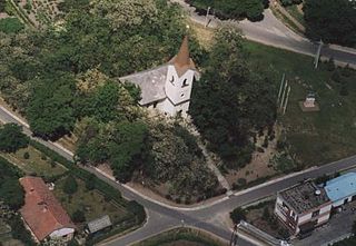
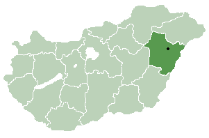
Sarkadtanya (formerly Sarkad) is a populated place, now part of Tiszalúc, in the county of Borsod-Abaúj-Zemplén, Hungary. [1]
Tiszalúc is a village in Borsod-Abaúj-Zemplén County in northeastern Hungary.
Hungary is a country in Central Europe. Spanning 93,030 square kilometres (35,920 sq mi) in the Carpathian Basin, it borders Slovakia to the north, Ukraine to the northeast, Austria to the northwest, Romania to the east, Serbia to the south, Croatia to the southwest, and Slovenia to the west. With about 10 million inhabitants, Hungary is a medium-sized member state of the European Union. The official language is Hungarian, which is the most widely spoken Uralic language in the world. Hungary's capital and its largest city and metropolis is Budapest. Other major urban areas include Debrecen, Szeged, Miskolc, Pécs and Győr.
Coordinates: 48°02′N21°02′E / 48.033°N 21.033°E
A geographic coordinate system is a coordinate system that enables every location on Earth to be specified by a set of numbers, letters or symbols. The coordinates are often chosen such that one of the numbers represents a vertical position and two or three of the numbers represent a horizontal position; alternatively, a geographic position may be expressed in a combined three-dimensional Cartesian vector. A common choice of coordinates is latitude, longitude and elevation. To specify a location on a plane requires a map projection.
Aștileu is a commune in Bihor County, northwestern Romania, close to the border with Hungary. It is composed of four villages: Aștileu, Călățea (Kalota), Chistag (Keszteg) and Peștere (Körösbarlang). At the 2011 census, 87.94% of the population were Romanians, 5.2% Roma, 4.48% Slovaks, 1.55% Hungarians and 0.23% Germans.
Nyírtass, formerly Tass, is a Hungarian village in Szabolcs-Szatmár-Bereg county. The village dates back to the 13th century; the name of the river Nyír was added as a prefix in 1908.
Harta is a village in Bács-Kiskun county, Hungary.
Leles is a village and municipality in the Trebišov District in the Košice Region of eastern Slovakia.
Branovo is a municipality and village in the Nové Zámky District in the Nitra Region of south-west Slovakia.
Körösszegapáti or Apateu (Romanian) is a village in Hajdú-Bihar county, in the Northern Great Plain region of eastern Hungary.
Ajak is a town in Szabolcs-Szatmár-Bereg county, in the Northern Great Plain region of eastern Hungary.
Tiszadada is a village in Szabolcs-Szatmár-Bereg county, in the Northern Great Plain region of eastern Hungary.
Rohod is a village in Szabolcs-Szatmár-Bereg county, in the Northern Great Plain region of eastern Hungary.
Nyírjákó is a village in Szabolcs-Szatmár-Bereg county, in the Northern Great Plain region of eastern Hungary.
Bătarci is a commune of 3,612 inhabitants situated in Satu Mare County, Romania. It is composed of four villages: Bătarci, Comlăușa (Ugocsakomlós), Șirlău (Sellő) and Tămășeni (Tamásváralja).
Bernecebaráti is a village in Pest county, Hungary.
Tésa is a village in Pest county, Hungary.
Oszlár is a village in Borsod-Abaúj-Zemplén County in northeastern Hungary.
Sajópetri is a village in Borsod-Abaúj-Zemplén County in northeastern Hungary.
Szentistvánbaksa is a village in Borsod-Abaúj-Zemplén County in northeastern Hungary.
Sajóörös is a village in Borsod-Abaúj-Zemplén County in northeastern Hungary.
Dejtár is a village and municipality in the comitat of Nógrád, Hungary.
Szerencs is a district in central-eastern part of Borsod-Abaúj-Zemplén County. Szerencs is also the name of the town where the district seat is found. The district is located in the Northern Hungary Statistical Region.
This Borsod-Abaúj-Zemplén location article is a stub. You can help Wikipedia by expanding it. |