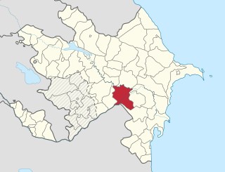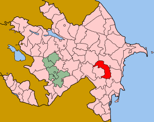
Imishli (İmişli) is a rayon of Azerbaijan. Imishli and neighbouring Sabirabad rayon share Sarysu, the largest lake in Azerbaijan.

Sabirabad is a rayon of Azerbaijan whose capital which lies at the junction of the Araz and Kura rivers. The low-lying area is dependent on canals and dams whose damage during 2010 caused waters from Lake Sarisu to flood several of the region's villages.

Greater Caucasus is the major mountain range of the Caucasus Mountains.
Heydar Aliyev Stadium is a multi-use stadium in Imishli, Azerbaijan. It is currently used mostly for football matches and is the home stadium of Mil-Muğan. The stadium holds 8,500 people and was opened in 2006.
Sari-su, Sary-su. Sara-su, Sarısu, Sarisu, Sarysu, or Ṣáríṣú, the name means yellow water in Turkic languages, may refer to:
Mil plain is a plain in Azerbaijan. It is located on the bank of the Aras river and extends to Iran. Mil-plain is located in the southwest part of the Kur-Araz lowland, where the Kura and Araz rivers meet. The area is between the right bank of the Kura River and the left bank of the Araz River. The north-eastern part of the plain is lower than the ocean level. In the south-west, these areas are covered by sand, gravel. More than 40 percent of the altitude in the plain is 0-100 meters, 25 percent - 100-200 meters above sea level, and 35 percent - absolute altitude is less than 0 meters. The absolute altitude decreases about 8 m to north and varies from 200 to 250 to the west. The plain includes mainly the areas of Imishli and Beylagan districts. Seismic activity is high as the plain is in the convergent border the Alpine-Himalayan orogenic belt.
Sarysu is the largest lake of Azerbaijan located in Imishli and Sabirabad raions of the Kur-Araz Lowland.

Imishli is the capital of the Imishli Rayon of Azerbaijan.

Gyulmirza is a village in the Imishli Rayon of Azerbaijan.

Mamedli is a village in the Imishli Rayon of Azerbaijan.

Khanlykh-Dzhevat is a village in the Imishli Rayon of Azerbaijan.

Agadzhaly is a village in the Imishli Rayon of Azerbaijan.

Guseinbeyly is a village in the Imishli Rayon of Azerbaijan.

Adzhily is a village in the Imishli Rayon of Azerbaijan.

Bayramly is a village in the Imishli Rayon of Azerbaijan.

Kyurabazly is a village in the Imishli Rayon of Azerbaijan.
Məhəmmədli is a village and municipality in the Imishli Rayon of Azerbaijan. It has a population of 581.

Meyniman is a village in the municipality of Birinci Meyniman in the Hajigabul Rayon of Azerbaijan. In 2014, it was listed as an abandoned village.

Terebna is a village in Edineț District, Moldova.

Hernádkércs is a village in Borsod-Abaúj-Zemplén County in northeastern Hungary.


