Related Research Articles

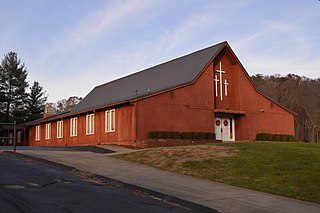
Sharpsburg is an unincorporated community in northwestern Bern Township, Athens County, Ohio, United States. There is a convenience store there, with gas pumps, and also containing the post office with the ZIP code 45777. Additionally there is a church, the Bern Township office, and a few houses.

Wingett Run is an unincorporated community in western Ludlow Township, Washington County, Ohio, United States. It has a post office with the ZIP code 45789. It is located along State Route 26 and the Little Muskingum River.

Whipple is an unincorporated community in southern Salem Township, Washington County, Ohio, United States. Although it is unincorporated, it once had a post office, with the ZIP code 45788. It lies on State Route 821 south of the village of Lower Salem, at the junction of Whipple Run with Duck Creek. The community took its name from nearby Whipple Run.
Cutler is an unincorporated community in southwestern Fairfield Township, Washington County, Ohio, United States. It has a post office with the ZIP code 45724. It lies at the intersection of State Route 555 and County Road 59 near Gilbert Run, a subsidiary of the Little Hocking River, which meets the Ohio River at Little Hocking to the southeast.

Bartlett is an unincorporated community in southwestern Wesley Township, Washington County, Ohio, United States. It has a post office with the ZIP code 45713. It sits at the intersection of State Routes 550 and 555 near Coal Run, a subsidiary of Wolf Creek, which meets the Muskingum River at Waterford to the north. Near Bartlett is located the Shinn Covered Bridge, which spans Wolf Creek.
Frenchtown is an unincorporated community in Yuba County, California. It is located on Dry Creek 6 miles (9.7 km) southeast of Rackerby, at an elevation of 1447 feet.
Bristol is a former town in Morgan County, in the U.S. state of Ohio. The GNIS classifies it as a populated place.
Archers Fork is an unincorporated community in Washington County, in the U.S. state of Ohio.
Beavertown is an unincorporated community in Washington County, in the U.S. state of Ohio.
Pinehurst is an unincorporated community in Washington County, in the U.S. state of Ohio.
Cow Run is an unincorporated community in Washington County, in the U.S. state of Ohio.
Moss Run is an unincorporated community in Washington County, in the U.S. state of Ohio.
Newell Run is an unincorporated community in Washington County, in the U.S. state of Ohio.
Wade is an unincorporated community in Washington County, in the U.S. state of Ohio.
Big Run is an unincorporated community in Athens County, in the U.S. state of Ohio.
Woodville is an unincorporated community in Clermont County, in the U.S. state of Ohio.
Shenango Creek is a stream in the U.S. state of West Virginia.
Reas Run is a stream in the U.S. state of Ohio. It is a tributary to the Ohio River.
Danas Run is a stream in the U.S. state of Ohio. It is a tributary to the Ohio River.
Emerson is an unincorporated community in northwest Marion County, in the U.S. state of Missouri. The community is located on Missouri Route M approximately ten miles northwest of Palmyra, on a ridge north of the South Fabius River. There are no businesses there, or services excepting two churches and a river access ramp; but there are numerous homes.
References
39°15′18″N81°41′52″W / 39.25500°N 81.69778°W
| | This article related to a river in Ohio is a stub. You can help Wikipedia by expanding it. |