Course
The Schmale Gera branches off to the right in the Venice Park in the old town of Erfurt from the Wilder Gera, at the end of the section called Breitstrom . Shortly afterwards, the narrow Gera crosses under the main river of the Gera, known as the flood ditch, in a culvert .
Culvert of the Schmalen Gera (back) under the flood ditch (front) from 1895 in Erfurt
The water crosses the Johannesviertel in Erfurt's old town and the Mühlenviertel in the Andreasvorstadt . In Ilversgehofen it drives the Heiligenmühle at Mittelhäuser Strasse 16. It then flows through the Rieth and then between Gispersleben and the Red Mountain to Mittelhausen .
Outside the urban area, it flows between Nöda and Riethnordhausen close to the foot of the hills. At Haßleben, its course is separated from that of the main Gera river by the Kantorberg and another hill.
The narrow Gera drives the Cux mill south of Werningshausen . On the outskirts it takes up the Wilder Graben, which previously flows parallel to the Gramme, but does not branch off from it. On the western edge of Werningshausen there is a connecting ditch between Schmaler Gera and Gramme at Lindenstrasse, but only 0.6 km north of the village the two bodies of water unite, whereby the Gramme, which was previously close to the edge of the village, is in the bed of the previously in a wide arc around the village Schmalen Gera, which is led around, continues to flow.
From the confluence it is another 1.57 km to the confluence of the Gramme in the Unstrut . This means that the separate Schmalen Gera run is over 25 km long.

The Thuringian Forest is a mountain range in the southern parts of the German state of Thuringia, running northwest to southeast. Skirting from its southerly source in foothills to a gorge on its north-west side is the Werra valley. On the other side of the Forest is an upper outcrop of the North German Plain, the Thuringian Basin, which includes the city Erfurt. The south and south-east continuation of the range is the highland often called the Thuringian-Vogtlandian Slate Mountains.

The River Tame is a river in the West Midlands of England, and one of the principal tributaries of the River Trent. The Tame is about 95 km (59 mi) long from the source at Oldbury to its confluence with the Trent near Alrewas, but the main river length of the entire catchment, i.e. the Tame and its main tributaries, is about 285 km (177 mi).

White Clay Creek is an 18.5-mile-long (29.8 km) tributary of the Christina River in southern Pennsylvania and northern Delaware in the United States. It is renowned for its scenic character and is largely federally protected.

The East Branch Delaware River is one of two branches that form the Delaware River. It is approximately 75 mi (121 km) long, and flows through the U.S. state of New York. It winds through a mountainous area on the southwestern edge of Catskill Park in the Catskill Mountains for most of its course, before joining the West Branch along the northeast border of Pennsylvania with New York. Much of it is paralleled by State Route 30.
The Neversink River is a 55-mile-long (89 km) tributary of the Delaware River in southeastern New York in the United States. The name of the river comes from the corruption of an Algonquian language phrase meaning "mad river."

The River Wandle is a right-bank tributary of the River Thames in south London, England. With a total length of about 9 miles (14 km), the river passes through the London boroughs of Croydon, Sutton, Merton and Wandsworth, where it reaches the Thames. A short headwater – the Caterham Bourne – is partially in Surrey, the historic county of the river's catchment. Tributaries of the Wandle include Carshalton Ponds and Norbury Brook.
The Frome, historically the Froom, is a river that rises in Dodington Park, South Gloucestershire and flows southwesterly through Bristol to join the river Avon. It is approximately 20 miles (32 km) long, and the mean flow at Frenchay is 60 cubic feet per second (1.7 m3/s). The name Frome is shared with several other rivers in South West England and means 'fair, fine, brisk'. The river is known locally in east Bristol as the Danny.

The Hogsmill River in Surrey and Greater London, England, is a small chalk stream tributary of the River Thames. It rises in Ewell and flows into the Thames at Kingston upon Thames on the lowest non-tidal reach, that above Teddington Lock.

The Murr is a river in Baden-Württemberg, Germany. It is a right tributary of the Neckar. The river gave its name to a small town on its banks, Murr, and to the Rems-Murr-Kreis district, which was also named after the river Rems, which runs roughly parallel to the south of the Murr.

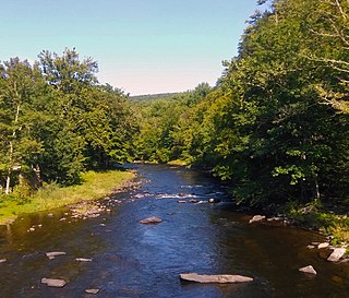
The Gera is a river in Thuringia, Germany.

The River Poddle is a river in Dublin, Ireland, a pool of which gave the city its English language name. Boosted by a channel made by the Abbey of St. Thomas à Becket, taking water from the far larger River Dodder, the Poddle was the main source of drinking water for the city for more than 500 years, from the 1240s. The Poddle, which flows wholly within the traditional County Dublin, is one of around a hundred members of the River Liffey system, and one of over 135 watercourses in the county; it has just one significant natural tributary, the Commons Water from Crumlin.

The Hörsel is a 56 km (35 mi) long river in Thuringia, Germany, right tributary of the Werra. It is formed by the confluence of two smaller rivers in Leinatal, at the northern edge of the Thuringian Forest. The Hörsel flows generally northwest through the towns Hörselgau, Wutha-Farnroda and Eisenach. It flows into the Werra in Hörschel, a village near Eisenach.
The Halle–Bebra railway, known in German as the Thüringer Bahn, is a 210 kilometre-long railway line from Halle (Saale) via Erfurt and Gerstungen to Bebra, mainly in Thuringia. As far as Gerstungen the line originally belonged to the Thuringian Railway Company. From Gerstungen to Bebra, it was owned by the Frederick William Northern Railway (Friedrich-Wilhelms-Nordbahn), named after the Prussian king, Frederick William IV. It is now a two-track, electrified, standard gauge mainline operated by DB Netze. It was opened between 1846 and 1849 and was the first railway line in Thuringia. All types of trains from Regionalbahn to ICE currently run on the line except Interregio-Express. Four of the six largest cities in Thuringia are located on the line.

The Eschach is a river of Baden-Württemberg, Germany. It flows into the Neckar south of Rottweil.

The Nesse is a 54.5-kilometre-long (33.9 mi) tributary of the Hörsel in the southern Thuringia. Strictly speaking, it represents a second, right main branch of the Hörsel, which brings about as much water to join the Hörsel as the Hörsel itself and drains an even larger catchment area.

Sudbrook and its tributary, the Latchmere stream, are north-flowing streams in London, England, that drain northern Kingston upon Thames and the eastern extreme of Ham following a meander scar in a terrace; the upper part of the Sudbrook drains a narrow vale in Richmond Park's southern corner into the tidal Thames.
The Sheldrake River is a freshwater stream located in Southern Westchester County, New York. The river forms in White Plains and flows six miles (9.7 km) south until it joins the Mamaroneck River. Approximately 1.58 miles (2.54 km) of the Sheldrake River flow through Scarsdale, 2.13 miles (3.43 km) through New Rochelle and two miles (3.2 km) through the Town of Mamaroneck.
The Rieth is a district in the north of the Thuringian state capital Erfurt, Germany.
Welton Beck is a small local stream which originates from Old Man's Head Spring in the west of Welton civil parish and flows eastwards through Welton and Dunholme in the West Lindsey district of Lincolnshire for approximately 10 km (6.2 mi) to a confluence with Barlings Eau near Reasby, which goes on to join the River Witham. The beck is fed from groundwater springs of the Lincolnshire limestone aquifer, with clear freshwater and aquatic plant growth typical of calcareous conditions. The channel of the beck has been largely modified from its original state, having been widened, straightened, and its course significantly altered.
