Related Research Articles

The St. Joseph River is an 86.1-mile-long (138.6 km) tributary of the Maumee River in northwestern Ohio and northeastern Indiana in the United States, with headwater tributaries rising in southern Michigan. It drains a primarily rural farming region in the watershed of Lake Erie.

The Feather River is the principal tributary of the Sacramento River, in the Sacramento Valley of Northern California. The river's main stem is about 73 miles (117 km) long. Its length to its most distant headwater tributary is just over 210 miles (340 km). The main stem Feather River begins in Lake Oroville, where its four long tributary forks join—the South Fork, Middle Fork, North Fork, and West Branch Feather Rivers. These and other tributaries drain part of the northern Sierra Nevada, and the extreme southern Cascades, as well as a small portion of the Sacramento Valley. The total drainage basin is about 6,200 square miles (16,000 km2), with approximately 3,604 square miles (9,330 km2) above Lake Oroville.

Cedar Creek is the largest tributary of the St. Joseph River, draining 174,780 acres (707.3 km2) in the Eastern Corn Belt Plains of northeastern Indiana. It is 31.9 miles (51.3 km) long, rising in northwestern DeKalb County and joining the St. Joseph just below the Cedarville Dam in Allen County.
Calaveritas is an unincorporated community in Calaveras County, California. It sits on the banks of the Calaveritas Creek at an elevation of 1,109 feet above sea level and is located at 38°09′29″N120°36′36″W. The community is in ZIP code 95249 and area code 209.

The Embarras River is a 195-mile-long (314 km) tributary of the Wabash River in southeastern Illinois in the United States. The waters of the Embarras reach the Gulf of Mexico via the Wabash, Ohio, and Mississippi Rivers. The river drains a watershed around 1,566,450 acres (6,339.2 km2) in an agricultural region. It arises near Champaign-Urbana and flows south to near Vincennes, Indiana. The name comes from French explorers, who used the French word, embarras, for river navigation obstacles, blockages, and difficulties relating to logjams.

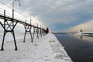
Black River is a 4.2-mile-long (6.8 km) river in the southwest part of the U.S. state of Michigan that empties into Lake Michigan in South Haven at 42°24′08″N86°17′04″W, where it discharges past the South Pier Lighthouse. The river takes its name from the dark brown color of its water, which is caused by suspended sediments and organic materials picked up along its course. The river supports a variety of wildlife including trout, snapping turtles, leeches, and many other varieties of flora and fauna. The Black River watershed encompasses 287 square miles (740 km2) across two counties and 13 townships.

The Dowagiac River is a southwesterly flowing 30.9-mile-long (49.7 km) stream in the Lower Peninsula of the U.S. state of Michigan. It is a tributary to the St. Joseph River which flows, in turn, into eastern Lake Michigan.
Tonoloway Creek, also known as Great Tonoloway Creek, is a 31.4-mile-long (50.5 km) tributary stream of the Potomac River in the U.S. states of Maryland and Pennsylvania.

The Betsie River is a 54.0-mile-long (86.9 km) river in the U.S. state of Michigan. The river is located in the northwestern Lower Peninsula of the state, flowing into Lake Michigan at Frankfort. The river's course is mostly within Benzie County,, although the river rises in western Grand Traverse County and flows briefly through northern Manistee County.

Jordan is an unincorporated community in Morgan Township, Owen County, in the U.S. state of Indiana.
Sturgeon River is a 63.6-mile-long (102.4 km) river in the U.S. state of Michigan, flowing mostly southward through Alger County and Delta County counties on the Upper Peninsula.

Indian River is a 59.1-mile-long (95.1 km) tributary of the Manistique River on the Upper Peninsula of Michigan in the United States. It rises out of Hovey Lake at 46°17′36″N86°42′20″W on Hiawatha National Forest land in Alger County and flows south and east through a lake district and on through Schoolcraft County. The river flows into the 8,659 acre (35 km2) Indian Lake at 46°17′36″N86°42′20″W and flows out at 45°59′30″N86°17′15″W. It then flows east and south about 2.5 miles where it merges with the Manistique River, which then flows through Manistique and into Lake Michigan at 45°56′56″N86°14′45″W.
Youngs Creek is a stream in Johnson County, Indiana, in the United States.
Bluff Creek is an unincorporated community in Johnson County, Indiana, in the United States.
Indian Creek is a stream in Marion County, Indiana, in the United States. It is a tributary of Fall Creek.
Honey Creek is a stream in Johnson County, Indiana, in the United States. It is a tributary of the White River.
Freeman is an unincorporated community in the center of Clay Township, Owen County, in the U.S. state of Indiana. It lies near the intersection of County Road 650 South and Indiana Highway 43, which is a community nearly nine miles south of the city of Spencer, the county seat. Its elevation is 541 feet (165 m), and it is located at 39°11′44″N86°44′1″W.
Stotts Creek is a stream in Morgan County, Indiana, in the United States.
Hubbell is an unincorporated community in the southwestern corner of Jefferson Township, Owen County, in the U.S. state of Indiana. It lies near the intersection of County Road 750 South and Indiana Highway 157, which is a community nearly twenty miles southwest of the city of Spencer, the county seat. Its elevation is 528 feet, and it is located at 39°10′59″N87°0′44″W. This community is also known as Hubbells Station.
McBride Branch is a stream in Owen County, in the U.S. state of Indiana.
References
- ↑ U.S. Geological Survey Geographic Names Information System: Upper Schooner Creek
- ↑ U.S. Geological Survey Geographic Names Information System: Lower Schooner Creek
- ↑ Blanchard, Charles (1884). Counties of Morgan, Monroe and Brown, Indiana: Historical and Biographical. F.A. Battey & Company. p. 720.
39°09′29″N86°20′11″W / 39.15806°N 86.33639°W