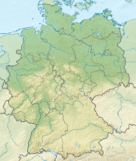
Hochsauerlandkreis is a Kreis (district) in the east of North Rhine-Westphalia, Germany. Neighboring districts are Soest, Paderborn, Höxter, Waldeck-Frankenberg, Siegen-Wittgenstein, Olpe, Märkischer Kreis.
The Ennepe-Ruhr-Kreis is a district in the center of North Rhine-Westphalia, Germany. It is part of the southern Ruhr urban area and has ca. 324,000 inhabitants (2012). The district's seat is Schwelm; the largest of its nine towns is Witten.
Soest is a Kreis (district) in the middle of North Rhine-Westphalia, Germany. Neighbouring districts are Warendorf, Gütersloh, Paderborn, Hochsauerland, Märkischer Kreis, Unna and the independent town of Hamm.
Warendorf is a Kreis (district) in the northern part of North Rhine-Westphalia, Germany. Neighboring districts are Steinfurt, Osnabrück (district), Gütersloh, Soest, district-free city Hamm, Coesfeld and the district-free city Münster.

The Sauerland[ˈzaʊɐlant] is a rural, hilly area spreading across most of the south-eastern part of North Rhine-Westphalia, in parts heavily forested and, apart from the major valleys, sparsely inhabited. For these reasons, it has been chosen as the first place in Germany to reintroduce the Wisent.

The Bergisches Land is a low mountain range region within the state of North Rhine-Westphalia, Germany, east of Rhine river, south of the Ruhr. The landscape is shaped by woods, meadows, rivers and creeks and contains over 20 artificial lakes. Wuppertal is one of the biggest towns and seen as the region's capital, whereas the southern part nowadays has closer economic and socio-cultural ties to Cologne. Wuppertal and the neighbouring cities of Remscheid, Solingen form the Bergisches Städtedreieck.
Gütersloh is a Kreis (district) in the north-east of North Rhine-Westphalia, Germany. Neighboring districts are Osnabrück, Herford, district-free Bielefeld, Lippe, Paderborn, Soest and Warendorf.
Paderborn is a Kreis (district) in the east of North Rhine-Westphalia, Germany. Neighboring districts are Gütersloh, Lippe, Höxter, Hochsauerland, and Soest.
Lippe is a Kreis (district) in the east of North Rhine-Westphalia, Germany. Neighboring districts are Herford, Minden-Lübbecke, Höxter, Paderborn, Gütersloh, and district-free Bielefeld, which forms the region Ostwestfalen-Lippe.

The Siegerland is a region of Germany covering the old district of Siegen and the upper part of the district of Altenkirchen, belonging to the Rhineland-Palatinate adjoining it to the west.

The Lordship of Myllendonk was an estate of the Holy Roman Empire, located in western North Rhine-Westphalia, Germany. It was bordered by the Duchy of Jülich to the west and north, the Lordship of Dyck to the south, and the Archbishopric of Cologne to the east and southeast. The lordship contained Grevenbroich and the Castle of Myllendonk. From 1700 Myllendonk was an Imperial Estate with a vote in the Bench of Counts of Westphalia.

The Lordship of Wickrath was a Lordship of the Holy Roman Empire located in western North Rhine-Westphalia around the castle of Wickrath. The Lordship was bordered by Jülich to the south, west and north, and the Archbishopric of Cologne or Highbishoprick of Coln to the east. Wickrath became an immediate Lordship in 1488 after it passed to the Knights of Hompesch. It was located in the Lower Rhenish-Westphalian Circle, and from 1752 it was an Imperial Estate with a vote in the Bench of Counts of Westphalia.

The Free State of Lippe was a German state formed after the Principality of Lippe was abolished following the German Revolution of 1918.

Germany is a country in west-central Europe, that stretches from the Alps, across the North European Plain to the North Sea and the Baltic Sea. Germany has the second largest population in Europe and is seventh largest in area. The territory of Germany covers 357,021 km2 (137,847 sq mi), consisting of 349,223 km2 (134,836 sq mi) of land and 7,798 km2 (3,011 sq mi) of waters.

Osnabrück Land is a region in southwest Lower Saxony in Germany, which extends into the state of North Rhine-Westphalia. Its centre is the city of Osnabrück. The region is dominated by the Teutoburg Forest and the River Hase. Originally a variant of Low German was spoken here which belonged to the East-Westphalian dialect. The region is generally identified with the district and city of Osnabrück, which largely corresponds to the Prince-Bishopric of Osnabrück in the Holy Roman Empire. The Osnabrück Land Regional Association looks after cultural issues for the region.

District 3 is a central city district of Düsseldorf, the state capital of North Rhine-Westphalia, Germany and the city's most populous and one of its most diverse districts.

Untreue is a river of North Rhine-Westphalia, Germany.

Göttchesbach is a river of North Rhine-Westphalia, Germany.

Tüterbach is a river of North Rhine-Westphalia, Germany.


