Augstenberg is a mountain in Liechtenstein in the Rätikon range of the Eastern Alps close to the border with Austria and the town of Malbun, with a height of 2,359 metres (7,740 ft).

Plasteikopf is a mountain in Liechtenstein in the Rätikon range of the Eastern Alps close to the border with Switzerland, with a height of 2,356 metres (7,730 ft).
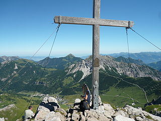
Rappenstein is a mountain in Liechtenstein in the Rätikon range of the Eastern Alps with a height of 2,222 metres (7,290 ft).

Galinakopf is a mountain in on the border of Austria and Liechtenstein in the Rätikon range of the Eastern Alps, with a height of 2,198 metres (7,211 ft).

The Hinter Grauspitz is a mountain on the border of Switzerland and Liechtenstein in the Rätikon range of the Eastern Alps. With a height of 2,574 metres (8,445 ft) above sea level, it is the second highest summit in Liechtenstein.
Gamsgrat is a mountain on the border of Liechtenstein and Austria in the Rätikon range of the Eastern Alps close to the town of Malbun, with a height of 2,246 metres (7,369 ft).
Ochsenkopf is a mountain on the border of Liechtenstein and Austria in the Rätikon range of the Eastern Alps close to the town of Malbun, with a height of 2,286 metres (7,500 ft).
Scheienkopf is a mountain on the border of Liechtenstein and Austria, although the summit is in Austria, in the Rätikon range of the Eastern Alps with a height of 2,159 metres (7,083 ft).
Garsellakopf is a mountain on the border of Liechtenstein and Austria in the Rätikon range of the Eastern Alps to the east of the town of Schaan, with a height of 2,105 metres (6,906 ft).

Mittlerspitz is a mountain on the border of Liechtenstein and Switzerland in the Rätikon range of the Eastern Alps east of the town of Balzers, with a height of 1,897 metres (6,224 ft).

Mittagspitz is a mountain in Liechtenstein, close to the border with Switzerland in the Rätikon range of the Eastern Alps, east of the town of Balzers, with a height of 1,857 metres (6,093 ft).
Koraspitz is a mountain in Liechtenstein in the Rätikon range of the Eastern Alps with a height of 1,927 metres (6,322 ft).
Kulmi is a mountain in Liechtenstein in the Rätikon range of the Eastern Alps with a height of 1,993 metres (6,539 ft).
Heubühl is a mountain in Liechtenstein in the Rätikon range of the Eastern Alps, to the east of the town of Triesen, with a height of 1,936 metres (6,352 ft).
Alpspitz is a mountain in Liechtenstein in the Rätikon range of the Eastern Alps, to the east of Vaduz, with a height of 1,943 metres (6,375 ft) or 1942 m.
Gafleispitz is a mountain in Liechtenstein in the Rätikon range of the Eastern Alps, to the east of Schaan, with a height of 2,000 metres (6,600 ft).
Maurerberg or Mauerer Berg is a mountain on the border of Liechtenstein and Austria in the Rätikon range of the Eastern Alps to the southeast of the town of Schaanwald, with a height of 1,378 metres (4,521 ft).
Stachlerkopf is a mountain in Liechtenstein in the Rätikon range of the Eastern Alps, close to the towns of Steg and Malbun, with a height of 2,071 metres (6,795 ft).

Sarojahöhe or Saroja is a mountain on the border of Liechtenstein and Austria in the Rätikon range of the Eastern Alps to the east of the village of Planken, with a height of 1,659 metres (5,443 ft).


