The topic of this article may not meet Wikipedia's notability guideline for sports and athletics .(May 2021) |
Charles Scott Rogers (December 4, 1961 - November 27, 2020) was an American hiker.
The topic of this article may not meet Wikipedia's notability guideline for sports and athletics .(May 2021) |
Charles Scott Rogers (December 4, 1961 - November 27, 2020) was an American hiker.
Rogers was born in Savannah, Georgia on December 4, 1961. [1] He became an amputee following an accident with a shotgun on Memorial Day 1998. [2]
Several media outlets, including CNN, Associated Press, and NBC, reported extensively on his 2004 hike. Duncan Mansfield, AP writer from Knoxville, Tennessee, coined the term "bionic hiker". [3]
Rogers died on November 27, 2020, after having tetraplegia for 40 years. [1]

The Appalachian Trail, also called the A.T., is a hiking trail in the Eastern United States, extending almost 2,200 miles (3,540 km) between Springer Mountain in Georgia and Mount Katahdin in Maine, and passing through 14 states. The Appalachian Trail Conservancy claims the Appalachian Trail to be the world's longest hiking-only trail. More than three million people hike segments of it each year.

The City of Lone Tree is a home rule municipality located in northern Douglas County, Colorado, United States. Lone Tree is a part of the Denver–Aurora–Lakewood, CO Metropolitan Statistical Area. The city population was 14,253 at the 2020 United States Census.

Hiking is a long, vigorous walk, usually on trails or footpaths in the countryside. Walking for pleasure developed in Europe during the eighteenth century. Religious pilgrimages have existed much longer but they involve walking long distances for a spiritual purpose associated with specific religions.

The Pacific Crest Trail (PCT), officially designated as the Pacific Crest National Scenic Trail, is a long-distance hiking and equestrian trail closely aligned with the highest portion of the Cascade and Sierra Nevada mountain ranges, which lie 100 to 150 miles east of the U.S. Pacific coast. The trail's southern terminus is next to the Mexico–United States border, just south of Campo, California, and its northern terminus is on the Canada–US border, upon which it continues unofficially to the Windy Joe Trail within Manning Park in British Columbia; it passes through the states of California, Oregon, and Washington.

Mount Whitney is the highest mountain in the contiguous United States, with an elevation of 14,505 feet (4,421 m). It is in East–Central California, in the Sierra Nevada, on the boundary between California's Inyo and Tulare counties, and 84.6 miles (136.2 km) west-northwest of North America's lowest topographic point, Badwater Basin in Death Valley National Park, at 282 ft (86 m) below sea level. The mountain's west slope is in Sequoia National Park and the summit is the southern terminus of the John Muir Trail, which runs 211.9 mi (341.0 km) from Happy Isles in Yosemite Valley. The eastern slopes are in Inyo National Forest in Inyo County. Mount Whitney is ranked 18th by topographic isolation.

Pacific Palisades is a neighborhood in the Westside region of Los Angeles, California, situated about 20 miles (32 km) west of Downtown Los Angeles.

A Walk in the Woods: Rediscovering America on the Appalachian Trail is a 1998 travel book by the writer Bill Bryson, chronicling his attempt to thru-hike the Appalachian Trail during the spring and summer of 1996. For much of his journey, Bryson was accompanied by his friend Matt Angerer, who had previously appeared in Bryson's 1991 book Neither Here nor There: Travels in Europe.

Hartwick College is a private liberal arts college in Oneonta, New York. The institution's origin is rooted in the founding of Hartwick Seminary in 1797 through the will of John Christopher Hartwick.

Bear Mountain is a peak of the southern Taconic Mountains in Salisbury, Connecticut. At 2,316 feet (706 m), Bear Mountain is the highest mountain that lies wholly within Connecticut. However, it is not the state highpoint: in the 1940s, the United States Geological Survey determined that the highest elevation in the state, at 2,380 feet (725 m), was actually on the nearby Connecticut-Massachusetts border, on the southern slope of Massachusetts’ Mount Frissell. There is a stone monument on the Bear Mountain summit. The Appalachian Trail crosses the mountain in a generally north-south direction.

Will Rogers State Historic Park is the former estate of American humorist Will Rogers. It lies in the Santa Monica Mountains in Los Angeles, in the Pacific Palisades area.

The Taconic Mountains are a 150-mile-long sub-range of the Appalachian Mountains lying on the eastern border of New York State and adjacent New England. The range, which played a role in the history of geological science, is separated from the Berkshires and Green Mountains to the east by a series of valleys, principally those of the Housatonic River, Battenkill River and Otter Creek. The Taconics' highest point is Mount Equinox in Vermont at 3,840 feet (1,170 m); among many other summits are Dorset Mountain, Mount Greylock and Mount Everett.

The climate of Virginia, a state on the east coast of the United States, is mild compared to more northern areas of the United States such as New England and the Midwest. Most of Virginia east of the Blue Ridge mountains, the southern part of the Shenandoah Valley, and the Roanoke Valley, has a humid subtropical climate. In the mountainous areas west of the Blue Ridge, the climate is warm-summer humid continental or oceanic climate. Severe weather, in the form of tornadoes, tropical cyclones, and winter storms, impacts the state on a regular basis. Central Virginia received significant snowfall of 20 inches in December 2009.

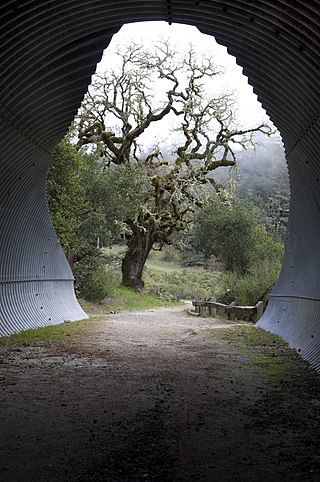
The Bay Area Ridge Trail is a planned 550-mile (890 km) multi-use trail along the hill and mountain ridgelines surrounding the San Francisco Bay Area, in Northern California. As of May 2022, 400 miles (640 km) have been established. When complete, the trail will connect over seventy-five parks and open spaces. The trail is being designed to provide access for hikers, runners, mountain bicyclists, and equestrians. It will be accessible through trailheads near major population centers, but the trail will extend into more remote areas. The first trail section was dedicated on May 13, 1989.

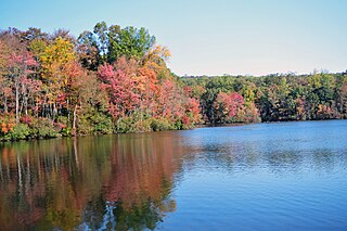
French Creek State Park is a 7,977-acre (3,228 ha) Pennsylvania state park in North Coventry and Warwick Townships in Chester County and Robeson and Union Townships in Berks County, Pennsylvania. It straddles northern Chester County and southern Berks County along French Creek. It is located in the Hopewell Big Woods. The park is the home of two lakes: Hopewell Lake, a 68-acre (28 ha) warm water lake, and Scotts Run Lake, a 22-acre (8.9 ha) cold water lake. The state record smallmouth bass was caught in Scotts Run Lake. There are extensive forests, and almost 40 miles (64 km) of hiking and equestrian trails. The park is also friendly to mountain bikers, having some renowned technical trails. Hopewell Furnace National Historic Site, which features a cold blast furnace restored to its 1830s appearance, is surrounded by the park. The Six Penny Day Use Area and Group Camp are listed on the National Register of Historic Places. French Creek State Park is located off of Pennsylvania Route 345 to the south of Birdsboro.

Mount Scott is a small stratovolcano and a so-called parasitic cone on the southeast flank of Crater Lake in southern Oregon. It is approximately 420,000 years old. Its summit is the highest point within Crater Lake National Park, and the tenth highest peak in the Oregon Cascades. A small fire lookout tower stands on the summit, at the end of a trail that zigzags approximately 1,500 feet up the mountain. The mountain is named for Oregon pioneer Levi Scott, founder of Scottsburg, Oregon.

The Stanford Dish, known locally as the Dish, is a radio antenna in the Stanford foothills. The 150-foot-diameter (46 m) dish was built in 1961 by the Stanford Research Institute. The cost to construct the antenna was $4.5 million, and was funded by the United States Air Force. In the 1960s the Dish was used to provide information on Soviet radar installations by detecting radio signals bounced off the moon.

Five Ten is a German manufacturer of mountain biking, climbing, and trail hiking shoes. Originally an American brand founded in California in 1985 by Charles Cole, Five Ten became one of the top-selling climbing shoe manufacturers worldwide by October 2011.

Quebec Run Wild Area is a 7,441-acre section of Forbes State Forest located in Fayette County, Pennsylvania just north of the Mason–Dixon line and the Pennsylvania border with West Virginia. Situated on the eastern slope of Chestnut Ridge, one of the westernmost ridges in the Appalachian Mountain Range, Quebec Run is heavily forested and contains several miles of maintained, interconnected trail. As is the case with all Pennsylvania state forest wild areas, no development of a permanent nature is permitted “in order to retain the undeveloped character of the area.” Quebec Run is the largest wild area without a road in southwestern Pennsylvania and serves as a destination for various outdoor activities including hiking, mountain biking, and cross-country skiing.

Northwest Arkansas (NWA) is a metropolitan area and region in Arkansas within the Ozark Mountains. It includes four of the ten largest cities in the state: Fayetteville, Springdale, Rogers, and Bentonville, the surrounding towns of Benton and Washington counties, and adjacent rural Madison County, Arkansas. The United States Census Bureau-defined Fayetteville–Springdale–Rogers Metropolitan Statistical Area includes 3,213.01 square miles (8,321.7 km2) and 590,337 residents, ranking NWA as the 98th most-populous metropolitan statistical area in the U.S. and the 13th fastest growing in the United States.

The Satsop Hills are foothills of the Olympic Mountains in Mason County, Washington north of Matlock, Washington, between Wynoochee Lake to the west and Lake Cushman to the east.