
Cornwall is a city in Eastern Ontario, Canada, situated where the provinces of Ontario and Quebec and the state of New York converge. It is the seat of the United Counties of Stormont, Dundas, and Glengarry and is Ontario's easternmost city.

Etobicoke is an administrative district and former city within Toronto, Ontario, Canada. Comprising the city's west end, Etobicoke is bordered on the south by Lake Ontario, on the east by the Humber River, on the west by Etobicoke Creek, the cities of Brampton, and Mississauga, the Toronto Pearson International Airport, and on the north by the city of Vaughan at Steeles Avenue West.

Greater Napanee is a town in southeastern Ontario, Canada, approximately 45 kilometres (28 mi) west of Kingston and the county seat of Lennox and Addington County. It is located on the eastern end of the Bay of Quinte. Greater Napanee municipality was created by amalgamating the old Town of Napanee with the townships of Adolphustown, North and South Fredericksburg, and Richmond in 1999. Greater Napanee is co-extensive with the original Lennox County.

Ancaster is a historic town in the city of Hamilton, Ontario, Canada, located on the Niagara Escarpment. Founded as a town in 1793, it immediately developed itself into one of the first significant and influential early British Upper Canada communities established during the late 18th century eventually amalgamating with the city of Hamilton in 2001. By 1823, due to its accessible waterpower and location at the juncture of prehistoric indigenous trading routes, Ancaster had become Upper Canada's largest industrial and commercial centre. Additionally, Ancaster had at that time attracted the 2nd largest populace (1,681) in Upper Canada, trailing only Kingston, but surpassing the populations of nearby Toronto (1,376) and Hamilton (1,000). After this initial period of prosperity in the late 18th century, sudden significant water and rail transportation advancements of the early 19th century would soon better benefit Ancaster's neighbouring towns nearer the Lake Ontario waterfront. Stationary steam engines for industries rapidly developing in the 19th century would eventually make Ancaster's water-powered industries less vital. As a result, after the 1820s, Ancaster's influence would begin to wane during the remainder of the 19th century.

North Dundas is a township in Eastern Ontario, Canada, in the United Counties of Stormont, Dundas and Glengarry.

Dundas is an urban district and former town in Hamilton, Ontario, Canada. It is nicknamed the Valley Town because of its topographical location at the bottom of the Niagara Escarpment on the western edge of Lake Ontario. The population has been stable for decades at about 20,000, largely because it has not annexed rural land from the protected Dundas Valley Conservation Area.

The United Counties of Stormont, Dundas and Glengarry (SDG) is an upper-tier municipality in the Canadian province of Ontario that comprises three historical counties and excludes the City of Cornwall and the Mohawk Nation of Akwesasne. However, both Cornwall and Akwesasne form part of a larger census division named for the United Counties of Stormont, Dundas and Glengarry. The municipality's administrative office is located within Cornwall.

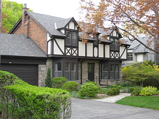
Westdale is a residential neighbourhood in Hamilton, Ontario, Canada. It is centred in the Westdale Village shopping district and located near McMaster University. It is bordered to the north by Cootes Paradise, an extensive nature reserve marking the western end of Lake Ontario, to the south by Main Street and Ainslie Wood, to the east by Highway 403, and to the west by McMaster University.
South Dundas is a municipality in eastern Ontario, Canada, in the United Counties of Stormont, Dundas and Glengarry along the north shore of the St. Lawrence River. It is located approximately 100 kilometres south of Ottawa and is midway between Kingston and Montreal, Quebec.

Unionville High School is a public high school of the York Region District School Board in Ontario, Canada. It is located west of the community of Unionville in the city of Markham. The school is located next to the Markham Civic Centre and the Markham Theatre.
White Oaks Secondary School (WOSS) is a secondary school located in Oakville, Ontario, Canada.
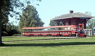
The Long Sault Parkway is a group of eleven islands west of Cornwall in the Canadian province of Ontario, as well as the name of the 10.1-kilometre (6.3 mi) scenic parkway connecting them. The islands, which include two public beaches and three campgrounds, were created by the flooding of the Long Sault rapids during construction of the St. Lawrence Seaway. The parkway, the islands, and their amenities are maintained by the St. Lawrence Parks Commission.
Humber Valley Village is a neighbourhood located in Toronto, Ontario, Canada. It is within the former suburb of Etobicoke and includes some of the most expensive real estate in the metropolitan west end. The boundaries are from Dundas Street on the south to Islington Avenue to the west, Eglinton Avenue to the north, and the Humber River in the east. The neighbourhood is in the political riding of Etobicoke Centre.

Islington-City Centre West is a commercial and residential neighbourhood in Toronto, Ontario, Canada. One of four central business districts outside Downtown Toronto, it is bounded by Rathburn Road to the north, Islington Avenue to the east, Bloor Street to the south, Mimico Creek to the west.
Vincent Massey Collegiate Institute is a Toronto District School Board facility that was previously operated as public secondary school in Toronto, Ontario, Canada. It was operated by the Etobicoke Board of Education in the former suburb of Etobicoke from its opening in 1961 until its closure in 1985 and later became the Vincent Massey Centre as an adult school until 1993. Owned and oversighted by the board's arms-length division, Toronto Lands Corporation, it is one of two schools in Etobicoke to be named for the late Governor General of Canada, the other was Vincent Massey Public School.
General Vanier Secondary School (GVIS) was a public intermediate school located in Cornwall, Ontario, Canada. Due to a decline in student enrollment, the school was closed in the fall of 2011 and its students transferred to Cornwall Collegiate and Vocational School (CCVS). The Catholic high school St. Joseph's Secondary School (SJSS) is attached and continues to share the school grounds.
North Dundas District High School (NDDHS) is a high school located in Chesterville, Ontario, Canada. It is part of the Upper Canada District School Board along with 78 other Ontario schools. It features grades 7 through 12 and has approximately 500 students. However, this number is expected to go down, as a decline in enrolment has been seen.

Bishop Marrocco/Thomas Merton Catholic Secondary School, officially Bishop Marrocco/Thomas Merton Catholic Secondary School and Regional Arts Centre is a Catholic secondary school located in Toronto, Ontario, Canada part of the Toronto Catholic District School Board, formerly the Metropolitan Separate School Board and serves about 740 students in grades 9 to 12.

Michael Power - St. Joseph High School is a Catholic secondary school in Toronto, Ontario, Canada. The school was founded as an amalgamation of two independent schools in the neighbourhood, Michael Power High School and St. Joseph Islington High School with the two schools amalgamated in 1982 officially. The school joined the Metropolitan Separate School Board in 1987.
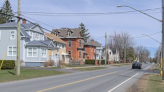
Morrisburg is an unincorporated community in the Municipality of South Dundas, located in Eastern Ontario, Canada. The population was 2,398 at the 2021 census.
