
Eklutna is a native village within the Municipality of Anchorage in the U.S. state of Alaska. The Tribal Council estimates the population at 70; many tribal members live in the surrounding communities.

Nummi is a district and a suburb of the city of Turku, Finland. It is located in the north-eastern part of the city, just outside the city centre and south of the river Aura. It is the fourth largest district in Turku, having a population of 7,011, with an annual growth rate of 2.21%.

El Porvenir is a municipio (municipality) and township in the Mexican state of Chiapas.

Monoharpur is a village and gram panchayat in Chanditala II CD Block in Srirampore subdivision of Hooghly district, West Bengal, India. It was earlier recorded as a census town.
Uttar Raypur is a town in Budge Budge I CD Block of South 24 Parganas district in the Indian State of West Bengal. Budge Budge police station serves this town.
Amdanga is a community development block that forms an administrative division in Barasat Sadar subdivision of North 24 Parganas district in the Indian state of West Bengal.
Wszewilki is a village in the administrative district of Gmina Milicz, within Milicz County, Lower Silesian Voivodeship, in south-western Poland. Prior to 1945 it was in Germany.

Tsootsha also known as Kalkfontein is a village in Ghanzi District of Botswana. It is located close to the border with Namibia. The population was 1,397 in 2001 census.
Makunda is a village in Ghanzi District of Botswana. It is located close to the Namibian border. The population was 331 in 2001 census.
Kule is a village in Ghanzi District of Botswana. It is located close to the border with Namibia and has a primary school, clinic, customary court, social and development offices, animal health and production and police offices. The population was 741 in 2001 census.
New Xanagas is a village in Ghanzi District of Botswana. It is located western part of the district. New Xanagas has a primary school and the population was 540 in 2001 census.
Nata is a village in Central District of Botswana. It is located in the northern part of the district, and is served by Nata Airport. The population was 4,150 at the 2001 census. The village of Nata lies along the Nata River, which carries its rainy season flow to the Makgadikgadi Pans, a seasonal hypersaline lake.
Stojeszyn Drugi is a village in the administrative district of Gmina Modliborzyce, within Janów Lubelski County, Lublin Voivodeship, in eastern Poland.

Rudnik Drugi is a village in the administrative district of Gmina Zakrzówek, within Kraśnik County, Lublin Voivodeship, in eastern Poland. It lies approximately 18 kilometres (11 mi) east of Kraśnik and 35 km (22 mi) south of the regional capital Lublin.
Muniakowice is a village in the administrative district of Gmina Słomniki, within Kraków County, Lesser Poland Voivodeship, in southern Poland. It lies approximately 5 kilometres (3 mi) north-east of Słomniki and 29 km (18 mi) north-east of the regional capital Kraków.
Nowe Łosienice is a village in the administrative district of Gmina Stężyca, within Kartuzy County, Pomeranian Voivodeship, in northern Poland. It lies approximately 10 kilometres (6 mi) north-west of Stężyca, 21 km (13 mi) west of Kartuzy, and 50 km (31 mi) west of the regional capital Gdańsk.
Czarna Łąka is a village in the administrative district of Gmina Goleniów, within Goleniów County, West Pomeranian Voivodeship, in north-western Poland. It lies approximately 12 kilometres (7 mi) south-west of Goleniów and 11 km (7 mi) north-east of the regional capital Szczecin.
Kopań is a village in the administrative district of Gmina Darłowo, within Sławno County, West Pomeranian Voivodeship, in north-western Poland. It lies approximately 5 kilometres (3 mi) north of Darłowo, 20 km (12 mi) north-west of Sławno, and 168 km (104 mi) north-east of the regional capital Szczecin.

Dandume is a Local Government Area in Katsina State, Nigeria. Its headquarters are in the town of Dandume in the west of the area, at 11°27′30″N7°07′37″E.
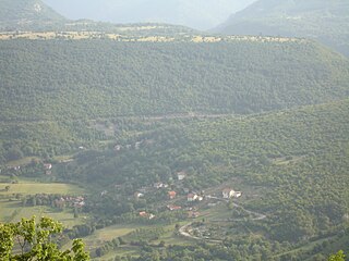
Mokronoge is a village in the municipality of Drvar, Bosnia and Herzegovina.


