Sources disagree as to the current population of Eritrea, with some proposing numbers as low as 3.6 million and others as high as 6.7 million. Eritrea has never conducted an official government census.

The Arctic Archipelago, also known as the Canadian Arctic Archipelago, is an archipelago lying to the north of the Canadian continental mainland, excluding Greenland and Iceland.
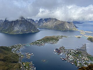
Lofoten, Lufoahtta (Lule Sami), or Lufuohttá (Northern Sami) is an archipelago and a traditional district in the county of Nordland, Norway. Lofoten has distinctive scenery with dramatic mountains and peaks, open sea and sheltered bays, beaches, and untouched lands. There are two towns, Svolvær and Leknes – the latter is approximately 169 km (105 mi) north of the Arctic Circle and approximately 2,420 km (1,500 mi) away from the North Pole. The archipelago experiences one of the world's largest elevated temperature anomalies relative to its high latitude.

Trashigang District is Bhutan's easternmost dzongkhag (district).
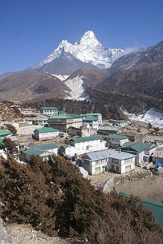
Sagarmāthā Zone was one of the fourteen zones of Nepal until the restructuring of zones into provinces. The headquarters of Sagarmatha is Rajbiraj. Sagarmāthā is a Nepali word which as per some sources, is derived from सगर and माथा.

The Dahlak Archipelago is an Eritrean island group located in the Red Sea, measuring around 643 square km and lying roughly 58 kilometers east of Massawa, the regional capital city.

The Mareb River, also known as the Gash River, is a river flowing out of central Eritrea. Its chief importance is defining part of the boundary between Eritrea and Ethiopia, between the point where the Mai Ambassa enters the river at 14°53.6′N37°54.8′E to the confluence of the Balasa with the Mareb at 14°38′N39°1.3′E.
Mendefera, formerly Adi Ugri, is an ancient town which is now the capital city of the Southern Region or Zoba Debub of Eritrea. The town's name derives from the high hill in the center of the city and it means that "who dared it" or "መን ደፈራ"( in Tigrinya) as it was a jungle and is a source of pride to Eritreans. The city is a reminder of the local anti-colonial movement.

Agordat, ኣቑርደት is a city in Gash-Barka, Eritrea. It was the capital of the former Barka Province, which was situated between the present-day Gash-Barka and Anseba regions.
Kuntaur is a town located in central part of the Gambia.
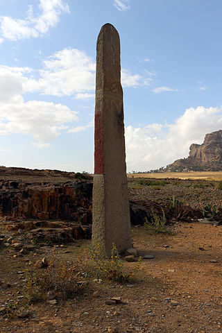
Metera or መጠራ (𐩣𐩷𐩧) is a small town and important archeological site located in the Debub Region of Eritrea. Situated a few kilometers south of Senafe (ሰንዓፈ), it was a major city in the Dʿmt (𐩵𐩲𐩣𐩩) and Medri Bahri kingdoms. The town has the oldest Example of Ge’ez, which is a pre-Aksumite Obelisk, Hawulti (monument). Since Eritrean independence, the National Museum of Eritrea has petitioned the Ethiopian government to return artifacts removed from the site. However, the efforts have thus far been rebuffed.

Agew Awi is a zone in the Amhara Region of Ethiopia. It is named for the Awi sub-group of the Agaw people, some of whom live in this Zone. Agew Awi Zone is bordered on the west by Benishangul-Gumuz Region, on the north by North Gondar Zone and on the east by West Gojjam. The administrative centre of Agew Awi is Injibara; other towns include Chagni, Agew Gimjabet, Tilili, Adis Kidame, Azena, Zigem, Jawi and Dangila.

Eritreans are the native inhabitants of Eritrea, as well as the global diaspora of Eritrea. Eritreans constitute several component ethnic groups, some of which are related to ethnic groups that make up the Ethiopian people in neighboring Ethiopia and people groups in other parts of the Horn of Africa. Nine of these component ethnic groups are officially recognized by the Government of Eritrea.
Uvs Lake Basin is an endorheic basin located on the territorial border of Mongolia and Tuva, a republic of the Russian Federation. The basin is part of the Central Asian Internal Drainage Basin and is named after Uvs Lake, a large saline lake situated in the western part of its drainage basin, and is one of the last remnants of the mammoth steppes. Uvs Lake is a shallow lake with an area of 3,350 km2 (1,290 sq mi). Its entire basin, which includes several smaller lakes, is 70,000 km2 (27,000 sq mi).
Afabet subregion is a subregion in the Northern Red Sea region of Eritrea. Its capital lies at Afabet.
Ghela'elo subregion is a subregion in the Northern Red Sea region of Eritrea. Its capital lies at Ghela'elo (Ghelalo).
Ghinda subregion is a subregion in the Northern Red Sea region of Eritrea. Its capital lies at Ghinda.
Mendefera subregion is a subregion in the Debub (Southern) region of Eritrea. Its capital lies at Mendefera.

Southern Denkalya is a subregion in the Southern Red Sea region of Eritrea.
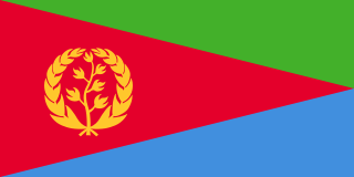
Eritrea, officially the State of Eritrea, is a country in the Horn of Africa region of Eastern Africa, with its capital and largest city being Asmara. It is bordered by Ethiopia in the south, Sudan in the west, and Djibouti in the southeast. The northeastern and eastern parts of Eritrea have an extensive coastline along the Red Sea. The nation has a total area of approximately 117,600 km2 (45,406 sq mi), and includes the Dahlak Archipelago and several of the Hanish Islands.
