
The National Forest is an environmental project in central England run by The National Forest Company. From the 1990s, 200 square miles (520 km2) of north Leicestershire, south Derbyshire and southeast Staffordshire have been planted in an attempt to blend ancient woodland with newly planted areas to create a new national forest. It stretches from the western outskirts of Leicester in the east to Burton upon Trent in the west, and is planned to link the ancient forests of Needwood and Charnwood.
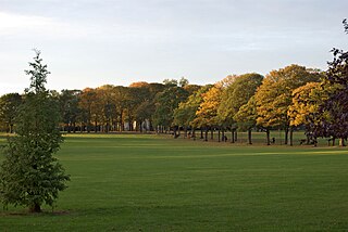
Victoria Park in Leicester, England is a public park of 69 acres. It is in the south-east, just outside the city centre, backing on to the University of Leicester and close to the Leicester railway station.
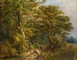
Sandwell Valley is an area of green belt in the county of West Midlands, England, on the border of Birmingham and West Bromwich, with Walsall at its northern end.

Salcey Forest is a fragment of a former medieval hunting forest east of the village of Hartwell, between Northampton and Newport Pagnell in Northamptonshire. It is managed by Forestry England and to promote biodiversity, and is also commercially exploited for timber products. The eastern third of the forest, an area of 159.6 hectares, is a biological Site of Special Scientific Interest (SSSI).
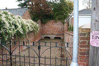
Ravenstone is a village and former civil parish, now in the parish of Ravenstone with Snibstone, in the North West Leicestershire district, in the county of Leicestershire, England. It is within the National Forest, just off the A511 road between Coalville and Ashby-de-la-Zouch, in 2001 it had a population of 2,149.

Delamere Forest is a large wood in the village of Delamere in Cheshire, England. The woodland, which is managed by Forestry England, covers an area of 972 hectares making it the largest area of woodland in the county. It contains a mixture of deciduous and evergreen trees.

Endcliffe Park is a large park in the city of Sheffield, South Yorkshire, England. The park was opened in 1887 to commemorate the Jubilee of Queen Victoria. When travelling West from the city centre it is the first in a series of parks and green spaces, known collectively as the Porter Valley Parks, all of which lie along the course of the Porter Brook. The next park in the sequence is Bingham Park, separated from Endcliffe Park by Rustlings Road. In 1924 Patrick Abercrombie said of the parks, "The Porter Brook Parkway, consisting as it does of a string of contiguous open spaces, is the finest example to be found in this country of a radial park strip, an elongated open space, leading from a built-up part of the city direct into the country, the land occupied being a river valley and so for the greater part unsuitable for building."

Wepre Park is a 160 acres (65 ha) country park near Connah's Quay in Flintshire, Wales. The park is home to Ewloe Castle and contains a children's playground, outdoor gym, football playing pitches and a visitor centre.

Alice Holt Forest is a royal forest in Hampshire, situated some 4 miles (6.4 km) south of Farnham, Surrey. Once predominantly an ancient oak forest, it was particularly noted in the 18th and 19th centuries for the timber it supplied for the building of ships for the Royal Navy. It is now planted mainly with conifers. Forestry England took over the management of the forest in 1924, and a research station was set up in 1946 in the Alice Holt Lodge, a former manor house. The forest is now part of the South Downs National Park, which was established on 31 March 2010, and it forms the most northerly gateway to the park.
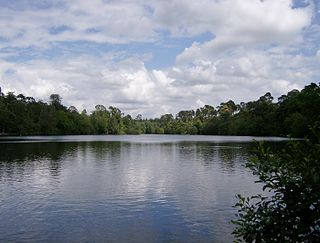
Black Park is a country park in Wexham, Buckinghamshire, England to the north of the A412 road. It is managed by Buckinghamshire Council, formerly County Council. It has an area of 250 hectares, of which two separate areas totalling 15.7 hectares have been designated a biological Site of Special Scientific Interest (SSSI). and a larger area of 66 hectares is a local nature reserve.

Newbold Comyn is a park on the Eastern edge of Leamington Spa, Warwickshire, England.

Dalby Forest is a forest located on the southern slopes of the North York Moors National Park in North Yorkshire, England. It is maintained by Forestry England. Dalby Forest, along with Langdale Forest and Cropton Forest, forms part of the North Riding Forest Park, found within the North York Moors National Park.

The River Sence is a river which flows in Leicestershire, England. The tributaries of the Sence, including the Saint and Tweed, fan out over much of western Leicestershire from Charnwood Forest and Coalville in the north-east to Hinckley and almost to Watling Street in the south and south-west. Its watershed almost coincides with Hinckley and Bosworth Borough of Leicestershire, which was formed in 1974 by amalgamation of Market Bosworth Rural District and Hinckley Urban District. It flows into the Anker, which in turn flows into the River Tame. It is part of the wider River Trent catchment, which covers much of central England. In 1881, Sebastian Evans wrote that the usual names for this river were Shenton Brook and Sibson Brook.

Moors Valley Country Park, officially Moors Valley Country Park and Forest, is a Country Park jointly managed by Dorset Council and Forestry England. It is situated in Ashley Heath, Dorset on the border with Hampshire, in the south of England.

Lady Park Wood National Nature Reserve is a 45-hectare (110-acre) nature reserve straddling the borders of Gloucestershire in England and Monmouthshire in Wales. Most of the wood is in Wales – where it forms Wales' easternmost point – but it is managed under agreement with Natural England.
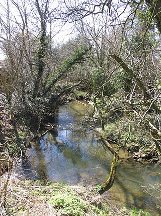
The River Sence is a Leicestershire (England) tributary of the larger River Soar. The River Sence can be traced eastwards up to the village of Billesdon, and then flows south west through Great Glen, and then west until the confluence with the River Soar just to the west of Blaby and south of Glen Parva. Tracing the River Sence upstream, the Environment Agency does monitor the river between Blaby and Great Glen, but there has been no significant flooding in recent years, and the land along the River Sence is largely agricultural. In 1881 Sebastian Evans wrote that the usual names for this river were Billesdon Brook and Burton Brook which are in fact two of its major tributaries.

Mortimer Forest is a forest on the Shropshire/Herefordshire border in England, near the town of Ludlow. It covers hilly terrain, including the marilyn of High Vinnalls, rising to 375 metres (1,230 ft).

Fineshade Wood is a large wooded area in the county of Northamptonshire in the English East Midlands region. The wood is managed by the Forestry England and is part of the former royal hunting forest of Rockingham Forest.
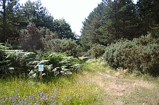
Breckland Forest is an 18,126 hectare biological and geological Site of Special Scientific Interest in many separate areas between Swaffham in Norfolk and Bury St Edmunds in Suffolk. It is part of the Breckland Special Protection Area under the European Union Directive on the Conservation of Wild Birds. It contains two Geological Conservation Review sites, Beeches Pit, Icklingham and High Lodge. Barton Mills Valley is a Local Nature Reserve in the south-west corner of the site.

Sherwood Pines Forest Park is a forest park located near the village of Kings Clipstone, Nottinghamshire, England. Originally called Clipstone Heath, it was acquired by Forestry England in 1925 and planted with trees in response to a wood shortage after World War I. The park offers activities such as walking, bushcraft, mountain biking and there is a visitor centre. It is the largest park in the East Midlands of England. The forest is also home to the average point between the geographical centres and population centres of Great Britain.


