
Puducherry, also known as Pondicherry, is a union territory of India, consisting of four small geographically unconnected districts. It was formed out of four territories of former French India, namely Pondichéry, Karikal (Karaikal), Mahé and Yanaon, excluding Chandannagar (Chandernagore), and it is named after the largest district, Puducherry, which was also the capital of French India. Historically known as Pondicherry, the territory changed its official name to Puducherry on 1 October 2006.

Gummidipoondi is an industrial town in Chennai Metropolitan Region of Thiruvallur district in the Indian state of Tamil Nadu. Notably, it is the northernmost assembly constituency and settlement in the state of Tamil Nadu.

Papanasam is a panchayat town in Thanjavur district in the Indian state of Tamil Nadu. It is located 25 kilometres (16 mi) from Thanjavur and 15 kilometres (9.3 mi) from Kumbakonam. The name literally translates to "Destruction of Sins" in the Tamil language. It is the suburban region of Kumbakonam.

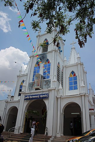
Thiruthangal is a neighbourhood of Sivakasi City, India.Thiruthangal is one of the Zones of Sivakasi City Municipal Corporation. Ninra Narayana Perumal temple, one among the 108 Divya Desams, Vishnu temples revered by saint poets, Alwars of 6th–9th century is located in Thiruthangal. The place is also famous for Karunellinathar temple, located adjacent to Nindra Narayana Temple.
Pennalurpet (Tamil: Velamakandriga is a village in India located on the Andhra Pradesh and Tamil Nadu border. The village is under the control of Tamil Nadu government. Farming is the main income source for this village.
Alamarathupatti is a village and panchayat in Sivakasi block, Virudhunagar district, Tamil Nadu.

The Tamil University is a public state university located in Thanjavur, Tamil Nadu, India. It was established to provide higher research in the Tamil language.
Guruvarajapet is a census town located in the Indian state of Tamil Nadu.
Kodimunai is a village located 22 km north-west of Kanyakumari at Southern Arabian seashore in the Indian state of Tamil Nadu. The nearest major city is Thiruvananthapuram around 68 km from here. There is a rock located offshore which is the second largest rock in Tamil Nadu which located offshore that is a very nice place to visit village full of people are very lovely and friendly
Muthuvijayapuram is a small village/hamlet located in Mudukulathur Block Ramanathapuram district of Tamil Nadu state in India. .It comes under Pirabakaloor Panchayat. It's located 25 km towards west from District headquarters Ramanathapuram.525 km from State capital chennai
Kottaipattinam is a village panchayat located in the Pudukkottai district of Tamil Nadu state, India. The latitude 9.97908 and longitude 79.198595 are the geocoordinate of the Kottaipattinam. The Kottaipattinam Population is 13454. Male is 6668. Female is 6786.
Dakshina Patha Pathapalem, sometimes shortened to D.P. Palayam, is a village located in Gudiyattam Taluk in the Vellore district, Tamil Nadu, India. It is located approximately 1 km (0.62 mi) from the border with Andhra Pradesh and 4 km (2.5 mi) from Paradarami. It is a small village and has about 50 other villages surrounding it. The official languages are Telugu and Tamil. The village is surrounded by hills on all the sides and has an old temple—Veera Vijaya Anjaneya Swamy Temple—which has been renovated.
Ikkadu Kandigai is a village near Tiruvallur town in the Indian state of Tamil Nadu. It is five kilometers from Tiruvallur town. The population is around 400 families. It is covered by fully cultivated lands.

Tamil Indonesians are persons from Indian Tamil ancestry living in Indonesia. Majority of them live in Medan in North Sumatra while there are small community in other parts of the country such as Jakarta, Aceh, Riau and Riau Islands. It is estimated that there are around 25,000 PIOs/NRIs living in Indonesia of which the Indian expatriate community registered with the Embassy and Consulate in Medan numbers around 30,000.
Karinkallathani is a town in Perinthalmanna taluk of the Malappuram district of the Indian state of Kerala.

Karkathakudi is a small town and panchayat located in the Ramanathapuram district of Tamil Nadu state, India. The villages under the panchayat of Karkathakudi are Siruvandal, Peruvandal, Melapanaiyur, Keelapanaiyur, Gudalur, and Karungudi. Karkathakudi contains 1000 houses and about 3000 people living here. It is the main panchayat under Thiruvadanai taluk.
Elavur is a village in the Tiruvallur district of Tamil Nadu, India. It is located in the Gummidipoondi taluk border between Tamil Nadu and Andhra pradesh. NH16 Chennai-Kolkata Highway. India's First modern Integrated Check post opened by Tamil Nadu chief minister and also located frontline medical village. ELR is and railway station code for Elavur.Farming land can be found in this place.
Madharpakkam is a village in the Tiruvallur district of Tamil Nadu, India. Part of it is located in the Gummidipoondi taluk. This village is located near Andhra Pradesh border. Weaving was one of the main source of income for very-long years. Due to the downfall of Handloom Industry. People migrated to different places seeking employment. The villagers main source of employment depends on Gummidipoondi sipcot. This village consists of four panchayats namely Madharpakkam, Padirivedu, Manellore and Nemallur. The Government higher secondary school is one of the oldest school in the district. Telugu and Tamil are major languages spoken by people.

Chengalpattu District is one of the 38 districts of Tamil Nadu, in India. The district headquarters is located at Chengalpattu. Chengalpattu district came into existence on 29 November 2019 when it was carved out of Kanchipuram district after the announcement about the bifurcation of districts on 18 July 2019.