The Bering Land Bridge National Preserve is one of the most remote United States national park areas, located on the Seward Peninsula. The National Preserve protects a remnant of the Bering Land Bridge that connected Asia with North America more than 13,000 years ago during the Pleistocene ice age. The majority of this land bridge now lies beneath the waters of the Chukchi and Bering Seas. During the glacial epoch this bridge was a migration route for people, animals, and plants whenever ocean levels fell enough to expose the land bridge. Archeologists disagree whether it was across this Bering Land Bridge, also called Beringia, that humans first migrated from Asia to populate the Americas, or whether it was via a coastal route.
The Koyuk River is a river on the Seward Peninsula of western Alaska, in the United States. The river originates in the interior of the peninsula, at the Lost Jim Lava Flow of the Bering Land Bridge National Preserve, where it flows southeast towards the mouth of Norton Bay on Norton Sound. The native village of Koyuk is located at its mouth. The two major tributaries are the Peace and Salmon rivers; other tributaries include Dime and Sweepstakes.

The Kugruk River is a stream, 60 miles (97 km) long, in the northwestern part of the U.S. state of Alaska. It is the largest tributary of the Kuzitrin River. It begins near Imuruk Lake on the Seward Peninsula and flows generally north to Kugruk Lagoon, at Kotzebue Sound on the Chukchi Sea. The river enters the lagoon 5.5 miles (8.9 km) southeast of Cape Deceit in the Northwest Arctic Borough.

The Fish River is a waterway in the U.S. state of Alaska. The 47-mile-long (76 km) river rises in the Bendeleben Mountains and flows south to Golovnin Lagoon, before emptying into Golovnin Bay, Norton Sound, and the Bering Sea. The basin formed by the Fish River is known for its placer gold deposits, and in particular, the Niukluk River and its tributaries; production from this tributary valley is reported to be more than from any other place in the region. A galena mine existed 40 miles (64 km) from the sea, worked on occasion by a San Francisco corporation with a few hundred tons of ore taken to the city for smelting and refining for silver. Walter Curran Mendenhall found obscure fossils on Fish River at White Mountain.

The Tubutulik River is a waterway in the U.S. state of Alaska. The 25-mile (40 km) long river is situated on the Seward Peninsula. It flows southeastwards to the Kwiniuk Inlet at the northwestern end of Norton Bay, 25 miles (40 km) southwest of Koyuk in the Bering Sea. Its Inuit name was reported as "Tubuktulik" in 1849 by Capt. Mikhail Dmitrievich Tebenkov of the Imperial Russian Navy. Exploration for placer gold occurred in the Council district area where the river valley is located, and in 1898, mining commenced. The production was substantial and ranked second only to that of Nome.
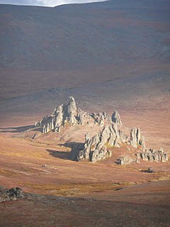
The Bendeleben (/ˈbɛn.dəˌleɪ.bɨn/) Mountains are a mountain range on the heart of the Seward Peninsula in Nome Census Area, Alaska, United States. This range forms a major divide between drainage basins draining into the Pacific Ocean and the Arctic Ocean. The tallest peak, Mount Bendeleben is 3,730 feet (1,140 m) at the summit, and is located on the west end. Bits of the range go into the Bering Land Bridge National Preserve, but most of the peaks remain unclaimed. The Tubutulik River flows in the area.

Cape Nome is a headland on the Seward Peninsula in the U.S. state of Alaska. It is situated on the northern shore of Norton Sound, 15 miles (24 km) to the east of Nome also on Norton Sound. It is delimited by the Norton Sound to the south, Hastings Creek on the west, a lagoon on the east and an estuary formed by the Flambeau River and the Eldorado River. From the sea shore, Cape Nome extends inland by about 4 miles (6.4 km), connected by road with Nome.
Candle Creek is a western tributary of the Kiwalik River, located on the Seward Peninsula of the U.S. state of Alaska. The unincorporated community of Candle is less than a mile away, while the village of Kiwalik is about 13 miles (21 km) away. The creek's name is attributed to the resemblance of the trees on the banks of the creek to candles when they are covered with snow. With the discovery of gold in 1901, Candle Creek's reputation as a top gold-yielding site was fixed.
Eldorado River is a waterway on the Seward Peninsula]] in the U.S. state of Alaska. It is situated 14 miles (23 km) west of Solomon. This river has its source within a few miles of Salmon Lake, from which it is separated by a low divide. It flows southeast through a broad gravel-filled valley for 30 miles (48 km) to Flambeau River before emptying into Safety Sound. Its headwaters reach the limestones of the Nome series and much of its course lies in a chlorite-albite-schist belt. The Eldorado River provides a southerly drainage into the Bering Sea.
Bonanza River is a waterway on the Seward Peninsula in the U.S. state of Alaska. The headwaters lie close to Venetia Creek and the Koksuktapaga River. It flows southeast for 25 miles (40 km) before reaching Safety Sound, as do the Flambeau and Eldorado Rivers, and then through Safety Inlet to Norton Sound. The village of Solomon is approximately 2 miles (3.2 km) away. Across the divide of West Creek, in the Bonanza River drainage, and lying above the West Creek schists, is a series of green chloride schists and sills of greenstone; these chloritic schists are the prevailing rocks of the divide between Eldorado and Bonanza rivers. In its general character, it is similar to the Eldorado River. Also called Bonanza Cal, later maps indicate California Creek to be a principal tributary of Bonanza River. According to Alfred Hulse Brooks, the Eskimo name is Ki-ul-uk.
Brooks Mountain is the highest peak in the York Mountains range on the Seward Peninsula in the U.S. state of Alaska. It is located in the central part of the Teller Quadrangle, about 25 miles (40 km) east of Cape Prince of Wales. It has an elevation of 2,918 feet (889 m). It has tin ore deposits, and high-grade uranium has also been found in the form of zeunerite.
Ear Mountain is an isolated mountain located on the Seward Peninsula in the U.S. state of Alaska. The mountain, with an elevation of 2,329 feet (710 m), has a belt of Cretaceous tin "granites." Though the mountain is located in an area long known for its tin deposits, it was only in 1953 and 1954 during a survey by the US Bureau of Mines that tin deposits were confirmed to be on Ear Mountain.
Cape Mountain is located 3 miles (4.8 km) southeast of Cape Prince of Wales on the Seward Peninsula in the U.S. state of Alaska. It was named by the surveyor, Alfred Hulse Brooks, in 1900.
Bluestone River is a waterway located on the Seward Peninsula in the U.S. state of Alaska. A tributary of the Tuksuk Channel from the south, Bluestone is a north-flowing stream situated 11 miles (18 km) southeast of Teller. It was named in 1900 by Edward Chester Barnard, topographer of the United States Geological Survey.

Grantley Harbor is a waterway located at the bay of Port Clarence, Alaska, on the Seward Peninsula in the U.S. state of Alaska. The inner harbor at the entrance to the northeast corner of the bay was named after Lord Grantley.
Nuluk River is a waterway on the Seward Peninsula in the U.S. state of Alaska. It enters the Ikpek Lagoon 40 miles (64 km) northeast of Cape Prince of Wales. It heads in the high mountains made up of the Port Clarence limestone about 35 miles south of the Arctic Ocean. For 15 miles (24 km) from its head, the river occupies a canyon, varying from 100–1,000 feet (30–305 m) in depth, cut in Silurian limestones. Fossils have been reported about the head of the river. Northward along its course, the character of the bed rock changes, and calcareous mica-schists are noted. The Silurian limestones dip toward the schists, and near the contact with them, are very highly folded. The coastal plain gravel extends inland farther along the Nuluk River than it does on the other rivers of this region.
Arctic River is a waterway in the U.S. state of Alaska. Situated on the northwestern portion of Seward Peninsula, it rises south of Ear Mountain. It is about 25 miles (40 km) long, and flows into the west side of Shishmaref Inlet. Southeast of Ear Mountain, the course of this river is in a broad basin containing a number of small lakes. Below this basin, the river has cut a well-defined canyon. Viewed from the surrounding hills, the basin appears to be an old lake bed. A broad, flat divide, which has what appears to be an abandoned river channel across it, separates this basin from the drainage of the Kugruk River of the Arctic region. Many of the tributaries of Arctic River were staked by gold miners.
American River is a waterway in the U.S. state of Alaska. Situated on the northwestern portion of Seward Peninsula, it is the eastern and larger fork of the Agiapuk River. It joins the Agiapuk River in a broad, gravel-filled basin, and for 20 miles (32 km) up, is characterized by a wide flood plain and a meandering course. It receives a number of large tributaries from the east, which also have wide floodplains developed in their lower parts. The important tributaries are Portage Creek, Budd Creek, and Igloo Creek, while smaller tributaries are Burke, Gold Run, Dome, and Camp creeks. All of these tributaries received some attention from gold prospectors. The river is easily navigable for small boats for several miles above the mouth of Portage Creek, and the region can also be reached from Teller. Gold had been discovered in the region in September 1901, and a number of the streams were known to be gold-bearing to some extent.
Mary River is a waterway in the U.S. state of Alaska. Situated on the northwestern portion of Seward Peninsula, it was included in the Agiapuk River mining district.

Imuruk Lake is the largest body of fresh water in Seward Peninsula in the U.S. state of Alaska. It measures 31 square miles and has a drainage basin of 102 square miles, It lies on top of a lava plateau at an elevation of 960 feet. The drainage basin is relatively flat, as the maximum elevation, it is only about 1,600 feet. A low gap in the divide between the lake and the head of the right fork of Goodhope River rises only a few feet above the lake. The Fairhaven Ditch takes practically all its water from the lake. Serpentine Hot Springs flow to the Serpentine River, 47 miles northwest of Imuruk Lake.


