Related Research Articles

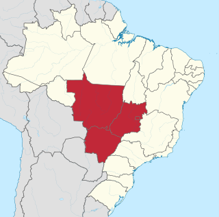
Mato Grosso is one of the states of Brazil, the third largest by area, located in the Central-West region. The state has 1.66% of the Brazilian population and is responsible for 1.9% of the Brazilian GDP.

Mato Grosso do Sul is one of the Midwestern states of Brazil. Neighboring Brazilian states are Mato Grosso, Goiás, Minas Gerais, São Paulo and Paraná. It also borders the countries of Paraguay, to the southwest, and Bolivia, to the west. The economy of the state is largely based on agriculture and cattle-raising. Crossed in the south by the Tropic of Capricorn, Mato Grosso do Sul generally has a warm, sometimes hot, and humid climate, and is crossed by numerous tributaries of the Paraná River. The state has 1.3% of the Brazilian population and is responsible for 1.5% of the Brazilian GDP.

Cáceres is a municipality in the Brazilian state of Mato Grosso. It covers an area of 24,000km2 and as of 2020 had an estimated population of 94,861.

The Pantanal is a natural region encompassing the world's largest tropical wetland area, and the world's largest flooded grasslands. It is located mostly within the Brazilian state of Mato Grosso do Sul, but it extends into Mato Grosso and portions of Bolivia and Paraguay. It sprawls over an area estimated at between 140,000 and 195,000 km2. Various subregional ecosystems exist, each with distinct hydrological, geological and ecological characteristics; up to 12 of them have been defined.

The Central-West or Center-West Region of Brazil is composed of the states of Goiás, Mato Grosso and Mato Grosso do Sul; along with Distrito Federal, where Brazil's national capital, Brasília, is situated. The region comprises 18.86% of the national territory.

The Federal University of Mato Grosso is a public university in the state of Mato Grosso, Brazil. Responsible for serving the entire state, its main campus is in the capital city of Cuiabá. Smaller campuses are located in Barra do Garças, Pontal do Araguaia, Sinop, and Várzea Grande, while the former campus at Rondonópolis is now the Federal University of Rondonópolis, split off in 2018.

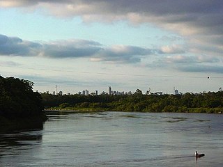
The Cuiabá River is a Brazilian river in the western state of Mato Grosso that flows in the Río de la Plata Basin. It is a tributary of the São Lourenço River.

The Nambikwaran languages are a language family of half a dozen languages, all spoken in the state of Mato Grosso in Brazil. They have traditionally been considered dialects of a single language, but at least three of them are mutually unintelligible.
The Cabaçal River is a river of Mato Grosso state in western Brazil. It is a tributary of the Paraguay River.
The Ferro River is a river of Mato Grosso state in western Brazil. It flows northeast, receives the Steinen River from the south, enters the Xingu Indigenous Park, receives the combined Ronuro and Jatoba rivers from the south and joins the Xingu River which flows north into the Amazon.
The Huaiá-Miçu River is a river of Mato Grosso state in western Brazil.
The Jauquara River is a river of Mato Grosso state in western Brazil.
The Manissauá-Miçu River is a river of Mato Grosso state in western Brazil.
The Peixoto de Azevedo River is a river of Mato Grosso state in western Brazil.
The São João da Barra River is a river of Mato Grosso state in western Brazil. It is a tributary of the Juruena River.
The Combate River is a river of Mato Grosso do Sul state in southwestern Brazil.
The Pardo River is a river of Mato Grosso do Sul state in southwestern Brazil. It is a tributary of the Paraná River, which it enters in the reservoir of Sérgio Motta Dam.

The Mato Grosso tropical dry forests (NT0140), also called the Mato Grosso seasonal forests, is an ecoregion in central Brazil to the south of the Amazon region. It contains vegetation in the transition between the Amazon rainforest to the north and the cerrado savanna to the south. The opening of highways through the region has caused rapid population growth, deforestation and pollution.
References
Coordinates: 12°55′33″S52°49′33″W / 12.92583°S 52.82583°W