Related Research Articles

The Iranian plateau or Persian plateau is a geological feature spanning parts of the Caucasus, Central Asia, South Asia, and West Asia. It makes up part of the Eurasian plate, and is wedged between the Arabian plate and the Indian plate. The plateau is situated between the Zagros Mountains to the west, the Caspian Sea and the Köpet Dag to the north, the Armenian Highlands and the Caucasus Mountains to the northwest, the Strait of Hormuz and the Persian Gulf to the south, and the Indian subcontinent to the southeast.

Kabir Kuh is one of the long ranges of the Zagros Mountains near the border of Lurestan and Ilam provinces in Ilam province, Iran. Covering an area of 9,500 km2 (3,700 sq mi), Kabir Kuh stretches 175 km (109 mi) in length and 48–80 km (30–50 mi) in width along the Zagros Mountains in the northwest–southeast direction. It begins about 20 km (12 mi) south of Ilam and stretches down to the vicinity of Andimeshk in Khuzestan. Made mainly by Cretaceous sedimentary rocks, the Kabir Kuh range consists of a large number of mountains, including Shah Ahmad, Tabriz, Kaleh-bad, Filman, Damaghey-e Anar, Rivasan, Puneh, Sabzkhani, Zarrin, Golgol that are covered by snow and ice all year round. Its highest peak is Kan Seifi with 2,790 m (9,150 ft) elevation, 50 km (31 mi) south-east of Ilam. Kabir Kuh runs along the Seymareh River, which becomes Karkheh when joins the Kashkan river before reaching the border of Ilam province and Khuzestan province. Kabir Kuh divides the mountainous region in western Iran into two regions generally referred as Piškuh and Poštkuh, the latter virtually coinciding with Ilam. In prehistoric times, one of the largest known landslides occurred on the north-eastern slope of Kabir Kouh, moving across the Seymareh River.

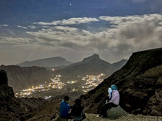
The Zagros Mountains are a long mountain range in Iran, northern Iraq, and southeastern Turkey. The mountain range has a total length of 1,600 km. The Zagros range begins in northwestern Iran and roughly follows Iran's western border while covering much of southeastern Turkey and northeastern Iraq. From this border region, the range continues southeast to the waters of the Persian Gulf. It spans the southern parts of the Armenian highlands, and the whole length of the western and southwestern Iranian plateau, ending at the Strait of Hormuz. The highest point is Mount Dena, at 4,409 metres (14,465 ft).

Shahr-e Kord is a city in the Central District of Shahrekord County, Chaharmahal and Bakhtiari province, Iran, serving as capital of the province, the county, and the district. It is the largest city in the province, and is 90 km away from Iran's third largest city, Isfahan.

The Köpet Dag, Kopet Dagh, or Koppeh Dagh, also known as the Turkmen-Khorasan Mountain Range, is a mountain range on the border between Turkmenistan and Iran that extends about 650 kilometres (400 mi) along the border southeast of the Caspian Sea, stretching northwest-southeast from near the Caspian Sea in the northwest to the Harirud River in the southeast. In the southwest it borders on the parallel eastern endings of the Alborz mountains being together part of the much larger Alpide belt. The highest peak of the range in Turkmenistan is the Mount Rizeh, located at the southwest of the capital Ashgabat and stands at 2,940 metres (9,646 ft). The highest Iranian summit is Mount Quchan at 3,191 metres (10,469 ft).

Zard-Kuh is a sub-range in the central Zagros Mountains, Iran.

Dena is the name for a sub-range within the Zagros Mountains, Iran. Mount Dena, with 80 km length and 15 km (49,000 ft) average width, is situated on the boundary of the Isfahan, Kohgiluyeh and Boyer-Ahmad and Chaharmahal and Bakhtiari Provinces of Iran.
Shir Kuh or Shirkuh is a high peak in central Iran about 40 km (25 mi) south-west of the city of Yazd in Yazd province.

The Aladagh Mountains or the Aladagh Range refers to a mountain range situated in the southeastern section of Iran's North Khorasan province, southeast of the Caspian Sea. The range is located 25 kilometres south of Bojnurd, the capital city of North Khorasan. The Aladagh Mountains merge with the Elburz or Alborz Mountains in the west and then run southeastwards in a northwest-southeast direction. The highest peak of the range is Mount Shahjahan with an elevation of 3,032 metres. This peak is located about 35 kilometres east of Esfarayen, almost in southeastern part of North Khorasan Province.
Mount Marshenan or Mount Mareshnan is a mountain that is located approximately 60 kilometres north-east of the city of Isfahan and 30 kilometres north of Kuhpayeh. With an elevation of 3330 metres, this mountain is about 15 kilometres south-east of Zefreh and 3 kilometres south of the village of Marshenan in Isfahan Province, almost in central Iran. Made chiefly of Eocene andesite and pyroclastic rocks, Mount Marshenan is situated in a central Iranian range, Sahand-Bazman volcanic range or belt, a mountain range which was formed mainly during Eocene volcanism and that stretches approximately from Sahand volcano in the north-west of Iran to Bazman volcano in the south-east of Iran.
Mount Bahr Aseman is a mountain located approximately 15 kilometres south of the town of Sarduiyeh and about 60 kilometres east of the city of Baft in Kerman Province in southeast Iran. With an elevation of 3,886 metres, the mountain is among high peaks of Iran. Made chiefly of Eocene pyroclastic rocks, Mount Bahr Aseman is situated in a central Iranian range, Sahand-Bazman volcanic range or belt, a mountain range which was formed mainly during Eocene volcanism and that stretches approximately from Sahand Volcano in the north-west of Iran to Bazman Volcano in the south-east of Iran.
Mount Soffeh or Kuh-e Soffeh is a mountain that is situated just south of the city of Isfahan, southeast of Mount Donbeh and south of the Zayanderud River in Iran.
Mount Donbeh or Kuh-e Donbeh is a mountain which is situated just southwest of the city of Isfahan in Isfahan province in Iran. Stretching in a northwest–southeast direction, Mount Donbeh is located south of the Zayanderud River and northwest of Mount Soffeh in the Sanandaj-Sirjan geologic and structural zone of Iran. The mountain is mainly formed of Lower Cretaceous limestone. Only the southeastern part of the mountain is made of Jurassic shale.
Mount Kolah Qazi or Kuh-e Kolah Qazi is a mountain that is located about 30 kilometres southeast of the city of Isfahan in Isfahan province in Iran. With an elevation of 2534 metres, the highest peak is in the north-central part of the mountain. Having a general northwest–southeast direction, this mountain is situated southeast of Mount Shah Kuh and west and almost parallel to Mount Qaruneh. With an average width of about 5 kilometres and a length of almost 20 kilometres, this mountain is a part of the Mount Kolah Qazi Protected Nature Reserve which covers an area of about 50,000 hectares of national park and 3,000 hectares of protected wildlife region.
Mount Qaruneh or Kuh-e Qaruneh is a mountain which is located about 30 kilometres southeast of the city of Isfahan in Isfahan Province in Iran. Situated southeast of Mount Shah Kuh and being almost parallel to Mount Kolah Qazi this mountain has an average width of about 2 kilometres and a length of around 25 kilometres. Mount Qaruneh has a general northwest southeast direction. With an elevation of 2030 metres, the highest peak is located in the southern section of the mountain. Mount Qaruneh is situated in the Sanandaj-Sirjan geologic and structural zone of Iran and is made mainly of Lower Cretaceous limestone.
Shah Kuh or Mount Shah Kuh is a mountain which is located about 15 kilometres south of the city of Isfahan in Isfahan province in Iran. With an average width of about 3 kilometres and a length of almost 20 kilometres, this mountain has a general northwest–southeast direction and is situated almost northwest of Mount Kolah Qazi. The highest peak is located in the northern section of the mountain and has an elevation of 2418 metres. Mount Shah Kuh is situated in the Sanandaj-Sirjan geologic and structural zone of Iran, and except for a very small section of Jurassic rocks in its north-central part this mountain is mainly formed of Lower Cretaceous limestone.
Oshtorankuh is a mountain located in city of Azna, in Lorestan province of western Iran.
Qaflankuh or Qaflankuh Mountain Range is a mountain range that is located about 20 kilometres north of the city of Zanjan in Zanjan Province, Iran. With an average width of almost 20 kilometres and a length of about 100 kilometres, this mountain range is stretched in a northwest–southeast direction, beginning from northwest of Zanjan, passing north of Zanjan and ending southeast of Zanjan. The Qezel Owzan River flows in a valley that separates Qaflankuh Mountains on the south from Talish Mountains on the north. With an elevation of 2971 metres, Mount Sendan Dagh is the highest mountain of the range which is located in the southeast section of this mountain range. There are some mineral hot springs containing sulphur in different parts of this range. Geologically, Qaflankuh Mountain Range was formed during the Tertiary volcanism and plutonism and is made mainly of the Eocene volcanic rocks with very small sections of intrusive rocks in the northern and southern parts of the range.

Hezar Masjed Mountains are a group of mountains that form the southeastern section of the Kopet-Dag Range. Located about 20 kilometres east of Dargaz and 70 kilometres north of Mashhad in Razavi Khorasan province in Iran and stretched in a northwest–southeast direction, the mountains are situated almost at the extreme northeastern part of Iran.
The Sahand-Bazman Volcanic and Plutonic Belt or the Sahand-Bazman Igneous Arc or the Central Iranian Range is a mountain range that is made by igneous and pyroclastic rocks. Located East and almost parallel to the Zagros Mountains, the Central Iranian Range is stretched in a north-west-southeast direction from Mount Sahand in Azerbaijan in the north-west to Mount Bazman in Baluchistan in the Southeastern part of Iran. This range was mainly formed during the Tertiary volcanic and orogenic phase and especially in the Eocene volcanism and plutonism. The Central Iranian Range or the Sahand-Bazman Volcanic Belt includes famous mountains such as the Sahand in East Azerbaijan Province, Mount Karkas in the Karkas Mountains and Mount Marshenan in Isfahan Province, the Jebal Barez, Mount Hezar and Mount Lalehzar in Kerman Province, and the Bazman in the Sistan va Baluchestan Province of Iran.
References
- ↑ Comprehensive Map of Iran, Microsoft Encarta Interactive World Atlas 2001, Microsoft Corporation
- ↑ Geological Map of Iran, National Geoscience Database of Iran, www.ngdir.ir