
The A15 is a major road in England. It runs north from Peterborough via Market Deeping, Bourne, Sleaford and Lincoln along a variety of ancient, Roman, and Turnpike alignments before it is interrupted at its junction with the M180 near Scawby. The road restarts 10 miles (16 km) east, and then continues north past Barton-upon-Humber, crossing the Humber on the Humber Bridge before terminating at Hessle near Kingston upon Hull.

The Giant's Ring is a henge monument at Ballynahatty, near Shaw's Bridge, Belfast, Northern Ireland. It was originally preserved by Viscount Dungannon. The inscribed stone tablet on the wall surrounding the site which details Viscount Dungannon's interest was carved by Belfast stonecarver Charles A Thompson about c.1919. This is confirmed by his granddaughter Ann Aston as told to her by him and was shown the tablet in situ by him.

The Malone Road is a radial road in Belfast, Northern Ireland, leading from the university quarter southwards to the affluent suburbs of Malone and Upper Malone, each a separate electoral ward. The road runs parallel to the Lisburn Road and is linked by over a dozen side streets, while at its northern end, the Stranmillis Road rejoins the Malone Road to form University Road, which in turn joins with the Lisburn Road to become Bradbury Place. Most of the road is in the BT9 postcode district.

The Queen Elizabeth ll Bridge is a bridge in Belfast, Northern Ireland, not to be confused with the adjacent Queen's Bridge. It is one of eight bridges over the Lagan in the city. It was built in the 1960s.
Shaw's Bridge Lower Ground is a cricket ground in Belfast, Northern Ireland. It hosted two matches in the 2005 ICC Trophy tournament. One of the matches saw Paul Hoffmann take 6 wickets for 12 runs playing for Scotland against Oman, a record for Scotland in ICC Trophy competition.
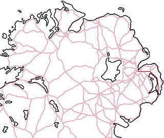
The A20 is a road in Northern Ireland. It runs from Belfast to Newtownards and on to Portaferry in County Down.
The Gaeltacht Quarter in Belfast, Northern Ireland, is an area surrounding the Falls Road in the west of the city. A Gaeltacht is an area where the Irish language is widely spoken. The area aims to promote the Irish language and provide tourist attractions associated with it, as well as Irish culture.

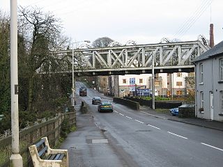
Dargan Bridge, built in the 1990s, is a railway bridge in Belfast, Northern Ireland. This bridge spans the River Lagan and connects the railway lines to Larne and Derry to those east Bangor and south to Newry and the Republic. It runs mostly parallel to the Lagan Bridge carrying the M3 motorway across the Lagan. One of the first people to cross it was Mr John Johnston, the first Station Manager of Belfast Central Station and his grandson James Currie.

The Elan aqueduct crosses Wales and the Midlands of England, running eastwards from the Elan Valley Reservoirs in Mid Wales to Birmingham's Frankley Reservoir, carrying drinking water for Birmingham.
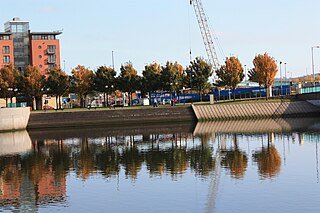
Queen's Quay is a section of land bordering the River Lagan, in the western Titanic Quarter of the city of Belfast, Northern Ireland.

Adavoyle was a station in the rural townland of Adavoyle, County Armagh, Northern Ireland.

The A55 road forms Belfast's outer-ring road.

Cusher River is a river in County Armagh, Northern Ireland. It is formed by the junction, near Mountnorris, of two small streams, flows by Tandragee, and joins the River Bann one mile above Portadown.

Mountpleasant railway station was a railway station in County Louth, Ireland on the Belfast - Dublin Railway line, which closed in 1965.

The Lagan Viaduct is a railway and pedestrian bridge across the River Lagan in Belfast, slightly north of Belfast Central railway station. The next bridge upstream is the Albert Bridge, whilst the next downstream is Queen's Bridge.
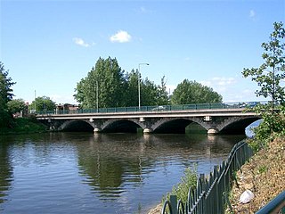
The Ormeau Bridge is a road bridge in Belfast, roughly 80m long, carrying the A24 Ormeau Road across the River Lagan from Stranmillis Embankment to Ormeau Embankment.

King's Bridge is a road bridge in Stranmillis, south Belfast. The first concrete road bridge in Ireland, it opened in 1910.
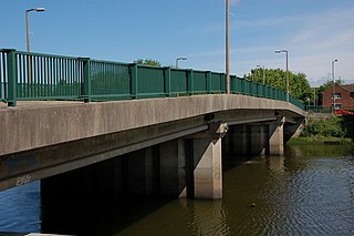
Governor's Bridge is a road bridge in Stranmillis, south Belfast. It was opened in the early 1970s.
The Crumlin Viaduct is a railway bridge in Crumlin, County Antrim. It has the distinction of being the only place in Ireland where a train, plane, car, and boat can theoretically cross paths, due to its unique status of being a railway bridge straddling a road bridge across a river, with Belfast International Airport two kilometers to the north.

The Bann Bridge is a railway bridge in Coleraine, County Londonderry. It is the only railway bascule bridge in Northern Ireland.


