Related Research Articles

The San Juan Islands is an archipelago in the Pacific Northwest of the United States between the U.S. state of Washington and Vancouver Island, British Columbia, Canada. The San Juan Islands are part of Washington state, and form the core of San Juan County.

San Juan County is a county in the Salish Sea in the far northwestern corner of the U.S. state of Washington. As of the 2020 census, its population was 17,788. The county seat and only incorporated town is Friday Harbor, on San Juan Island. The county was formed on October 31, 1873, from Whatcom County and is named for the San Juan Islands, which are in turn named for Juan Vicente de Güemes, 2nd Count of Revillagigedo, the Viceroy of New Spain.

Island County is a county located in the U.S. state of Washington. As of the 2020 census, its population was 86,857. Its county seat is Coupeville, while its largest city is Oak Harbor.
Goose Island is one of the San Juan Islands in San Juan County, Washington, United States.

Guemes Island is a small island in western Skagit County, Washington, United States. It is located north of Fidalgo Island and the city of Anacortes, and is accessible by private boat and by the Guemes Island ferry operated by Skagit County.

Samish Island is an unincorporated community in Skagit County, Washington, United States. It lies on an island 48°34′25″N122°31′48″W with the same name, which is located off the northwest coast of the Washington mainland. It is connected to the mainland by land reclaimed through a system of dikes created in the early 20th century.

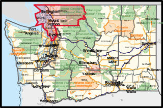
Washington's 2nd congressional district includes all of Island, San Juan, Skagit, and Whatcom counties, as well as coastal western Snohomish County. It stretches from Bellingham and the Canada–US border in the north down to the Skagit/Snohomish county line, with a narrow strip along the coast running down to Lynnwood and the King/Snohomish county line in the south. Since 2001, it has been represented by Democrat Rick Larsen.

Padilla Bay is a bay located in the U.S. state of Washington, between the San Juan Islands and the mainland. Fidalgo Island and Guemes Island lie to the west of Padilla Bay. Guemes Channel, between the islands, connects Padilla Bay to Rosario Strait. Samish Island lies to the north of Padilla Bay, beyond which is Samish Bay and Bellingham Bay.

Obstruction Island is one of the San Juan Islands in San Juan County, Washington, United States. It lies off the southeast tip of Orcas Island, between it and Blakely Island. Obstruction Island has a land area of 0.882 km2. The 2010 United States census reported a permanent population of 14 residents.

Johns Island is one of the San Juan Islands in San Juan County, Washington. It lies just east of Stuart Island and north of Spieden Island. Johns Island is home to Camp Nor'wester, a summer camp for children on the west end of the island, and several dozen private vacation cabins on the east end of the island. It has a land area of 0.9083 km2. As with many of the outlying San Juan Islands, Johns Island does not have electricity or plumbing. There was a resident population of five persons as of the 2000 census.
Pearl Island is one of the San Juan Islands of San Juan County, Washington, United States. Named during the 1841 Wilkes Expedition, it lies off the western shore of San Juan Island, between it and Henry Island. Pearl Island has a land area of 0.151 km², only one family lives on this island full time.
Henry Island is one of the San Juan Islands of San Juan County, Washington, United States. It lies just off the northwest shore of San Juan Island. The small Pearl Island also lies between Henry Island and San Juan Island at its northern end. Just northwest of the northern tip of Henry Island lies Battleship Island, a State bird sanctuary. Except for Stuart Island, Henry Island is the westernmost of the San Juan Islands. It has a land area of 4.126 km2 (1.593 sq mi) and had a total of19 permanent residents as of the 2010 census.
Vendovi Island is an island in the San Juan Islands of Washington State. Located in Skagit County, Washington, United States, Vendovi Island lies across Samish Bay from mainland Skagit County, between Guemes Island and Lummi Island. Vendovi Island has a land area of 220.24 acres (89.13 ha) and a population of two persons was reported as of the 2000 census. The Island was named after a Fijian High Chief Ro Veidovi who was brought to North America by the Wilkes Expedition.

Satellite Island lies in Prevost Harbor on the north side of Stuart Island in the San Juan Islands of San Juan County, Washington, United States. It has a land area of 116.42 acres (47.11 ha) and no resident population as it is a private island owned by the YMCA, which has five camping areas set up for its use. Two of the camps, Sunset Camp and Fellowship Camp, are used for overnight island trips by campers from YMCA Camp Orkila and are located on the western half of the island. Islander Camp is located on the east side of the island, and is used primarily by the Islander Teen Expedition, a kayaking trip which crosses into Canada's Gulf Islands. Mariner Camp is located on the east side of the island, near Islander Camp, and is used by the Mariner Teen Expedition, a sailing trip for teenagers.

Rosario Strait is a strait in northern Washington state, separating San Juan County and Skagit and Whatcom Counties. It extends from the Strait of Juan de Fuca about 23 kilometres (14 mi) north to the Strait of Georgia. The USGS defines its southern boundary as a line extending from Point Colville on Lopez Island to Rosario Head on Fidalgo Island, and its northern boundary as a line from Point Migley on Lummi Island to the east tip of Puffin Island and then to Point Thompson on Orcas Island. Rosario Strait runs north-south between Lopez, Decatur, Blakely, and Orcas Islands on the west, and Fidalgo, Cypress, Sinclair, and Lummi Islands on the east.
Skull Island is the name of two small islands in the San Juan Archipelago in the U.S. state of Washington. The northernmost Skull Island is located off the coast of Orcas Island in Massacre Bay, the most northern extension of the island's West Sound. It is identified as 3.2-acre (1.3 ha) Skull Island State Park Property by the Washington State Parks and Recreation Commission. It was named for holding skulls and bones of a band of Lummi who were killed by raiding Haida in 1858. Since 2013, it has been part of the San Juan Islands National Monument.
Blind Bay is a small bay on Shaw Island in San Juan County, Washington. On an island near its mouth is Blind Island State Park.
Griffin Bay State Park in San Juan County, Washington was a marine park with two campsites in the Washington State Parks. It consisted of 15 acres (6.1 ha) with 340 feet (100 m) of saltwater shoreline. It was part of the Cascadia Marine Trail and campsites were restricted to visitors arriving by human- and wind-powered watercraft. Though the state parks department still owned the land as of August, 2014, the park is no longer listed on the state parks website.
Upright Channel Park is a former unit of the Washington State Park System consisting of 20 acres (8.1 ha) of island, beach, and tidelands on Upright Channel in the northwest corner of Lopez Island. The park was not listed as a Washington State Parks property as of March 2014. San Juan County assumed management of the property per a memorandum of understanding in May 2014.