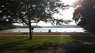
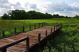
Lake Houston is a reservoir on the San Jacinto River, 15 miles (24 km) northeast of downtown Houston, Texas, United States. The reservoir is the primary municipal water supply for the city of Houston.

Squantz Pond State Park is a public recreation area located 10 miles (16 km) north of Danbury in the town of New Fairfield, Connecticut. The state park encompasses 172 acres (70 ha) on the southwestern shore of 270-acre (110 ha) Squantz Pond, offering opportunities for boating, swimming, fishing, and hiking. The park is bordered on the west by Pootatuck State Forest and is managed by the Connecticut Department of Energy and Environmental Protection.

Lake Oroville is a reservoir formed by the Oroville Dam impounding the Feather River, located in Butte County, northern California. The lake is situated 5 miles (8 km) northeast of the city of Oroville, within the Lake Oroville State Recreation Area, in the western foothills of the Sierra Nevada. Known as the second-largest reservoir in California, Lake Oroville is treated as a keystone facility within the California State Water Project by storing water, providing flood control, recreation, freshwater releases to assist in controlling the salinity intrusion into the Sacramento-San Joaquin Delta and protecting fish and wildlife.

Swartswood State Park is a 3,460-acre (14.0 km2) protected area located in the Swartswood section of Stillwater and Hampton townships in Sussex County, New Jersey, in the United States. Established in 1915 by the state's Forest Park Reservation Commission, it was the first state park established by the state of New Jersey for the purposes of recreation at the state's third-largest freshwater lake. Today, Swartswood State Park is operated and maintained by the New Jersey Division of Parks and Forestry.

Sheldon Lake is a reservoir on Carpenters Bayou in the San Jacinto River basin, 16 miles (26 km) northeast of downtown Houston, Texas. The reservoir was created in 1943 when the federal government built a dam to provide fresh water for shipbuilding and shipping industries on the Houston Ship Channel during World War II. After the war, the management of the reservoir was assumed by the City of Houston. In 1952, after the construction of the dam that creates Lake Houston, the city sold the reservoir to the Texas Parks and Wildlife Department for use as a waterfowl sanctuary and public fishing site. In 1984, the land around the reservoir was designated the Sheldon State Wildlife Management Area.

Bigelow Hollow State Park is public recreation area in the town of Union, Connecticut, in the Quinebaug Highlands. The state park's 516 acres (209 ha) border Nipmuck State Forest on the east and west and Mashapaug Lake on the north. The park and forest are located in a large hollow or depression approximately 700' below the surrounding ridgelines. They are managed by the Connecticut Department of Energy and Environmental Protection.

Mansfield Hollow Lake is a reservoir resting on the border of Windham County and Tolland County, Connecticut. The reservoir provides drinking water for Willimantic and helps control flooding in the 159-square-mile Thames River watershed. It was created by the Mansfield Hollow Dam and is entirely contained within Mansfield Hollow State Park and the Mansfield Hollow Wildlife Area. Designed and constructed by the United States Army Corps of Engineers, the dam substantially reduces flooding along the Quinebaug, Shetucket, and Thames rivers. Construction of the project began in 1949 with completion in 1952 at a cost of US$6.5 million. The Mansfield Hollow reservoir is located within the Shetucket River Watershed and is part of the Thames River Basin. Access to the site is available from US Route 6 and State Route 195. The damsite, covering an area of 25 acres (10 ha), was listed on the National Register of Historic Places in 2003.

Senecaville Lake is a reservoir in Guernsey and Noble Counties, Ohio. It is located approximately 13 miles (21 km) southeast of Cambridge near the village of Senecaville, Ohio. The lake is popular among recreation and fishing enthusiasts. It is often referred to locally as Seneca Lake.
Coastal Prairie Conservancy was established in 1992 to conserve Katy Prairie, part of the Western Gulf coastal grasslands located in Texas, United States. Approximately 24,500 acres is under conservation easements or owned by CPC in western Harris and Waller Counties.

Blue Lake Regional Park is a public park in Fairview, in the U.S. state of Oregon. The 101-acre (41 ha) park, near the south shore of the Columbia River in Multnomah County, includes many covered and uncovered picnic areas, playing fields for sports such as softball, a cross country course and infrastructure related to lake recreation including swimming, boating, and fishing. Encompassing wooded areas, three ponds, and a wetland in addition to the lake, the park is frequented by migrating birds and other wildlife. Paved paths run through the park, which is near the 40-Mile Loop hiking and biking trail. Park vegetation includes cottonwoods, willows, and other trees and shrubs as well as wetland plants such as cattails.
The Mead Wildlife Area is a state wildlife area covering over 33,000 acres (130 km2) in central Wisconsin. It includes portions of Marathon, Portage, and Wood counties. It is managed by the Wisconsin Department of Natural Resources (WDNR). The Area is commonly referred to as "the Mead". Five WDNR staff manage the Area. The non-profit organization Friends of the Mead/McMillan Association, Inc. assist with raising funds to support the area's activities.

Seth Low Pierrepont State Park Reserve is a public recreation area covering 305 acres (123 ha) in the town of Ridgefield, Connecticut. The state park offers opportunities for hiking, fishing, and boating.

Clarksburg State Park is a 368-acre (149 ha) Massachusetts state park located in the town of Clarksburg. The park is made up of unspoiled northern hardwood forest, with views of the Hoosac Range, Mount Greylock and the Green Mountains. It is managed by the Department of Conservation and Recreation.

Lake Bob Sandlin State Park is a state park in Titus County, Texas managed by the Texas Parks and Wildlife Department. The park covers 639.8 acres of land on the northern shore Lake Bob Sandlin about 10 miles southwest of Mount Pleasant.

Cedar Bluff Reservoir is a reservoir in Trego County, Kansas, United States. Built and managed by the U.S. Bureau of Reclamation for irrigation and area water supply, it is also used for flood control and recreation. Cedar Bluff State Park is located on its shore.
Quinebaug Lake State Park is a public recreation area covering 181 acres (73 ha) in the town of Killingly, Connecticut. The state park offers opportunities for fishing and non-motorized boating on Wauregan Reservoir. The park is managed by the Connecticut Department of Energy and Environmental Protection.

Hopeville Pond State Park is a public recreation area located on Hopeville Pond, an impoundment of the Pachaug River, in the town of Griswold, Connecticut. A portion of the 554-acre (224 ha) state park occupies the site of the lost village of Hopeville. The park manager's house occupies Avery House, which is listed on the National Register of Historic Places. The park offers fishing, swimming, camping, and trails for hiking and biking. It is managed by the Connecticut Department of Energy and Environmental Protection.

James L. Goodwin State Forest is a Connecticut state forest covering approximately 2,000 acres (810 ha) in the towns of Chaplin and Hampton. The lands became public property when James L. Goodwin donated the personal forest he had been developing since 1913 to the state in 1964.

Nassahegon State Forest is a Connecticut state forest occupying 1,227 acres (497 ha) in the town of Burlington.The forest is managed for forestry and recreational purposes and is operated by the Connecticut Department of Energy and Environmental Protection.


