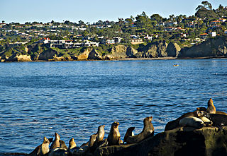
La Jolla is a hilly, seaside neighborhood in San Diego, California, occupying 7 miles (11 km) of curving coastline along the Pacific Ocean. The population reported in the 2010 census was 46,781. The climate is mild, with an average daily temperature of 70.5 °F (21.4 °C).

Black's Beach is a secluded section of beach beneath the bluffs of Torrey Pines on the Pacific Ocean in La Jolla, a community of San Diego, California. It is officially part of Torrey Pines State Beach. The northern portion of Black's Beach is owned and managed by the California Department of Parks and Recreation, while the southern portion of the beach, officially known as Torrey Pines City Beach, is jointly owned by the City of San Diego and the state park, and managed by the City of San Diego. This distinction is important as Black's Beach is most known as a nude beach, a practice that is now prohibited in the southern portion managed by the City of San Diego.
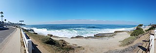
Windansea Beach is a stretch of coastline in the La Jolla community of San Diego, California. The neighborhood adjacent to the beach is named Windansea after the beach. It is named after the 1909 oceanfront Strand Hotel that was renamed "Windansea" Hotel in 1919 after the owner Arthur Snell ran a "naming contest". The Windansea Hotel which was located on Neptune Avenue between Playa del Sur and Playa del Norte burned down in 1943. Geographically, it is defined by the beachfront extending north of Palomar Avenue and south of Westbourne Street.
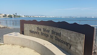
Silver Strand, or simply The Strand, is a low, narrow, sandy isthmus or a human-constructed tombolo 7 miles (11 km) long in San Diego County, California, partially within Silver Strand State Beach. It connects Coronado with Imperial Beach. Together with the Point Loma peninsula it shelters and defines San Diego Bay.

Birch Aquarium is a public aquarium in La Jolla, a community of San Diego, California. It serves as the public outreach center for Scripps Institution of Oceanography at the University of California, San Diego, with over half a million people visiting the aquarium each year.

Children's Pool Beach is a small sandy beach in La Jolla, a community of San Diego, California.
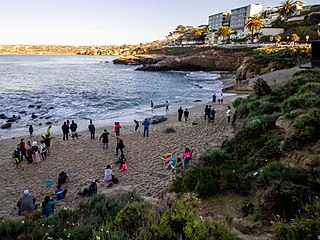
La Jolla Cove is a small cove with a beach that is surrounded by cliffs in La Jolla, a community of San Diego, California. Point La Jolla forms the south side of the cove. The area is protected as part of a marine reserve and is popular with snorkelers, swimmers and scuba divers.
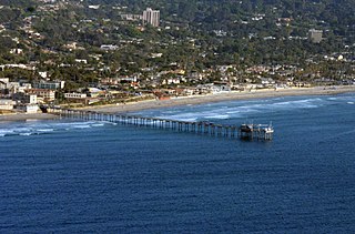
La Jolla Shores, with its northern part Scripps Beach, is a beach and vacation/residential community of the same name in the community of La Jolla in San Diego, California. The La Jolla Shores business district is a mixed-use village encircling Laureate Park on Avenida de la Playa in the village of La Jolla Shores.
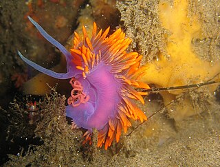
The San Diego-La Jolla Underwater Park is the historical name for a marine reserve that includes the San Diego-Scripps Coastal Marine Conservation Area (SMCA) and Matlahuayl State Marine Reserve (SMR), adjoining marine protected areas that extend offshore from La Jolla in San Diego County on California's south coast.
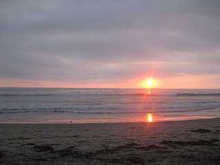
San Elijo State Beach is a California State Beach in San Diego County, California, United States.
The La Jolla Historical Society is a private 501(c)(3) nonprofit organization in the La Jolla community of San Diego, California. According to its mission statement, it "celebrates the history and culture of this region along the water's edge through interdisciplinary programs, exhibitions, and research that challenge expectations. It balances contemporary and historic perspectives to create understanding and connection."

San Diego-Scripps Coastal Marine Conservation Area (SMCA) and Matlahuayl State Marine Reserve (SMR) are adjoining marine protected areas that extend offshore from La Jolla in San Diego County on California's south coast. The two marine protected areas cover 2.51 square miles (6.5 km2).
South La Jolla State Marine Conservation Area (SMCA) and South La Jolla State Marine Reserve (SMR) are two adjoining marine protected areas that extend offshore in San Diego County on California's south coast. The two marine protected areas cover 7.51 square miles (19.5 km2). The SMR protects marine life by prohibiting the removal of marine wildlife from within its borders, while the SMCA limits removal of marine wildlife.
Swami’s State Marine Conservation Area (SMCA) is a marine protected area that extends offshore of Encinitas in San Diego County on California’s south coast. The SMCA covers 12.65 square miles. It protects marine life by limiting the removal of marine wildlife from within its borders.

Crystal Cove State Marine Conservation Area (SMCA) is one of a cluster of four adjoining marine protected areas that extend offshore of Newport Beach in Orange County on California’s south coast. The SMCA covers 3.45 square miles of near shore waters. Crystal Cove protects marine life by limiting the removal of marine wildlife from within its borders, including tide pools. Take of all living marine resources is prohibited except: recreational take of finfish by hook-and-line or by spearfishing, and lobster and sea urchin is allowed. Commercial take of coastal pelagic species by round haul net, spiny lobster by trap, and sea urchin is allowed.
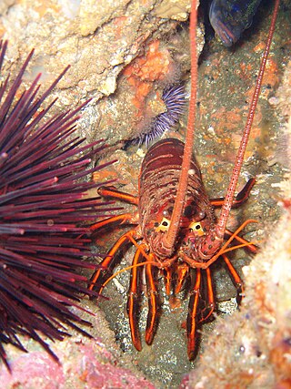
Dana Point State Marine Conservation Area
Bird Rock is a seaside neighborhood within the larger community of La Jolla in San Diego, California. It lies on the Pacific Ocean at the southernmost end of La Jolla, just north of Pacific Beach. The mostly residential neighborhood includes homes for 1,400 to 1,500 families, with a commercial district along the main street, La Jolla Boulevard. The shore is rocky and has no beach, but offshore reefs are used for surfing.

Tourmaline Surfing Park is a beach access point and surfing spot in North Pacific Beach, a neighborhood of San Diego, California. The park is situated at the northern end of Pacific Beach, a short distance south of where the sand beach ends and the rocky promontory of La Jolla begins. There are cliffs to the north and south of Tourmaline Surfing Park, but the park itself lies in Tourmaline Canyon, which cuts down through the cliffs to the beach. Tourmaline Surfing Park is also known locally as Old Man's and is a known for its more gentle waves. It attracts surfers of all kinds but is known as a great spot for longboarders and beginners.
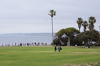
Ellen Browning Scripps Memorial Park, often referred to as Scripps Park, is an urban park in La Jolla, a community in San Diego, California. The park is sited on a sandstone bluff overlooking the Pacific Ocean. It is 5.6 acres (2.3 ha) and has approximately 1,500 ft (460 m) of shoreline and includes La Jolla Cove, Point La Jolla, Boomer Beach, and Shell Beach. The La Jolla Adult Recreation Center, three historic belvederes, and a pavilion are the only buildings in the park.


