Related Research Articles

Skagit County is a county in the U.S. state of Washington. As of the 2020 census, the population was 129,523. The county seat and largest city is Mount Vernon. The county was formed in 1883 from Whatcom County and is named for the Skagit Indian tribe, which has been indigenous to the area prior to European-American settlement.

Belvedere is a residential incorporated city located on the San Francisco Bay in Marin County, California, United States. Consisting of two islands and a lagoon, it is connected to the Tiburon Peninsula by two causeways. At the 2020 census, the population was 2,126. The per capita income of Belvedere residents in 2000 was $250,000, but currently the average income is $283,000, making it one of the highest-income cities in California and the eighth highest-income community in the United States. Belvedere and Tiburon share a post office and the 94920 ZIP code.

Dillon Beach is a census-designated place (CDP) in Marin County, California, United States. It is located 3.25 miles (5.2 km) west of Tomales, at an elevation of 89 ft (27 m). The population was 246 at the 2020 census. Dillon Beach was named after the founder, George Dillon, who settled there in 1858. The area includes a public access beach, as well as a private beach resort, the only private beach in California.

Inverness is an unincorporated community and census-designated place (CDP) in western Marin County, California, United States. It is located on the southwest shore of Tomales Bay 3.5 miles northwest of Point Reyes Station and about 40 miles (65 km) by road northwest of San Francisco, at an elevation of 43 feet. In the 2020 census, the population was 1,379. The community was named by a Scottish landowner after Inverness in Scotland.

Martin City is an unincorporated community and census-designated place (CDP) in Flathead County, Montana, United States. As of the 2010 census, it had a population of 500, up from 331 in 2000.

Lake Barcroft is a census-designated place (CDP) in Fairfax County, Virginia, United States. The population was 9,558 at the 2010 census. It is also the name of the privately owned lake—part of the Cameron Run Watershed—around which this population is located. The lake is named for Dr. John W. Barcroft, who owned and operated a mill on Holmes Run during the mid-19th century.

Freeland is an unincorporated community and census-designated place (CDP) on Whidbey Island in Island County, Washington, United States. At the time of the 2020 census the population was 2,252. The town received its name based on its origins as a socialist commune in the early 1900s: in the eyes of its founders, the land of the town was literally to be free for all people. Some of the first settlers were veterans of a prior experiment in socialism, the nearby Equality Colony.

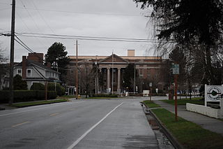
La Conner is a town in Skagit County, Washington, United States with a population of 965 at the 2020 census. It is included in the Mount Vernon–Anacortes, Washington Metropolitan Statistical Area. The town hosts several events as part of the annual Skagit Valley Tulip Festival held in April.

The Swinomishpeople are a Lushootseed-speaking people Indigenous to western Washington state.
Raft Island is a private island and CDP located near the Pierce County community of Rosedale, Washington, United States. Gig Harbor, Washington is the nearest incorporated town, although unincorporated Artondale is much closer. The island features approximately 200 homes on 160 acres. All of these homes are served through the Gig Harbor post office.

Padilla Bay is a bay located in the U.S. state of Washington, between the San Juan Islands and the mainland. Fidalgo Island and Guemes Island lie to the west of Padilla Bay. Guemes Channel, between the islands, connects Padilla Bay to Rosario Strait. Samish Island lies to the north of Padilla Bay, beyond which is Samish Bay and Bellingham Bay.
Oriole Beach is an unincorporated community located in Santa Rosa County, Florida, United States on Santa Rosa Sound. It lies east of Gulf Breeze on the Fairpoint Peninsula, and about three miles north of Pensacola Beach. The population was 1,679 at the 2020 census, up from 1,420 at the 2010 census. Oriole Beach is part of the Pensacola–Ferry Pass–Brent, Florida Metropolitan Statistical Area.

Eliza Island is located in the western part of Bellingham Bay in the U.S. state of Washington. It lies just east of the southern part of Lummi Island, in Whatcom County. Eliza Island has a land area of 0.571 km2. Its population was ten persons as of the 2010 census.

Shelter Cove is a census-designated place in Humboldt County, California. It lies at an elevation of 138 feet. Shelter Cove is on California's Lost Coast where the King Range meets the Pacific Ocean. A nine-hole golf course surrounds the one-runway Shelter Cove Airport at the center of Shelter Cove's commercial district. Utilities are provided by the Humboldt County Resort Improvement District #1 and boating access to the sea is managed by the Humboldt Bay Harbor, Recreation & Conservation District. The population was 803 at the 2020 census.

The Port of Skagit is a port authority that owns and operates four key facilities in Skagit County, Washington. They include the Skagit Regional Airport, Bayview Business Park, the SWIFT Center and the La Conner Marina. The Port of Skagit also maintains an extensive trail system and several properties it owns.

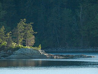
Kiket Island is a small tied island in Washington, co-managed by the Washington State Parks and Recreation Commission and the Swinomish Indian Tribal Community. Located at Snee Oosh, less than four miles (6.4 km) northwest of the town of La Conner in Skagit County, Washington, Kiket is connected to Fidalgo Island by a tombolo called sdᶻalgʷiɬ, over which runs an access road. The name "Kiket" is derived from the Lushootseed-language name of the island, kʷuʔkʷuʔtali. The name means "place of cattail mat." The small spit connecting the two is called sdᶻalgʷiɬ, 'changing canoes'.

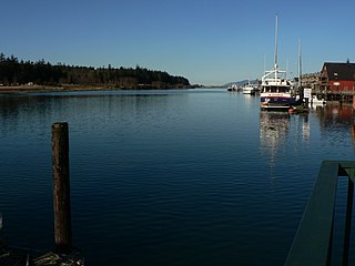
The Swinomish Channel is an 11-mile (18 km) long salt-water channel in Washington state, United States, which connects Skagit Bay to the south and Padilla Bay to the north, separating Fidalgo Island from mainland Skagit County. The Swinomish Channel is the smallest of the three entrances to Puget Sound—the other two being Deception Pass and Admiralty Inlet.

The Swinomish Indian Tribal Community, also known as the Swinomish Tribe, is a federally recognized tribe located on Puget Sound in Washington state. Swinomish is a legal successor to signatories of the 1855 Treaty of Point Elliott. Its Reservation is located 65 miles North of Seattle, Washington on Fidalgo Island.The tribe's population is primarily composed of Swinomish, Lower Skagit, Kikiallus, and Samish peoples and their descendants. Other populations on the reservation include the Suquamish and Upper Skagit.

Chuckanut Bay is a crescent-shaped bay about three miles (4.8 km) long in southwestern Whatcom County, directly south of Bellingham, Washington, United States. The bay was formed along the axis of a plunging syncline during the formation of the Chuckanut Mountains. It is situated on the eastern shore of the Salish Sea at the southeast end of Bellingham Bay. The bay was named Puerto del Socorro by Lieutenant Juan Francisco de Eliza in 1791. The present name was chosen by Captain Henry Roeder on December 1, 1852. Natural features include Pleasant Bay located south of Chuckanut Bay, Mud Bay to the north, and Chuckanut Island and Chuckanut Rocks to the west. Other natural features include Teddy Bear Cove, Governors Point and Clark Point. Several creeks drain into the bay, including Chuckanut Creek and Fragrance Lake Outlet. The bay is home to tafoni formations found in the area.

Lake Arrowhead is a private community and census-designated place (CDP) in Clinton County, Missouri, United States. It is in the southeastern part of the county, surrounding a lake of the same name. It is 4 miles (6 km) south of Lathrop, 3 miles (5 km) north of Holt, and 33 miles (53 km) northeast of Kansas City. It is served by the Lathrop post office.
References
- ↑ "US Gazetteer files: 2010, 2000, and 1990". United States Census Bureau. 2011-02-12. Retrieved 2011-04-23.
- 1 2 "Shelter Bay Homeowners Association FAQ". 27 May 2023. Archived from the original on 13 August 2007.