Shepherd of Salisbury Plain

Last updated
The Shepherd of Salisbury Plain MoreShepherd.png
The Shepherd of Salisbury Plain

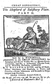
Shepherd of Salisbury Plain (1795) is the name of the hero, a shepherd of the name of Saunders, in a tract written by Hannah More, characterised by homely wisdom and simple piety. It was satirised, renamed The Washerwoman of Finchley Common, by William Thackeray in his novel Vanity Fair .

Related Research Articles

<span class="mw-page-title-main">Plain</span> Expanse of land that is mostly flat and treeless

In geography, a plain, commonly known as flatland, is a flat expanse of land that generally does not change much in elevation, and is primarily treeless. Plains occur as lowlands along valleys or at the base of mountains, as coastal plains, and as plateaus or uplands. Plains are one of the major landforms on earth, being present on all continents and covering more than one-third of the world's land area. Plains in many areas are important for agriculture. There are various types of plains and biomes on them.

<span class="mw-page-title-main">Wiltshire</span> County of England

Wiltshire is a ceremonial county in South West England. It borders Gloucestershire to the north, Oxfordshire to the north-east, Berkshire to the east, Hampshire to the south-east, Dorset to the south, and Somerset to the west. The largest settlement is Swindon, and Trowbridge is the county town.

<span class="mw-page-title-main">Salisbury, Nassau County, New York</span> Hamlet and census-designated place in New York, United States

Salisbury is a hamlet and census-designated place (CDP) in the Town of Hempstead in Nassau County, on Long Island, in New York, United States. The population was 12,093 at the 2010 census.

<span class="mw-page-title-main">River Avon, Hampshire</span> River in the south of England

The River Avon is in the south of England, rising in Wiltshire, flowing through that county's city of Salisbury and then west Hampshire, before reaching the English Channel through Christchurch Harbour in the Bournemouth, Christchurch and Poole conurbation of Dorset.

<span class="mw-page-title-main">Salisbury Plain</span> Chalk plateau in England

Salisbury Plain is a chalk plateau in southern England covering 300 square miles (780 km2). It is part of a system of chalk downlands throughout eastern and southern England formed by the rocks of the Chalk Group and largely lies within the county of Wiltshire, but stretches into Hampshire.

<span class="mw-page-title-main">Coopers Plains railway station</span> Railway station in Brisbane, Queensland, Australia

Coopers Plains railway station is located on the Beenleigh line in Queensland, Australia. It serves the Brisbane suburb of Coopers Plains.

<span class="mw-page-title-main">City of Salisbury</span> Local government area of Adelaide

The City of Salisbury is a local government area (LGA) located in the northern suburbs of Adelaide, South Australia. Its neighbours are the City of Playford, City of Tea Tree Gully and City of Port Adelaide Enfield.

<span class="mw-page-title-main">Electoral district of Ramsay</span> State electoral district of South Australia

Ramsay is a single-member electoral district for the South Australian House of Assembly. It is named after Alexander Ramsay, who was general manager of the South Australian Housing Trust for 25 years. It is a 24.7 km² suburban electorate north of Adelaide—based on the angle between Main North Road and the Port Wakefield Road, Ramsay covers the outer northern Adelaide suburbs of Brahma Lodge, Burton, Direk, portion of Elizabeth South, Elizabeth Vale, portion of Paralowie, Salisbury, Salisbury South, Salisbury Plain and Salisbury North.

<span class="mw-page-title-main">Electoral district of Taylor</span> State electoral district of South Australia

Taylor is a single-member electoral district for the South Australian House of Assembly. This district is named after Doris Irene Taylor MBE, a leading force in the founding of Meals on Wheels, and Labor activist. Taylor is a 246.2 km2 semi-urban electorate in Adelaide's outer northern suburbs and market gardens on the Adelaide Northern plains. A large portion of the district lives in the western half of the City of Playford and it is regarded as a safe Labor seat. It now includes the suburbs and townships of Andrews Farm, Angle Vale, Bolivar, Buckland Park, Davoren Park, Edinburgh, Edinburgh North, Elizabeth North, Eyre, Macdonald Park, Munno Para West, Penfield, Penfield Gardens, Riverlea Park, Smithfield, Smithfield Plains, St Kilda, Virginia, and Waterloo Corner.

<span class="mw-page-title-main">Chitterne</span> Human settlement in England

Chitterne is a village and civil parish in the county of Wiltshire, in the south west of England. The village lies in the middle of Salisbury Plain, about 7 miles (11 km) east of the town of Warminster.

<span class="mw-page-title-main">A360 road</span> Road in England from Devizes to Salisbury

The A360 is an A road in Wiltshire, England, running from Devizes to Salisbury, through the villages of Potterne, West Lavington, Tilshead, and Shrewton, and passing near the Stonehenge ancient monument.

The SP postcode area, also known as the Salisbury postcode area, is a group of eleven postcode districts in southern England, within six post towns. These cover south Wiltshire and parts of north Dorset and west Hampshire.

<span class="mw-page-title-main">Salisbury Plain, South Georgia</span> Coastal plain in South Georgia

Salisbury Plain is a broad coastal plain found with the Bay of Isles on the north coast of South Georgia. It lies between the mouths of Grace and Lucas glaciers on the southern coast of the bay, with Mount Ashley south of it. Best known as the breeding site for as many as 60,000 King penguins, its beaches are also covered with many Southern elephant seals and Antarctic fur seals.

<span class="mw-page-title-main">Dangarsleigh, New South Wales</span> Town in New South Wales, Australia

Dangarsleigh is a rural locality and minor trigonometrical station about 11 km south east of Armidale, New South Wales. The locality is at an altitude of about 1,020 metres on the Northern Tablelands in the New England region of New South Wales, Australia. The name Dangarsleigh commemorates the surveyor and pastoralist Henry Dangar’s name. It is within the Armidale Regional Council local government area and Sandon County.

Salisbury is an unincorporated community located in Sangamon County, Illinois. It is located on Illinois Route 97, 11 miles (18 km) northwest of Springfield. Salisbury was once located in its own rural township, Salisbury Township. After Salisbury Township dissolved itself in 1989, the Salisbury area joined the adjacent Gardner Township, with postal addresses being assigned to the neighboring village of Pleasant Plains about seven miles to the southwest.

The Archdeacon of Berkshire is a senior ecclesiastical officer in the Church of England Diocese of Oxford. The archdeacon is the head of the archdeaconry of Berkshire, a post historically found within the diocese of Salisbury, and then, from 7 October 1836, within Oxford diocese.

The Salisbury Plain River is a 4.7-mile-long (7.6 km) river in Plymouth County, Massachusetts that flows from the city of Brockton into the towns of West Bridgewater and East Bridgewater where it joins the Matfield River, a major tributary of the Taunton River.

John Richard Cockwell is a British-born Falkland Islands politician who served as a Member of the Legislative Council for the Camp constituency from 1997 until 2001, and then as a member for the Stanley constituency from 2001 until 2009.

<span class="mw-page-title-main">Electoral district of Toohey</span> State electoral district of Queensland, Australia

Toohey is an electoral district of the Legislative Assembly in the Australian state of Queensland. It was created in the 2017 redistribution. It was named after Toohey Forest Park.

<span class="mw-page-title-main">St Osmund's Church, Salisbury</span> Church in Salisbury, United Kingdom

St Osmund's Church is a Roman Catholic church in Salisbury, Wiltshire, England. It was designed by Augustus Pugin in the Gothic Revival style and built in 1847–1848. It is on Exeter Street, opposite Bishop Wordsworth's School, in the city centre. It is a Grade II listed building.

References

Wikisource-logo.svg  This article incorporates text from a publication now in the public domain :  Wood, James, ed. (1907). "The Shepherd of Salisbury Plain". The Nuttall Encyclopædia . London and New York: Frederick Warne.