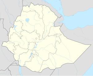
The Somali Region, also known as Soomaali Galbeed and officially the Somali Regional State, is a regional state in eastern Ethiopia. Its territory is the largest after Oromia Region. The regional state borders the Ethiopian regions of Afar and Oromia and the chartered city Dire Dawa to the west, as well as Djibouti to the north, Somalia to the northeast, east and south; and Kenya to the southwest.

Sitti Zone, formerly known as Shinile, is a zone in Somali Region of Ethiopia.

East Hararghe is a zone in the Oromia Region of Ethiopia. East Hararghe Zone is bordered on the southwest by Bale, on the west by West Hararghe Zone, on the north by Dire Dawa and on the north and east by the Somali Region. The Harari Region is an enclave inside this zone.
Ayesha is a woreda in Somali Region, Ethiopia. The northernmost woreda of the Shinile Zone, Ayesha is bordered on the south by Dembel, on the west by Shinile, on the north by Djibouti, on the east by Somaliland, and on the southeast by the Jijiga Zone. Towns in Ayesha include Ayesha, Dewele, Lasarat and Mermedebis.
Erer is a woreda in Somali Region, Ethiopia. Part of the Shinile Zone, Erer is bordered on the south by Dire Dawa and Oromia Region, on the southwest by Afdem, on the northwest by the Afar Region, and on the east by Shinile.
Afdem is a woreda in Somali Region, Ethiopia. Located in the Sitti Zone, this woreda is bordered on the southwest by Mieso, on the north by the Afar Region and on the east by Erer, and on the south by the Oromia Region. The administrative center of this woreda is Afdem; other towns in Afdem include Ali jiir
Dembel is a woreda in Somali Region, Ethiopia. Part of the Shinile Zone, Dembel is bordered on the west by Shinile, on the north by Ayesha, and on the east and south by the Jijiga Zone. Towns in Dembel include Arabi, Dembel, Samakab, Sandalol, Biobahie, Dure and Harmukale.
Shinile is a woreda in Somali Region, Ethiopia. Part of the Sitti Zone, Shinile is bordered on the south by Dire Dawa, on the west by Erer, on the north by the Afar Region, on the east by Ayesha, and on the southeast by Dembel and Jijiga Zone. Towns in Shinile include Adigale, Harewa, Milo, and Shinile; villages include Jaldessa, Marmaarsa, and Toome.
Mieso is a woreda in Somali Region, Ethiopia. Part of the Shinile Zone, this woreda is bordered on the south by the Oromia Region, on the northwest by the Afar Region, and on the east by the Afdem woreda. The administrative center for this woreda is Mulu town.
Kombolcha is a woreda in Oromia Region, Ethiopia. Part of the East Hararghe Zone, Kombolcha is bordered on the south by the Harari Region, on the southwest by Haro Maya, on the northwest by Dire Dawa, on the north by the Somali Region, and on the east by Jarso. The administrative center of the woreda is Melka Rafu.
Meta is one of the districts in the Oromia of Ethiopia. Part of the East Hararghe Zone, Meta is bordered on the southwest by Deder, on the northwest by Goro Gutu, on the north by the Somali Region, on the northeast by Kersa, and on the southeast by Bedeno. Towns in Meta include Chelenqo and Kulubi.
Moyale is one of the Districtss in the Somali Region of Ethiopia. It is named after the administrative center of the woreda, Moyale. Located in the southeast corner of the Borena Zone, Moyale is bordered on the south by Kenya, on the west by Dire, on the northwest by Arero, on the north by the Dawa River which separates it from Liben, and on the east by Dawa Zone Somali Region.
Gurgura is a woreda in the chartered city of Dire Dawa in Ethiopia.
Dewele is a town in Ethiopia, near to the Ethiopia and Djibouti border. Located in the Sitti Zone in the Somali Region the town has a longitude and latitude of 11°2′N42°37′E with an elevation of 898 meters above sea level.
Milo is a town in eastern Ethiopia. Located in the Shinile Zone of the Somali Region. This town is served by a station on the Ethio-Djibouti Railways.
Erer is a town in central Ethiopia. Located in the Sitti Zone of the Somali Region, it is located 51km east of Shinile. It is the administrative center of Erer woreda .The city of Erer and its surroundings were the Afar people. In 1958, the Somalis forcibly removed them from the Afar people.
Bike is a town in central Ethiopia of the Somali Region in the Sitti Zone. It is located 72 km west of Shinile. The town is located on the main railway between Djibouti City and Addis Ababa.
Āfdem is a town is east central Ethiopia. Located in the Sitti Zone of the Somali Region. It is located 59 km east of Shinile. It is the administrative center of Afdem woreda. It sprawls on a wide basin surrounded by granitic mountains on all sides.
Chinaksen is a town located in Chinaksen woreda, East Hararghe Zone of the eastern Oromia Region, Ethiopia. This city has a latitude and longitude of 9°30′N42°42′E with an elevation of 1816 meters above sea level. Chinaksan is a historical settlement with stone walls built at the foot of an oval hill; on the hill are ruins of fortifications of Adalite origins during the Adal Sultanate period.
Hurso is a town in eastern Ethiopia. Located in the Shinile Zone of the Somali Region about 40 km west of Dire Dawa, it has a longitude and latitude of 9°36′N41°38′E and an altitude of 1130 meters above sea level. It is one of four towns in Erer woreda.


